Turtle Ridge Trailhead
Explore Irvine's stunning vistas from Turtle Ridge Trailhead, offering panoramic views and scenic trails perfect for hiking and photography.
Highlights
Must-see attractions

Social
From TikTok & Reddit
Best Time
Wildflowers in bloom, cooler temps
Turtle Ridge Trailhead
Best Time
Wildflowers in bloom, cooler temps
Highlights
Must-see attractions
Explore Irvine's stunning vistas from Turtle Ridge Trailhead, offering panoramic views and scenic trails perfect for hiking and photography.
"Probably the best views in Irvine, on a clear day you can see Catalina to the west out to Saddleback Valley in the east."
🚗 Arrive Early for Parking
Trailhead parking is scarce! Aim to arrive before 8 AM or be ready to walk from a nearby park.
🐶 Leash Your Dogs
Dogs are welcome but must be on a leash. Please clean up after your pets to keep trails pristine.
Highlights
Discover the most iconic attractions and experiences
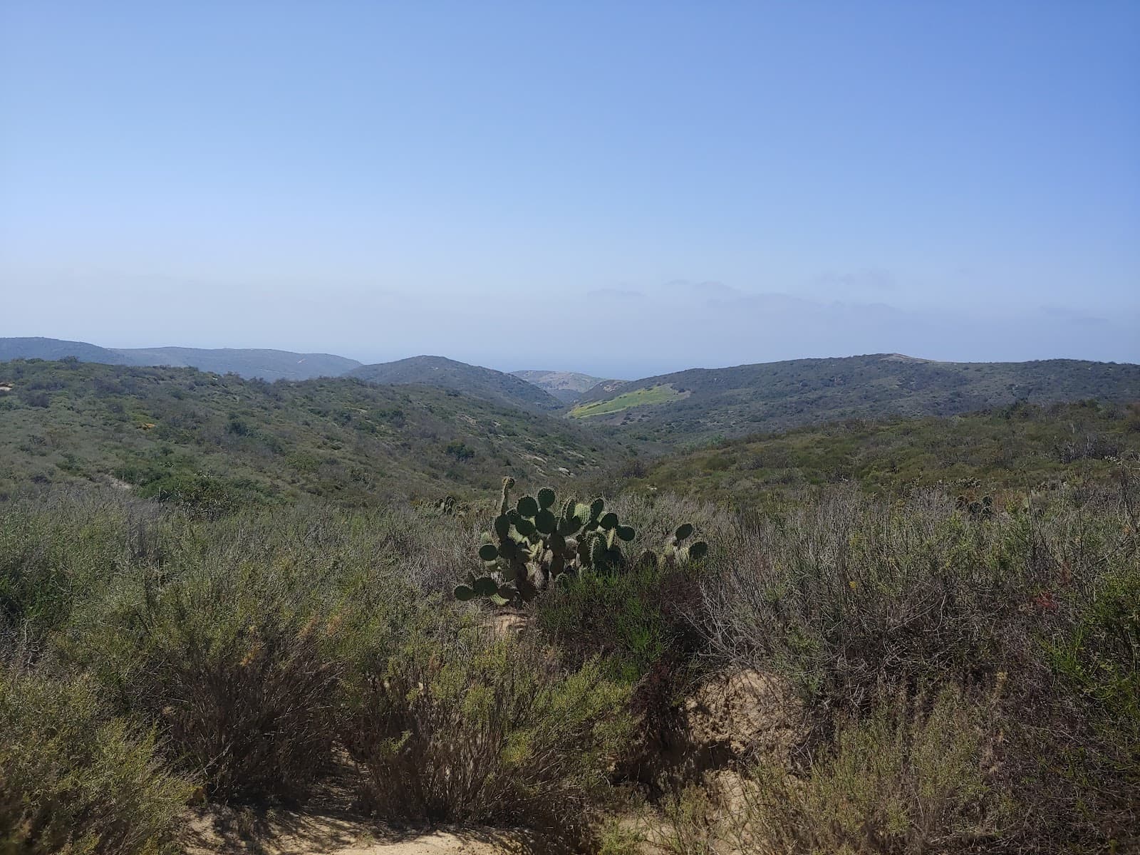
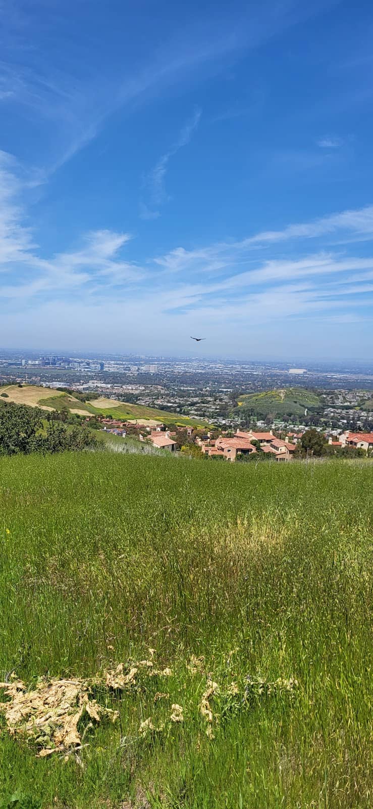
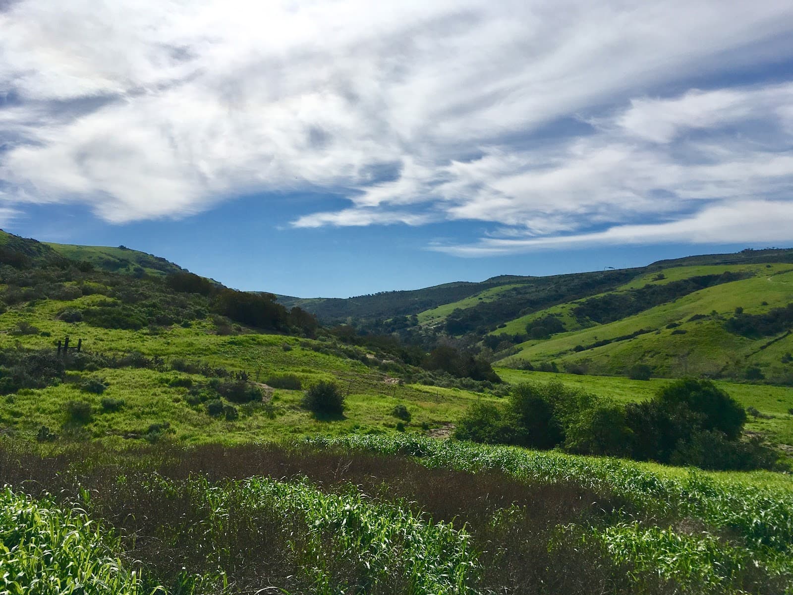
Panoramic City & Mountain Views
Various vantage points along the trails
On clear days, witness breathtaking vistas stretching from Catalina Island to Downtown LA and Saddleback Valley.
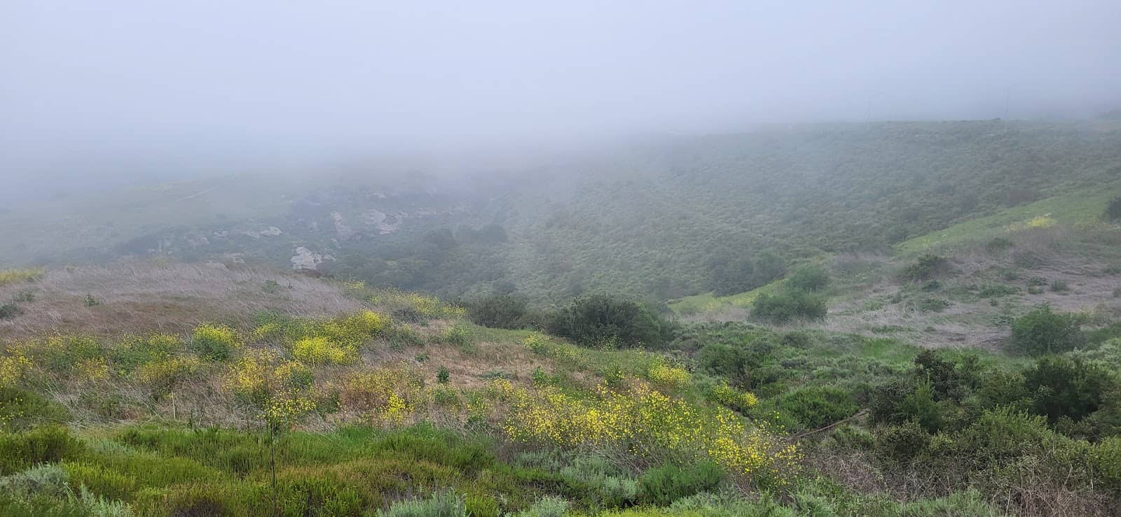
Scenic Flower Meadows
Along the trails
Enjoy picturesque meadows bursting with colorful flowers, adding a vibrant touch to your hike.

Tuscan-Style Villa
Visible from some trails
Catch a glimpse of a charming Tuscan-style villa, an unexpected and picturesque sight amidst the natural landscape.
Plans like a pro.
Thinks like you
Planning Your Visit
Parking Pointers
Trail Variety & Conditions
Best Times
Insider Tips
from TikTok, Instagram & Reddit
🚗 Arrive Early for Parking
Trailhead parking is scarce! Aim to arrive before 8 AM or be ready to walk from a nearby park.
🐶 Leash Your Dogs
Dogs are welcome but must be on a leash. Please clean up after your pets to keep trails pristine.
city views
🗺️ Explore Multiple Trails
Don't stick to one path! This area has many interconnected trails for varied hiking experiences.
💧 Bring Plenty of Water
Especially on longer loops, stay hydrated. There are no water sources on the trails.
Tips
from all over the internet
🚗 Arrive Early for Parking
Trailhead parking is scarce! Aim to arrive before 8 AM or be ready to walk from a nearby park.
🐶 Leash Your Dogs
Dogs are welcome but must be on a leash. Please clean up after your pets to keep trails pristine.
🗺️ Explore Multiple Trails
Don't stick to one path! This area has many interconnected trails for varied hiking experiences.
💧 Bring Plenty of Water
Especially on longer loops, stay hydrated. There are no water sources on the trails.
👟 Wear Sturdy Footwear
The trails can be uneven and involve switchbacks, so good hiking shoes are a must.
What Travellers Say
Reviews Summary
Visitors rave about the stunning panoramic views, describing them as the best in Irvine, with clear days offering vistas stretching to Catalina Island and Downtown LA. The well-maintained trails and picturesque flower meadows are also frequently praised. However, the extremely limited parking at the trailhead is a consistent point of frustration for many.
"I did a 13.1 mile loop here on April 20, 2021, you can see my trail recording on the Alltrails app, just look up my name and please follow me for more fun trails and my reviews.
So I had to go back to this area because I just thought it was a really nice place to hike.
The parking at the trailhead only allows for 6 vehicles and one of them is for handicapped. I had to park at the park 0.6 mile north of the trailhead due to lack of parking.
This hike I took is now in my top 5 favorite hikes in OC. The switchback are fun with amazing views of the mountains, ground coverings and City of Irvine. They keep this place in immaculate condition. About 5 miles into my hike, my trail path led me to the area I hiked a week earlier, but since there are so many different trails, I was able to explore places I didn't go the last time. Most of my hike (9 miles) was on the east side of the toll road, the other (4 miles) are west of the toll roads, so I rested under the bridges and out of the sun for a few minutes. I didn't really find any part of this hike difficult, however, part of the trail was closed, so please be respectful to the land. Enjoy.
If you are interested in joining in any hikes, you can find my hikes on the "Meet Up" app under the group "Five Miles or More Hiking Group" with the times and places I'll be going. Enjoy your hiking."
Kevin Mcnamee
"probably the best views in irvine. on a clear day you can see catalina to the west out to saddleback valley in the east, and all the way north to downtown LA and Malibu. along the way you will see picturesque flower meadows and a Tuscan-style villa."
Timothy Lasater
"Nice suburban hike. Take your dog on a leash, but noticed too many inconsiderate people don't pick up after their dogs."
David King
What People Like
What People Dislike
Frequently Asked Questions
🚇 🗺️ Getting There
Turtle Ridge Trailhead is located in Irvine, California. Access is typically via local roads. For navigation, use 'Turtle Ridge Trailhead' as your destination. Be aware that parking is extremely limited at the trailhead itself.
Public transportation options directly to the trailhead are limited. It's generally recommended to drive. If using public transport, you might need to take a bus to a nearby stop and then walk or arrange a ride-share. Check local Irvine transit schedules for routes near the trailhead.
Parking at the trailhead is very scarce, with only about 6 spots available, including one for handicapped parking. Many visitors report having to park about 0.6 miles north of the trailhead at a nearby park. Arriving very early is key to securing a spot.
Yes, if the main trailhead parking is full, visitors often park at a park located approximately 0.6 miles north of the trailhead. This adds a short walk to your hike but is a common alternative.
Yes, the trailhead is accessible by car. The main challenge is the limited parking capacity at the trailhead itself.
🎫 🎫 Tickets & Entry
No, there is no entrance fee to access Turtle Ridge Trailhead or its trails. It is a public access area for hiking and enjoying nature.
The trails are generally open from dawn to dusk. There are no specific posted operating hours for the trailhead itself, but it's best to hike during daylight hours for safety and visibility.
No, tickets are not required for Turtle Ridge Trailhead as there is no entrance fee. You can visit anytime during daylight hours.
The main restriction is the limited parking. Some trails may be temporarily closed for maintenance, so always be observant of posted signs. Dogs must be on a leash.
While there are no strict closing times, hiking at night is not recommended due to safety concerns and lack of lighting. Some Redditors mention seeking city views at night, but Turtle Ridge is primarily a daytime hiking destination.
🎫 🥾 Onsite Experience
The best way is to explore the network of interconnected trails. Many visitors create loops of varying lengths, from 5 to over 16 miles. Consider using a trail app to plan your route.
Yes, reviews consistently mention that the trails are kept in immaculate condition. This ensures a pleasant hiking experience for visitors.
Expect stunning panoramic views! On clear days, you can see Catalina Island, Saddleback Valley, Downtown LA, and even Malibu. The trails also feature picturesque flower meadows.
Yes, dogs are welcome at Turtle Ridge Trailhead, but they must be kept on a leash at all times. Remember to clean up after your pet.
While generally not considered difficult, some trails involve switchbacks and elevation gain. The length of your chosen loop will determine the overall challenge.
📸 📸 Photography
The highest vantage points offer the most expansive city and mountain panoramas. Look for areas with wildflowers in bloom for colorful shots, especially in spring. The Tuscan-style villa also makes for a unique photo opportunity.
Golden hour, shortly after sunrise and before sunset, provides the most flattering light for landscape photography. Midday can be harsh, but offers clear views of distant landmarks.
A wide-angle lens is great for capturing the sweeping vistas. A telephoto lens can be useful for zooming in on distant cityscapes or mountain ranges. Don't forget a polarizing filter to enhance sky colors.
Keep an eye out for the seasonal wildflower blooms, which can transform the landscape into a photographer's dream. The unique Tuscan villa also offers a distinct subject.
Drone usage regulations can vary. It's advisable to check with local authorities or park management regarding drone operation policies before flying.
For Different Travelers
Tailored advice for your travel style
👨👩👧 Families with Kids
While the trails are generally well-maintained, some sections can be steep with switchbacks, so assess your children's hiking abilities. The scenic views and potential for spotting wildflowers can be exciting for kids. Remember to bring plenty of water and snacks, as there are no facilities on the trails. Leashing dogs is mandatory, so ensure your furry family members are well-behaved.
🐶 Dog Owners
Be mindful of the terrain, which can include uneven surfaces and inclines. On warmer days, ensure your dog has enough water and consider sticking to shadier sections or hiking during cooler parts of the day. The limited parking can be an issue, so plan your visit accordingly.
🏃♀️ Fitness Enthusiasts
Consider tackling longer loops that incorporate more elevation changes for a greater cardiovascular challenge. The well-maintained trails are generally good for running, though some sections may be more suited for hiking. The panoramic views serve as a great motivator during your fitness endeavors.
Deep Dives
In-depth insights and expert knowledge
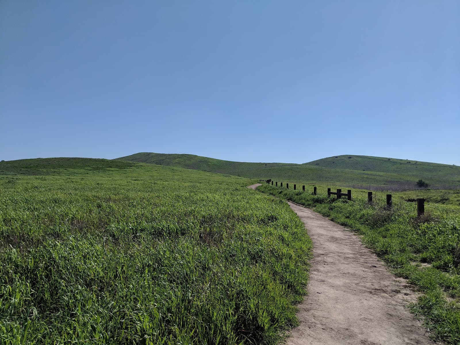
Navigating the Trail Network
When planning your hike, it's highly recommended to use a trail map or a GPS-enabled app like AllTrails. This will help you navigate the numerous junctions and ensure you stay on your intended route. Some trails are more exposed, while others offer shade under bridges or through canyons, especially those west of the toll road. Be prepared for switchbacks, which are a common feature and can add to the workout.
Remember that trail conditions can change, and sections may occasionally be closed for maintenance. Always pay attention to signage and respect any closures to help preserve the natural environment. The flexibility of the trail system means you can tailor your hike to your fitness level and desired duration, making it suitable for a wide range of outdoor enthusiasts.
Capturing the Scenery: Photography Tips
Beyond the expansive views, the trails are known for their picturesque flower meadows, particularly vibrant in the spring. These bursts of color offer fantastic opportunities for close-up shots or to add a vibrant foreground element to your landscape photos. Keep an eye out for the unique Tuscan-style villa visible from some trails; it provides an interesting architectural contrast to the natural scenery.
For capturing the distant cityscapes and mountains, a telephoto lens can be very useful. A wide-angle lens is essential for encompassing the vastness of the views. Don't forget to bring plenty of battery power and memory cards, as you'll likely find yourself stopping frequently to capture the beauty. Remember to also be mindful of other hikers and avoid blocking trails while taking photos.
Understanding the Local Environment
Wildlife in the area can include various bird species, small mammals, and reptiles. While generally not a concern for hikers, it's always wise to be aware of your surroundings. The presence of the toll road nearby means that some trails are located on either side of it, with hikers often using underpasses or resting under bridges for shade.
It's important to respect the natural environment. This includes staying on marked trails to prevent erosion and habitat disruption, and always packing out everything you pack in. The condition of the trails, often noted as immaculate, is a testament to the care taken by local authorities and the community.


Social
from TikTok, Instagram & Reddit