
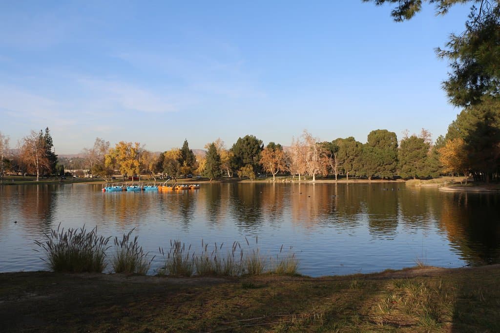
Santa Ana River Trail
A sprawling paved multi-use path perfect for biking, walking, and enjoying the Southern California landscape.
Highlights
Must-see attractions

Social
From TikTok & Reddit
Best Time
Fewer crowds, pleasant weather
Santa Ana River Trail
Best Time
Fewer crowds, pleasant weather
Highlights
Must-see attractions
A sprawling paved multi-use path perfect for biking, walking, and enjoying the Southern California landscape.
🗺️ Grab a Trail Map
Always have a map of Santa Ana River Trail handy to navigate access points and plan your route.
☀️ Ride During Daylight
For safety, stick to daytime hours. Some sections can feel less secure after dark.
Quick Facts
Highlights
Discover the most iconic attractions and experiences
Anaheim to Huntington Beach Stretch
Southern Section
A popular and scenic route offering diverse views, perfect for a long bike ride.
Riverside to San Bernardino Section
Northern Section
Explore the upper reaches of the trail, often less crowded and offering a different landscape.
Connecting to Local Parks
Various Points
Discover numerous parks and recreational areas accessible directly from the trail.
Plans like a pro.
Thinks like you
Planning Your Visit
Trail Access & Parking
Safety & Best Times to Ride
Best Times
Insider Tips
from TikTok, Instagram & Reddit
Anyone Is the Santa Ana River safe to travel thru the whole length of the river? All the way to the Pacific Ocean
During normal hours, usually 6am to noon time, I ride my bike from pch to weir canyon and I would like say I feel “safe” Wouldn’t go through it when it’s dark but that’s how I would treat any river trail.
🗺️ Grab a Trail Map
Always have a map of Santa Ana River Trail handy to navigate access points and plan your route.
☀️ Ride During Daylight
For safety, stick to daytime hours. Some sections can feel less secure after dark.
Bike ride on the Santa Ana river trail towards PCH
That's a nice ride, but I think the trail is much nicer up towards Anaheim Hills/Yorba Linda area.
Favorite routes for road biking / cycling? Visiting from Utah and I was looking at Santa Ana River Trail and connecting to some places, but not sure if it's friendly to fast-moving road bikes? Would love any other route recommendations!
The Santa Ana River Trail is probably the most road-bike friendly trail in Orange County with its long sightlines. It mostly connects to streets with dedicated bike lanes, e.g. the Pacific Coast Highway. There is on extended bike path through Orange and Villa Park into Anaheim…
🚴♀️ Bike Path Etiquette
Be mindful of other users on the Santa Ana River Trail bike path. Yield to faster riders and pedestrians. :athletic_shoe:
🅿️ Scout Parking Spots
Research Santa Ana River Trail parking options beforehand, as some entry points can get busy. 🚗
Long protected bike trails with NO CARS suitable for kids within 1-1.5 hours of LA?
Hey folks - looking for new trails to ride with my family. Our current go-to trails: * Encanto Park to Santa Fe Dam along the San Gabriel River Trail * Whittier Narrows Park to Whittier Narrows Dam along the Rio Hondo Bike Path (pretty sketch at times) * The beach bike path…
Tips
from all over the internet
🗺️ Grab a Trail Map
Always have a map of Santa Ana River Trail handy to navigate access points and plan your route.
☀️ Ride During Daylight
For safety, stick to daytime hours. Some sections can feel less secure after dark.
🚴♀️ Bike Path Etiquette
Be mindful of other users on the Santa Ana River Trail bike path. Yield to faster riders and pedestrians. :athletic_shoe:
🅿️ Scout Parking Spots
Research Santa Ana River Trail parking options beforehand, as some entry points can get busy. 🚗
💧 Stay Hydrated
Carry plenty of water, especially on longer rides. Water fountains are not always available. :droplet:
What Travellers Say
Reviews Summary
The Santa Ana River Trail is a vast, paved multi-use path appreciated for its length and accessibility, offering great opportunities for biking and walking. While generally safe during the day, some users advise caution after dark and recommend sticking to well-trafficked areas. Potential closures and construction can sometimes impact routes.
What People Like
What People Dislike
Frequently Asked Questions
🚇 🗺️ Getting There
The Santa Ana River Trail access points are numerous. Popular entry points with parking include areas near Huntington Beach, Anaheim, Riverside, and San Bernardino. Checking a map of Santa Ana River Trail is highly recommended to find the most convenient Santa Ana River Trail entrances for your starting point.
You can find a map of Santa Ana River Trail online through various city and county websites, or by searching for 'Santa Ana River Trail map PDF'. These maps are crucial for understanding the trail's layout and identifying Santa Ana River Trail parking and access points.
Public transport access varies greatly depending on the specific section of the Santa Ana River Trail you wish to visit. Some areas might be accessible via bus routes, but it's best to check local transit schedules for Santa Ana River Trail near me to confirm feasibility.
The Santa Ana River Trail is a long, continuous path, so there isn't one single 'start' point. Many people begin their journey from designated entry points or access points that offer convenient parking. Popular starting areas are often near major cities along the river.
It's important to check for Santa Ana River Trail closure notices before you go, as sections can be closed due to construction, maintenance, or weather events. Local park or city websites often provide the latest Santa Ana River Trail news regarding closures.
🎫 🎫 Tickets & Entry
No, the Santa Ana River Trail is a public multi-use path and does not require tickets for entry. Access is generally free, though Santa Ana River Trail parking fees may apply at some designated lots.
The Santa Ana River Trail is typically open from dawn to dusk. However, specific Santa Ana River Trail hours can vary by section and local park regulations. Always check local advisories if you plan to visit early or late.
There is no admission fee to use the Santa Ana River Trail itself. It's a public amenity for recreation. However, some Santa Ana River Trail parking areas managed by local municipalities might have associated fees.
While you can technically access the Santa Ana River Trail from many points along its length, it's best to use official Santa Ana River Trail entrances or access points that provide safe and legal entry, often with designated parking.
The main restrictions involve adhering to multi-use trail etiquette, respecting Santa Ana River Trail hours, and being aware of any temporary closures or construction. Motorized vehicles are generally prohibited on the Santa Ana River Trail bike path.
🎫 🚴♀️ Onsite Experience
The Santa Ana River Trail bike experience is best enjoyed by planning your route using a map of Santa Ana River Trail. Consider the Santa Ana River Trail bike path length and your fitness level. Many enjoy the stretch from Anaheim to Huntington Beach for its varied scenery.
The Santa Ana River Trail is a very long, continuous multi-use path stretching for many miles. While the exact length can be debated based on connected segments, it's one of the longest urban trails in Southern California, offering ample opportunity for exploration.
Yes, the Santa Ana River Trail does have mile markers in many sections, which are helpful for navigation and tracking your progress. These markers are particularly useful for cyclists and runners using the Santa Ana River Trail bike path.
Most Redditors find the Santa Ana River Trail safe during daylight hours, even for solo riders, particularly on popular stretches. However, some advise caution after dark and recommend sticking to well-trafficked areas.
The Santa Ana River Trail is predominantly a paved, relatively flat multi-use path. You'll encounter smooth asphalt for most of the Santa Ana River Trail bike path, making it suitable for various types of bicycles and easy for walking.
📸 📸 Photography
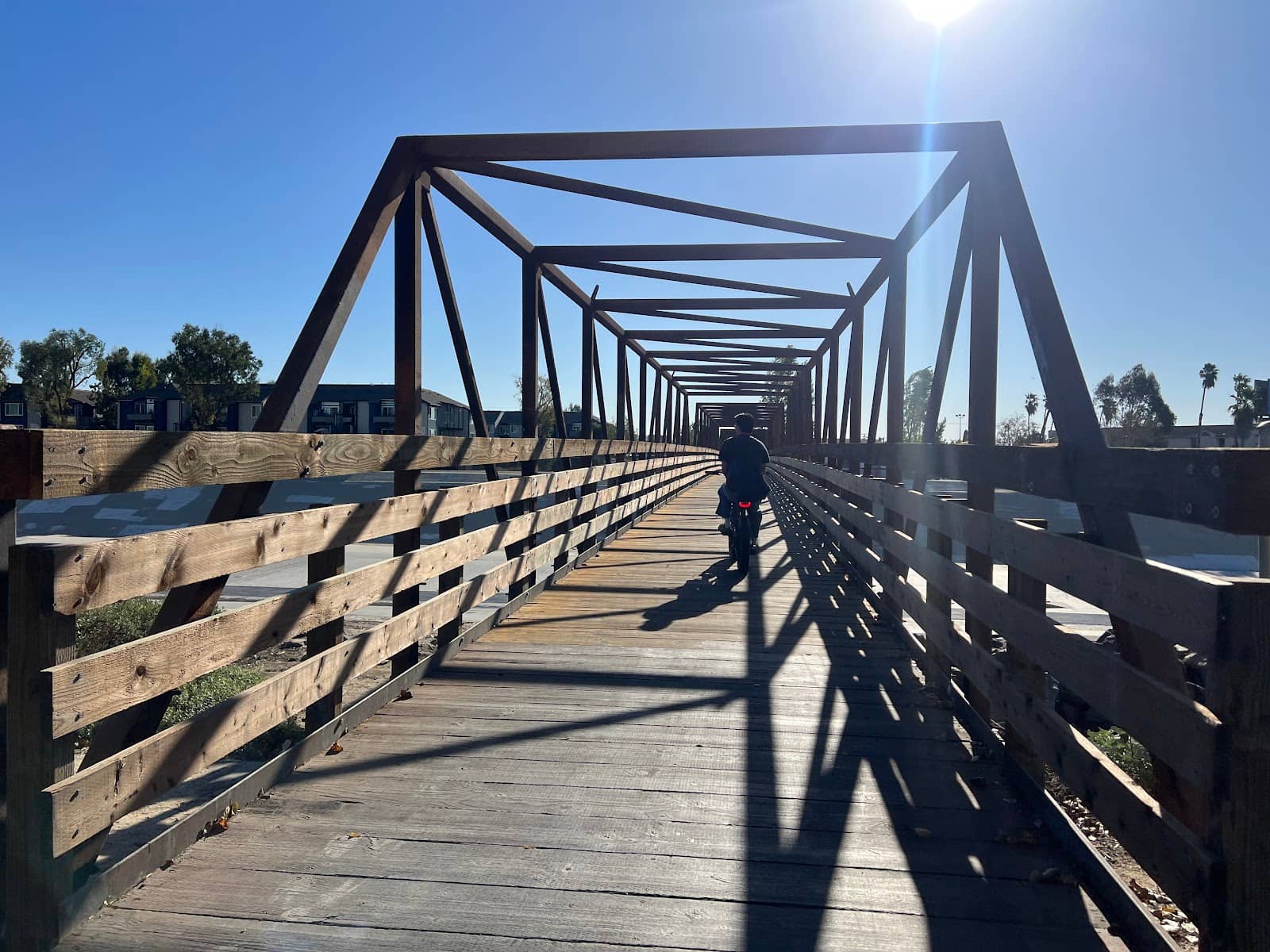
The Santa Ana River Trail offers diverse photographic opportunities, from urban landscapes to natural riverbed views. Look for scenic bridges, open stretches of the Santa Ana River Trail bike path, and areas where the trail winds through green spaces. The mile markers can also be fun photo props.
It's manageable to take photos while biking on the Santa Ana River Trail, especially if you use a handlebar mount or a secure phone case. However, for more composed shots, it's best to stop at one of the many access points or scenic overlooks along the Santa Ana River Trail. :iphone:
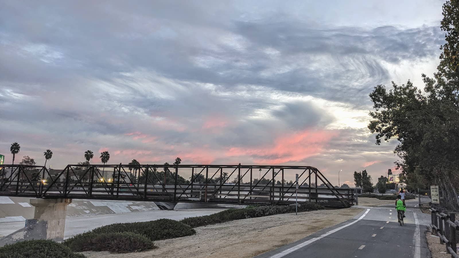
The 'golden hours' – shortly after sunrise and before sunset – offer the most beautiful light for photography along the Santa Ana River Trail. The soft, warm light can enhance the natural beauty and urban elements of the trail.
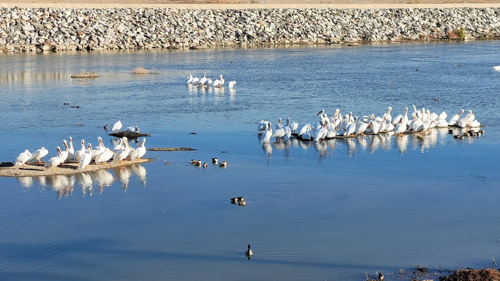
Keep an eye out for public art installations, unique bridge architecture, and the changing scenery as the Santa Ana River Trail passes through different communities. The vastness of the riverbed itself can also provide dramatic photographic backdrops.
Yes, you can bring a professional camera to the Santa Ana River Trail. There are no restrictions on personal photography. Remember to be mindful of other trail users and avoid blocking the Santa Ana River Trail bike path while setting up shots. :camerawithflash:


Social
from TikTok, Instagram & Reddit