
Santa Rosa Road Scenic Drive
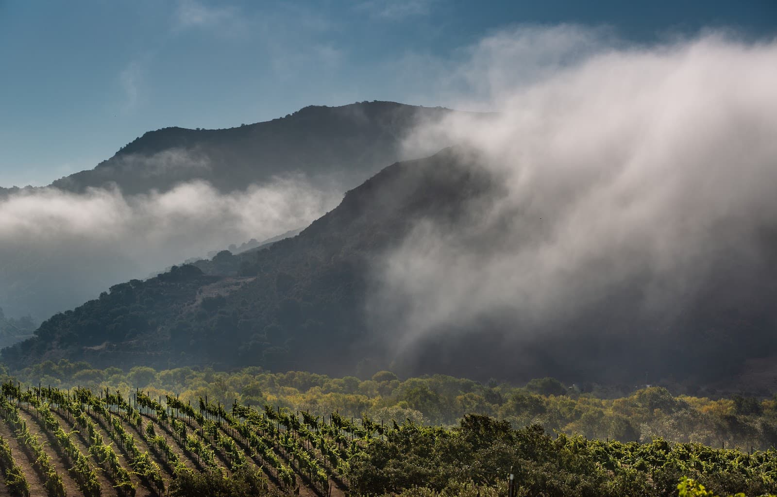
A winding mountain road offering dramatic shifts from desert to forest, with breathtaking vistas and a peaceful, remote escape.
Highlights
Must-see attractions

Social
From TikTok & Reddit
Best Time
Pleasant temperatures, fewer crowds
Santa Rosa Road Scenic Drive
Best Time
Pleasant temperatures, fewer crowds
Highlights
Must-see attractions
A winding mountain road offering dramatic shifts from desert to forest, with breathtaking vistas and a peaceful, remote escape.
"This route is pure alchemy, a portal to peace and the quiet wisdom of the Earth."
🚗 Download Offline Maps
Cell service is unreliable. Ensure your navigation is ready before you go! :iphone:
🧺 Pack a Picnic
Enjoy the peaceful surroundings with a meal. Limited dining options nearby. :knifeforkplate:
Quick Facts
Hours
Rating
4.1 · 16 reviews
Type
Park
Highlights
Discover the most iconic attractions and experiences
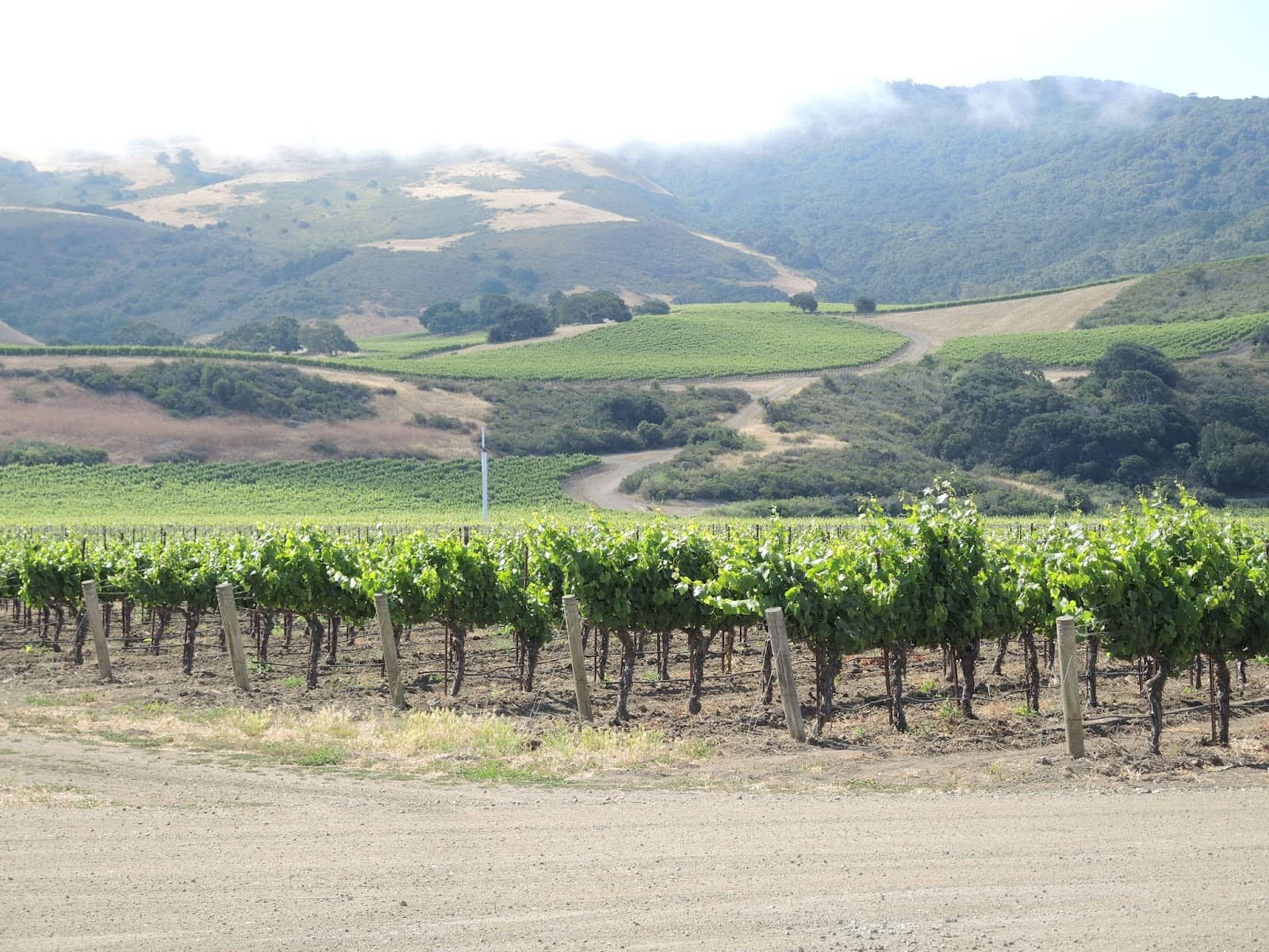
Coachella Valley Vista Point
Highway 74
Panoramic views of the valley below, perfect for photos and soaking in the vastness.
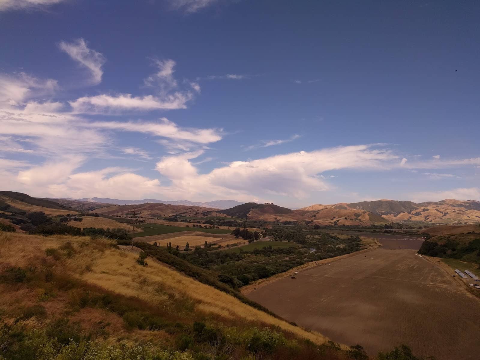
Mountain Ascents
Highway 74
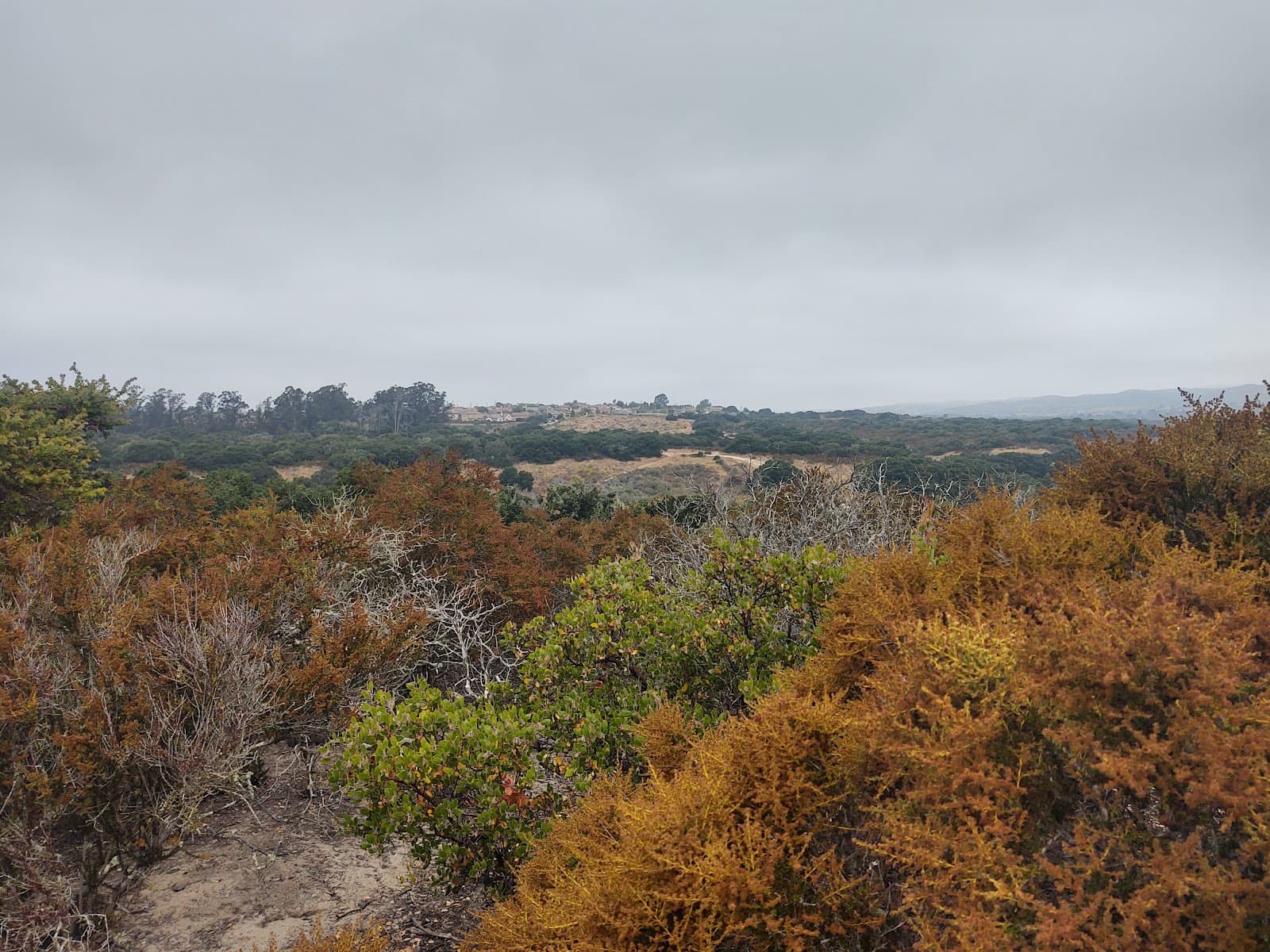
Experience the dramatic shift from desert floor to pine-kissed mountain air on this scenic route.
Santa Rosa Park
Santa Rosa Road
A quiet spot with picnic areas and a BBQ pit, offering a peaceful respite amidst nature.
Plans like a pro.
Thinks like you
Planning Your Visit
Embrace the Journey
Respect the Serenity
Best Times
Insider Tips
from TikTok, Instagram & Reddit
🚗 Download Offline Maps
Cell service is unreliable. Ensure your navigation is ready before you go! :iphone:
🧺 Pack a Picnic
Enjoy the peaceful surroundings with a meal. Limited dining options nearby. :knifeforkplate:
Route recommendations for Lompoc to Santa Barbara. Is it safe to head to Solvang on the way? (California, USA)
Hi everyone, I know the usual route is along the 1 to the 101 South passing Gaviota and Refugio etc. I will have a gravel bike packed for a 2 day credit card tour from SLO to LA (hosteling in SB, \~100 miles each day), and looking to also find my way through Solvang on this…
👟 Comfortable Shoes
For exploring the park and viewpoints, comfortable footwear is a must. :athletic_shoe:
📸 Capture the Views
The changing scenery is breathtaking. Don't forget your camera! :camerawithflash:
Tips
from all over the internet
🚗 Download Offline Maps
Cell service is unreliable. Ensure your navigation is ready before you go! :iphone:
🧺 Pack a Picnic
Enjoy the peaceful surroundings with a meal. Limited dining options nearby. :knifeforkplate:
👟 Comfortable Shoes
For exploring the park and viewpoints, comfortable footwear is a must. :athletic_shoe:
📸 Capture the Views
The changing scenery is breathtaking. Don't forget your camera! :camerawithflash:
What Travellers Say
Reviews Summary
Visitors rave about the Santa Rosa Road Scenic Drive for its incredible, transformative views and peaceful, remote atmosphere. Many find the drive magical and a welcome escape from daily life. However, some reviews mention a poorly maintained park and a local resident who can be unwelcoming.
"Quiet and remote. Small park with weather beaten picnic tables and port-o-potties. The BBQ and horseshoe area looks like it has not entertained people for years but I saw many happy lizards."
Amos
"Incredible views. Peaceful no loud noises. Makes you feel like you were transported in a different reality. Something’s about the hill’s ridges, creeks , canyons. I always feel like it’s magical place. No cell phone reception."
Jmoney None
"Went for a drive and ended up here, at least the drive was nice. The north facing sloped park COULD boast an expansive view of the valley through the oaks above the picnic tables, but it's naturally unatractive. It would be pleasant on a hot spring day, but it was neither spring, hot or pleasant. The kids explored a little before hearing an unseen woman screeching wildly, "Stella, get in here right now!" The phantom demand echoed through the cold empty park, promoting us to rethink our visit. At least I got a story to tell out of the place, so 2 stars."
Jason Campbell
What People Like
What People Dislike
Frequently Asked Questions
🚇 🗺️ Getting There
The most popular route is Highway 74, also known as the Palms to Pines Scenic Byway, which climbs from the Palm Desert area into the Santa Rosa Mountains. This 67-mile stretch offers dramatic elevation changes and diverse scenery.
Yes, Santa Rosa Road is a public road accessible by car. It connects to Highway 74 and offers access to Santa Rosa Park.
The Coachella Valley Vista Point on Highway 74 is a must-stop for incredible panoramic views of the valley. The drive itself, with its winding turns and changing vegetation, is the main attraction.
A standard car is generally sufficient for the paved roads. However, be prepared for winding roads and steep inclines.
The drive can take anywhere from 1 to 3 hours, depending on how often you stop to enjoy the views and explore points like Santa Rosa Park.
🎫 🎫 Tickets & Entry
There are no entrance fees for driving along Santa Rosa Road or Highway 74. Santa Rosa Park may have nominal fees for specific amenities like picnic areas or BBQ pits, but general access is free.
Santa Rosa Park is generally open during daylight hours. It's advisable to check local park service information for specific opening and closing times, especially if planning an early morning or late evening visit.
No, advance booking is not required for the scenic drive itself. It's a public road. If you plan to reserve the picnic area or BBQ pit at Santa Rosa Park for a large gathering, booking ahead is recommended.
For casual personal photography, no permits are typically needed. However, for commercial filming or large-scale photography projects, it's best to contact the relevant local authorities or park services to inquire about permit requirements.
While not explicitly stated in all reviews, it's generally recommended to keep pets leashed if allowed. Some reviews mention aggressive dogs, so be mindful of other visitors and their pets.
🎫 🏞️ Onsite Experience
Santa Rosa Park offers picnic tables and BBQ pits. Some reviews mention port-o-potties. There's also a reservable area suitable for larger gatherings.
No, cell phone reception is very limited or non-existent along much of Santa Rosa Road and the scenic drive. It's recommended to download offline maps and inform someone of your travel plans.
Visitors have reported seeing happy lizards. The diverse elevation means you might encounter various desert and mountain flora and fauna.
While the primary focus is the scenic drive, the mountainous terrain suggests potential for off-road exploration or informal trails. However, no specific marked hiking trails are widely advertised.
Pull over at designated vista points like the Coachella Valley Vista Point for unobstructed views. Take your time driving and stop at safe pull-offs to appreciate the changing landscapes.
📸 📸 Photography
Early morning and late afternoon offer the best light for photography, with softer shadows and warmer tones. The golden hour can create magical shots of the mountain ridges and valley.
A wide-angle lens is great for capturing the expansive valley views and mountain vistas. A telephoto lens can be useful for isolating details in the landscape or spotting wildlife.
The Coachella Valley Vista Point is a prime location. Also, look for safe pull-offs along Highway 74 that offer unique perspectives of the winding road and the surrounding mountains.
Experiment with different angles, including shots from inside your car looking out, or photos that show the road winding through the landscape. Capturing the transition from desert to mountains is key.
The lack of cell service can be a challenge if you need to quickly share photos or use online resources. Also, be mindful of the sun's position and potential glare.


Social
from TikTok, Instagram & Reddit