Cone Peak
Conquer the steepest mountain-to-sea summit in the lower 48 for breathtaking Big Sur coastal views. A challenging, rewarding adventure.
Highlights
Must-see attractions

Social
From TikTok & Reddit
Best Time
Wildflowers bloom, cooler temps
Cone Peak
Best Time
Wildflowers bloom, cooler temps
Highlights
Must-see attractions
Conquer the steepest mountain-to-sea summit in the lower 48 for breathtaking Big Sur coastal views. A challenging, rewarding adventure.
"One of the most incredible hikes you can do in the lower 48, year round."

🚗 Check Road Conditions First
Rutty dirt roads lead to trailheads. Closures can mean a much longer hike. Always check before you go! :car:
💧 Pack Extra Water
Summer hikes are very hot. Bring more water than you think you'll need to stay hydrated on the steep ascent. :droplet:

Highlights
Discover the most iconic attractions and experiences
Summit Views
Cone Peak Summit
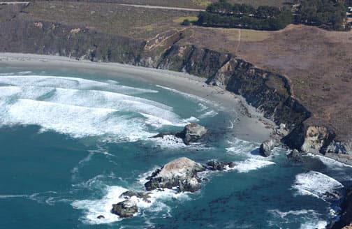
Unbelievable panoramic views of the Big Sur coastline and the Pacific Ocean. Breathtaking from sea to summit.

Steepest Mountain-to-Sea Trail
Highway 1 Trailhead
Experience the dramatic ascent from sea level to over 5100 feet. A true test of endurance with rewarding vistas.

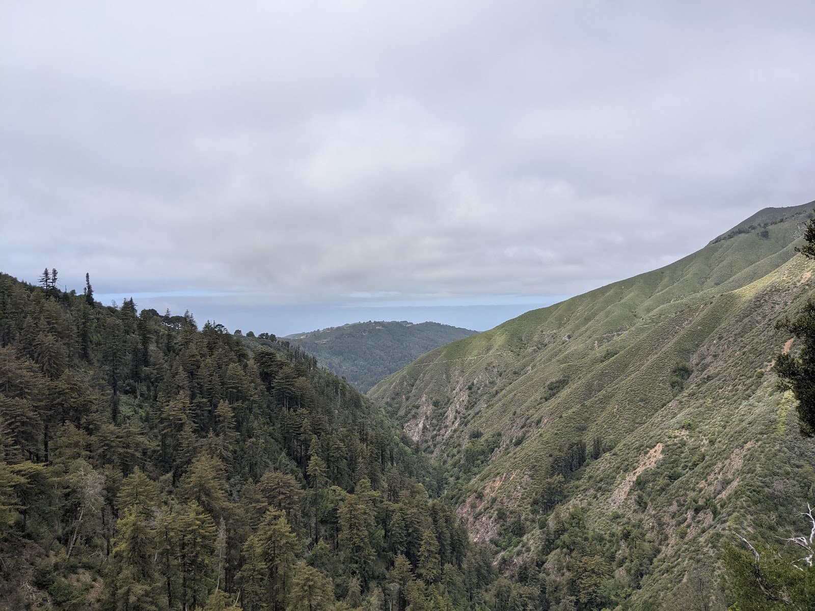
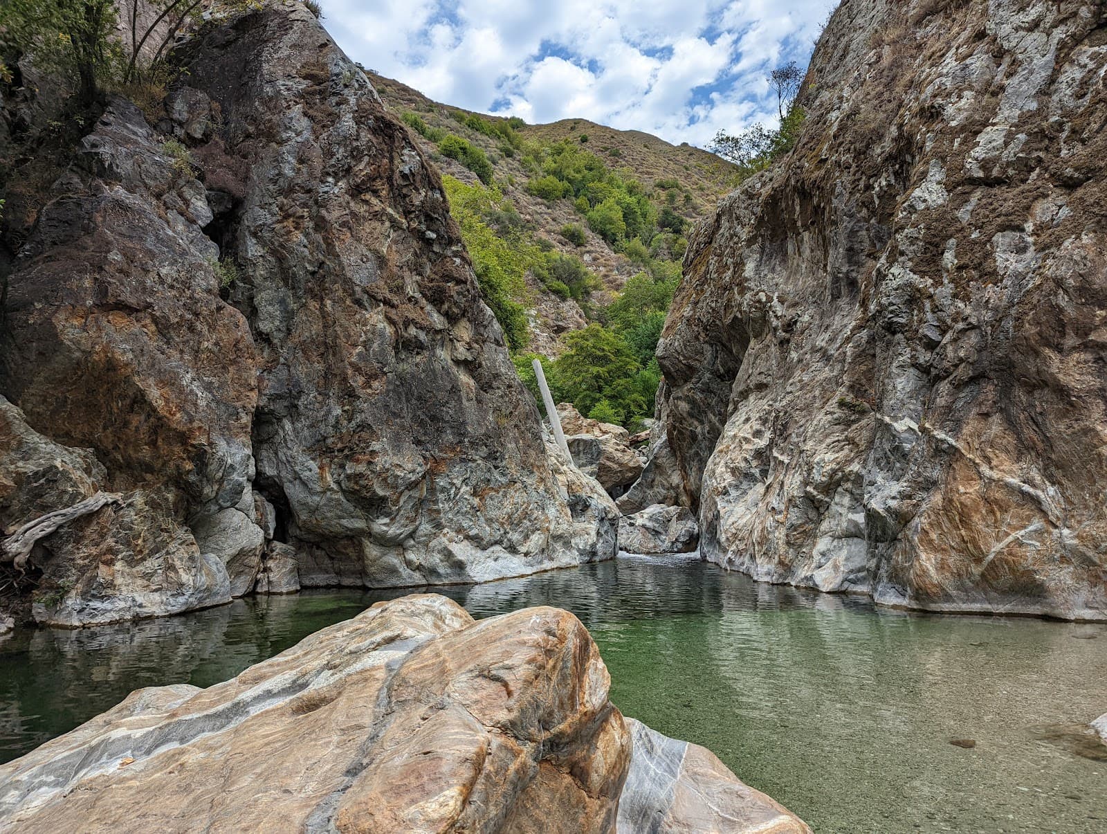
Redwood Groves and Meadows
Lower sections of the trail
Hike through enchanting redwood forests and open hillside meadows before the rugged climb begins.
Plans like a pro.
Thinks like you
Planning Your Visit
Prepare for Big Sur's Steepest Climb
Water and Weather Savvy
Best Times
Insider Tips
from TikTok, Instagram & Reddit
🚗 Check Road Conditions First
Rutty dirt roads lead to trailheads. Closures can mean a much longer hike. Always check before you go! :car:
💧 Pack Extra Water
Summer hikes are very hot. Bring more water than you think you'll need to stay hydrated on the steep ascent. :droplet:
🥾 Sturdy Hiking Boots
The trail is steep and can be rocky. Good footwear is essential for grip and ankle support. :athletic_shoe:
🐍 Wildlife Awareness
Be aware of potential wildlife like rattlesnakes and ticks, especially in warmer months. :snake:
Tips
from all over the internet
🚗 Check Road Conditions First
Rutty dirt roads lead to trailheads. Closures can mean a much longer hike. Always check before you go! :car:
💧 Pack Extra Water
Summer hikes are very hot. Bring more water than you think you'll need to stay hydrated on the steep ascent. :droplet:
🥾 Sturdy Hiking Boots
The trail is steep and can be rocky. Good footwear is essential for grip and ankle support. :athletic_shoe:
🐍 Wildlife Awareness
Be aware of potential wildlife like rattlesnakes and ticks, especially in warmer months. :snake:
⬆️ Drive Past First Turnout
For the shorter hike, pass the initial turnout and continue up the steep hill. :arrow_up:
What Travellers Say
Reviews Summary
Cone Peak offers incredibly dramatic and rewarding hikes with unparalleled coastal views, often described as one of the most incredible in the lower 48. Hikers praise the breathtaking scenery and the unique challenge of its steep ascent. However, visitors should be prepared for potentially rough access roads, intense summer heat requiring ample water, and the presence of wildlife.
"Pretty much one of the most incredible hikes you can do in the lower 48, year round. In the winter you might even get snow. In the summer it can be very hot so be sure to bring a lot of water."
Josiah Roe
"Awesome short hike with amazing views of the coast! The road up should be do able in a normal car as long as it has not been raining and you drive slowly. Make sure you pass the first hiking turn out and continue up the steep hill unless you want an extra long hike."
Geoff B
"One of the most dramatic short hikes I've done. About 2 miles each way after a lengthy drive on rutty dirt roads that are sometimes closed...be sure to check before going, since road closures may greatly lengthen hiking time. On a sunny day in February it was very warm after driving above the marine layer, and there were large numbers of ticks on the trail. Also heard but did not see rattlesnakes."
Mark Andrus
What People Like
What People Dislike
Frequently Asked Questions
🚇 🗺️ Getting There
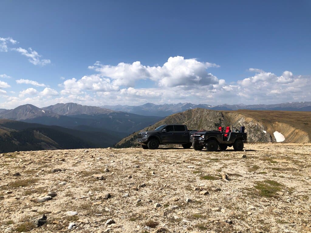
Access to Cone Peak typically involves driving on Highway 1 and then taking dirt roads to various trailheads. The road conditions can be rough and are subject to closures, especially after rain. It's crucial to check current road status before your trip. Some visitors recommend a vehicle with good clearance, though a normal car might manage if conditions are dry and you drive slowly.
The dirt roads leading to some Cone Peak trailheads can be rutty and steep. While some visitors have managed in normal cars, it's best to be cautious, especially if it hasn't been raining. Driving slowly and carefully is advised.
This is a challenging 23-mile out-and-back hike that starts near Highway 1 and ascends over 5100 feet to Cone Peak. It's known for its dramatic elevation gain and stunning coastal views.
Yes, besides the Highway 1 route, there are other trailheads that offer shorter but often steeper ascents to Cone Peak. These might involve driving further up dirt roads.
If the primary access roads are closed, your hiking time will significantly increase as you'll need to start from a further point. Always verify road conditions before departing.
🎫 🎫 Tickets & Entry
Typically, no specific permit is required for day hiking to Cone Peak. However, if you plan to backpack or camp in the surrounding Los Padres National Forest, you may need a wilderness permit. It's always best to check with the local ranger district for the most up-to-date regulations.
There are generally no entrance fees to access the Cone Peak trails themselves. However, if you are using a trailhead within a designated campground or recreation area, standard day-use fees might apply.
Cone Peak is an outdoor natural area and is generally accessible year-round, 24 hours a day. However, access can be limited by road conditions and weather, especially during winter months.
As there are no traditional tickets, the best 'time to buy' is to plan your visit during favorable weather conditions and ensure your vehicle is prepared for the access roads.
Since Cone Peak is a natural trail system and not a ticketed attraction, advance booking is not applicable. Planning your visit based on weather and road access is key.
🎫 🥾 Onsite Experience
The duration varies greatly by route. The 23-mile Highway 1 out-and-back can take a full day or more for backpackers. Shorter, steeper trails might take 3-6 hours roundtrip depending on your pace and fitness.
Cone Peak is considered a strenuous hike due to its significant elevation gain, especially the steep ascents. The Highway 1 trail is a long and demanding trek.
Expect absolutely breathtaking, panoramic views of the Big Sur coastline, the Pacific Ocean, and the surrounding Santa Lucia Mountains. It's a dramatic vista.
Restroom facilities are typically limited to the trailhead areas, if available at all. It's advisable to use facilities before you start your hike and be prepared for primitive conditions on the trail.
Wear sturdy hiking boots with good traction, comfortable moisture-wicking clothing, and layers for changing mountain weather. Sun protection (hat, sunscreen) is essential.
📸 📸 Photography
The summit offers unparalleled panoramic views of the coastline. Look for dramatic overlooks along the trail, especially where the vegetation opens up to reveal the ocean.
Golden hour, both sunrise and sunset, can provide stunning light for coastal and mountain photography. Midday can be harsh but still offers dramatic views.
A wide-angle lens is great for capturing the expansive coastal vistas. A telephoto lens can be useful for details in the landscape. Consider a sturdy tripod for low-light conditions. :camerawithflash:
Drone usage is generally restricted in national forests and state parks to protect wildlife and the natural environment. Always check local regulations before flying a drone. :noentrysign:
Use foreground elements to emphasize scale and depth. Shooting from a lower vantage point looking up can also highlight the dramatic incline.
For Different Travelers
Tailored advice for your travel style
👨👩👧 Families with Kids
If you are determined to experience the area, consider exploring more accessible coastal viewpoints in Big Sur or opting for shorter, flatter nature walks in nearby state parks. For families seeking a mountain experience, researching trails with less extreme elevation gain would be a more suitable choice.
💰 Budget Travelers
Be mindful of potential vehicle wear and tear on the dirt access roads. Packing all your own food and water is essential, as amenities are scarce. For an overnight trip, consider dispersed camping in the Los Padres National Forest (where permitted and with proper planning) rather than paid campgrounds to save money.
💑 Couples Seeking Adventure
For a shorter, yet still intense, experience, opt for one of the steeper, shorter trails. The incredible summit views provide a perfect backdrop for memorable moments and stunning photos. Remember to pack plenty of water and snacks to fuel your journey.
Deep Dives
In-depth insights and expert knowledge
The Steepest Ascent: Understanding Cone Peak's Challenge
This significant elevation change creates a unique hiking experience. As you ascend, you'll transition from coastal chaparral and potentially redwood groves into more rugged, exposed mountain terrain. The effort required is substantial, making it a rewarding challenge for experienced hikers and backpackers. Proper preparation, including ample water and sturdy footwear, is paramount for tackling this formidable peak.
Navigating Big Sur's Access Roads
While some visitors report success with standard cars, a vehicle with higher clearance and four-wheel drive can provide greater peace of mind and capability, especially if conditions are less than ideal. Driving slowly and cautiously is key to avoiding damage to your vehicle and ensuring a safe journey to the trailhead.
Wildlife and Seasonal Considerations
Seasonally, Cone Peak offers different experiences. Summer hikes can be extremely hot and dry, necessitating a significant water supply.


Social
from TikTok, Instagram & Reddit