Cerro Manquehue Santiago Chile
Hike to the summit of Cerro Manquehue for unparalleled panoramic views of Santiago and the Andes Mountains. A challenging yet rewarding trek.

Highlights
Must-see attractions

Social
From TikTok & Reddit
Best Time
Best visibility, less heat
Cerro Manquehue Santiago Chile
Best Time
Best visibility, less heat
Highlights
Must-see attractions
Hike to the summit of Cerro Manquehue for unparalleled panoramic views of Santiago and the Andes Mountains. A challenging yet rewarding trek.
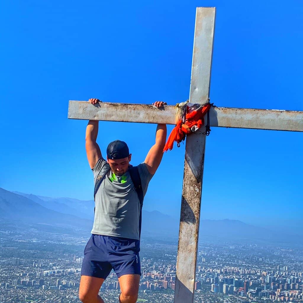
"The perfect spot to contemplate the city of Santiago de Chile. This is a moderate hike not recommended for beginners."
Wear Proper Hiking Shoes
Crucial for grip and safety, especially on descents. Avoid sneakers! :athletic_shoe:
Bring Plenty of Water
At least 2 liters per person, more on hot days. Hydration is key! :droplet:
Highlights
Discover the most iconic attractions and experiences

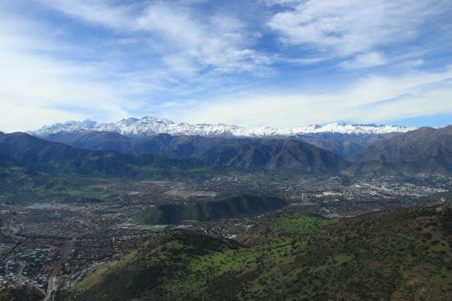
Panoramic City Views
Summit
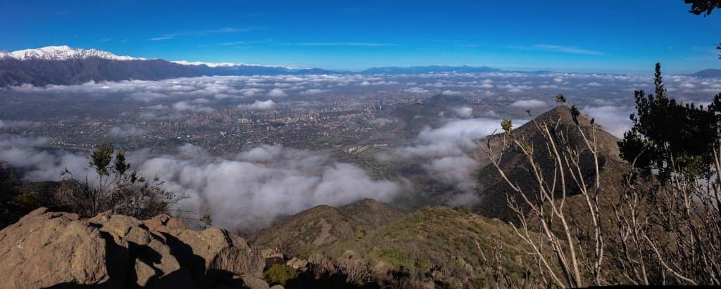
Breathtaking 360-degree views of Santiago and the Andes Mountains. A perfect spot for contemplation. :cityscape:

Andes Mountain Backdrop
Summit
Witness the majestic Andes range, sometimes snow-capped, providing a stunning natural backdrop. :mountain:

Challenging Yet Rewarding Trek
Trails
A moderately difficult hike that tests your endurance but offers immense satisfaction upon reaching the summit. :hiking_boot:
Plans like a pro.
Thinks like you
Planning Your Visit
Footwear is Key!
Timing and Hydration
Best Times
Insider Tips
from TikTok, Instagram & Reddit
Wear Proper Hiking Shoes
Crucial for grip and safety, especially on descents. Avoid sneakers! :athletic_shoe:
Bring Plenty of Water
At least 2 liters per person, more on hot days. Hydration is key! :droplet:
Sun Protection is a Must
Hat, sunscreen, and sunglasses are essential, even on cloudy days. :sunwithface:
Consider a GPS Backup
Trails are marked, but a GPS device or app can be helpful. :iphone:
Tips
from all over the internet
Wear Proper Hiking Shoes
Crucial for grip and safety, especially on descents. Avoid sneakers! :athletic_shoe:
Bring Plenty of Water
At least 2 liters per person, more on hot days. Hydration is key! :droplet:
Sun Protection is a Must
Hat, sunscreen, and sunglasses are essential, even on cloudy days. :sunwithface:
Consider a GPS Backup
Trails are marked, but a GPS device or app can be helpful. :iphone:
Muddy Trails After Rain
Be prepared for slippery conditions if it has rained recently. :umbrella:
Public Transport Options
Metro to Escuela Militar, then C14 bus to Via Roja. Taxis or Ubers are also options. :bus:
Leave No Trace
Pack out all your trash to keep the mountain beautiful. :recycle:
What Travellers Say
Reviews Summary
Visitors consistently praise Cerro Manquehue for its breathtaking panoramic views of Santiago and the Andes, calling it a 'mesmerizing' experience. The challenging yet rewarding hike is a significant draw for both locals and tourists seeking outdoor adventure. However, some find the trails unexpectedly difficult and emphasize the critical need for proper hiking footwear to avoid slips and falls, especially on muddy descents.
"Just mesmerizing!
I visited Manquehue on Sunday 6.09.2024. We were so lucky that it did rain the previous night and the sky was clear, no pollution line at all over Santiago. On the not so good side, the trail was a bit muddy and it made it difficult to go down.
On my way to Manquehue it was a bit confusing to find where the trail starts, so I am adding a picture as a reference. I took an UBER on my way there. It was about $12,000 CLP starting my trip in Kennedy Mall.
Once you start the trail, is easy to find the way. It is well signaled all the way up. It took me about 2 hours and a half on my way up and almost the same time on my way down but we saw more experienced people doing much less time.
Totally recommended when visiting Santiago Chile!"
Carlos Pena
"Google or Uber to 10300 Vía Roja, Vitacura. That will get you to the trailhead. Although the trail is marked pretty well, have a GPS device as a backup. I recommend Osmand. Do not underestimate this hike. It's pretty tough. Bring two liters of water, maybe more for hot days. Also, have adequate protection against the sun. CRITICALLY--use adequate footwear!!! My three-quarters Columbia hiking shoes were NOT adequate, particularly for the slippery descent. I fell about six times and could have hurt myself. I am a reasonably fit, 45-year-old man and I made it up in about 1:15 minutes. So don't back down from this hike. By the way, the views are beautiful."
John Saxon
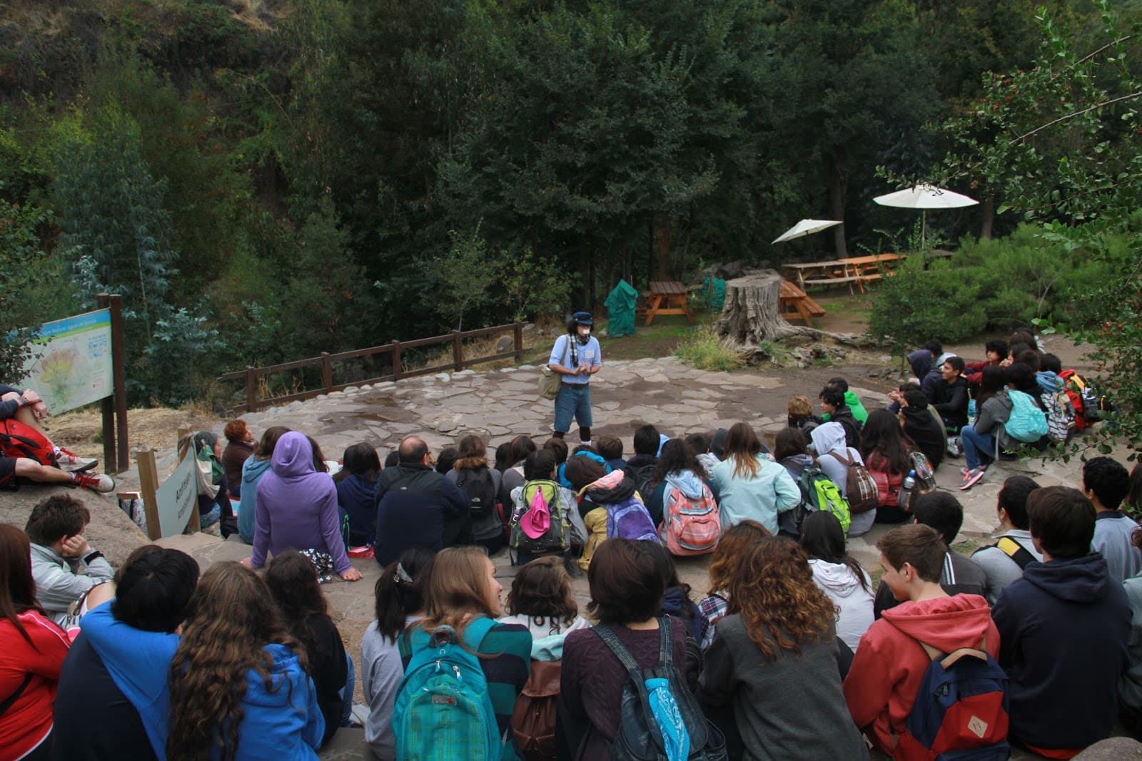
"Manquehue is such a beautiful place. Thank you to all the trail volunteers who keep it safe and accessible to the rest of us."
jose umana
What People Like
What People Dislike
Frequently Asked Questions
🚇 🗺️ Getting There
You can reach Cerro Manquehue using public transport or ride-sharing services. Take the Metro to Escuela Militar station, then catch the C14 bus towards Santa María with Vía Roja. From there, a short taxi or Uber ride (around CLP 4,000) will take you to the trailhead on Vía Roja. Alternatively, you can use Google Maps to search for 'Cerro Manquehuito' which often directs you to the parking area near the entrance.
Some visitors opt for an Uber directly from their accommodation, which can cost around $12,000 CLP from areas like Kennedy Mall.
The most common trailhead is located at 10300 Vía Roja, Vitacura. If using ride-sharing apps, inputting this address or 'Cerro Manquehuito' should guide you effectively.
Some TikToks show navigating to the 'military school' area and then finding the micro bus stop.
Parking is available near the main entrance, especially if you use navigation apps that guide you to the trailhead. It's advisable to arrive earlier on weekends to secure a spot, as it can get busy.
Yes, taxis and Ubers are a convenient option, especially if you're coming from further within Santiago or prefer not to navigate public transport. They can drop you directly at the trailhead.
Yes, there are at least two main access points: the southern face via Vía Roja and the northern face via El Golf de Manquehue. The Vía Roja entrance is generally more popular and accessible via public transport.
🎫 🎫 Tickets & Entry
There is no entrance fee to hike Cerro Manquehue. It's a public access area, making it a popular and accessible outdoor activity in Santiago.
Cerro Manquehue is generally accessible year-round during daylight hours. There are no official opening or closing times posted, but it's best to start your hike with enough daylight to complete it safely.
No, there is no admission fee to hike Cerro Manquehue. It's a free natural attraction for locals and tourists to enjoy.
Yes, weekends are a popular time for locals to visit Cerro Manquehue for hiking and recreation. Be prepared for larger crowds on Saturdays and Sundays.+1
While you can reach the summit in about 1-2 hours depending on your pace, the entire experience including travel time and enjoying the views can take half a day. It's more than just a quick stop.
🎫 🥾 Onsite Experience
Cerro Manquehue is considered a moderate to challenging hike. While some describe it as suitable for beginners, many reviewers emphasize it's tougher than it looks and not recommended for absolute beginners due to steep sections and potential for falls. It requires good physical condition.
The ascent typically takes between 1.5 to 2.5 hours, depending on your fitness level and pace. Some experienced hikers can reach the summit in about 1 hour and 15 minutes.
Sturdy hiking boots with good grip are essential. Wear comfortable athletic clothing suitable for variable weather. Layers are recommended as temperatures can change with altitude and sun exposure.
There are no facilities like restrooms or water fountains on the trail itself. It's crucial to bring all necessary supplies, including water and snacks, from the start.
Many people hike solo, and the trails are generally well-marked. However, it's always recommended to inform someone of your plans, carry a fully charged phone, and be aware of your surroundings, especially if hiking during off-peak hours.
📸 📸 Photography
Early mornings offer soft light and fewer crowds, ideal for capturing the city waking up. Sunsets provide dramatic colors over Santiago. Clear days after rain offer pristine views without the typical city pollution haze.
You can capture stunning panoramic shots of Santiago, the Andes mountain range, and the surrounding natural landscape. Drone photography is also popular for unique aerial perspectives.
The summit offers the most iconic panoramic views. However, various points along the trail provide excellent vantage points of the city and mountains, especially during sunrise or sunset.
Yes, drone photography is popular here, offering unique aerial views of the summit and the city. Ensure you are aware of any local drone regulations.
A wide-angle lens is great for capturing the expansive city and mountain vistas. A telephoto lens can be useful for details in the Andes. A sturdy tripod is helpful for low-light photography during sunrise or sunset.
For Different Travelers
Tailored advice for your travel style
👨👩👧 Families with Kids
💰 Budget Travelers
🏃 Fitness Enthusiasts
Deep Dives
In-depth insights and expert knowledge
Navigating the Trails
Consider the different routes available. While the Vía Roja entrance is common, there's also access from El Golf de Manquehue.
Best Times for Views and Photography
Photography enthusiasts will find ample opportunities. A wide-angle lens is ideal for capturing the sweeping panoramas.
Understanding the Difficulty and Preparation
Preparation is key. Bring at least two liters of water per person, and more on hot days.


Social
from TikTok, Instagram & Reddit