Sugarloaf Mountain San Mateo
A rewarding hike with stunning panoramic views of the San Francisco Peninsula and a refreshing, shaded forest experience.
Highlights
Must-see attractions

Social
From TikTok & Reddit
Best Time
Less fog, clearer views
Sugarloaf Mountain San Mateo
Best Time
Less fog, clearer views
Highlights
Must-see attractions
A rewarding hike with stunning panoramic views of the San Francisco Peninsula and a refreshing, shaded forest experience.
"Spectacular views of the peninsula and San Francisco from the top!"
Wear Sturdy Shoes
Trails can be steep and muddy. Good hiking boots are a must! :athletic_shoe:
Bring a Jacket
Mornings can be foggy and cool, even in summer. Layer up! :cloud:
Highlights
Discover the most iconic attractions and experiences
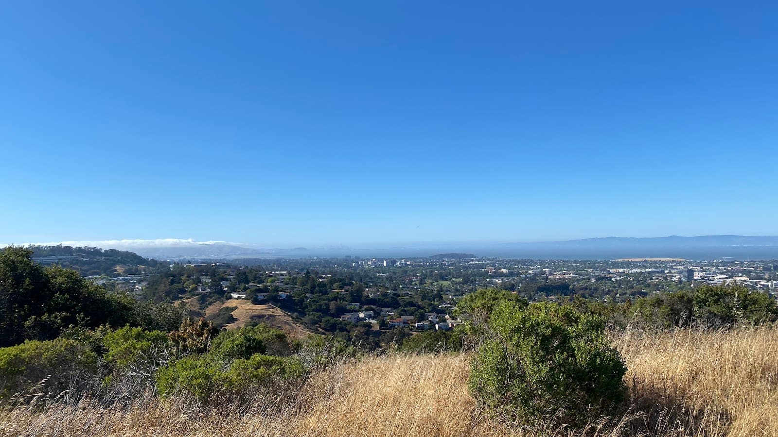
Panoramic Peninsula Views
Summit
Spectacular vistas of the entire peninsula and the distant San Francisco skyline.
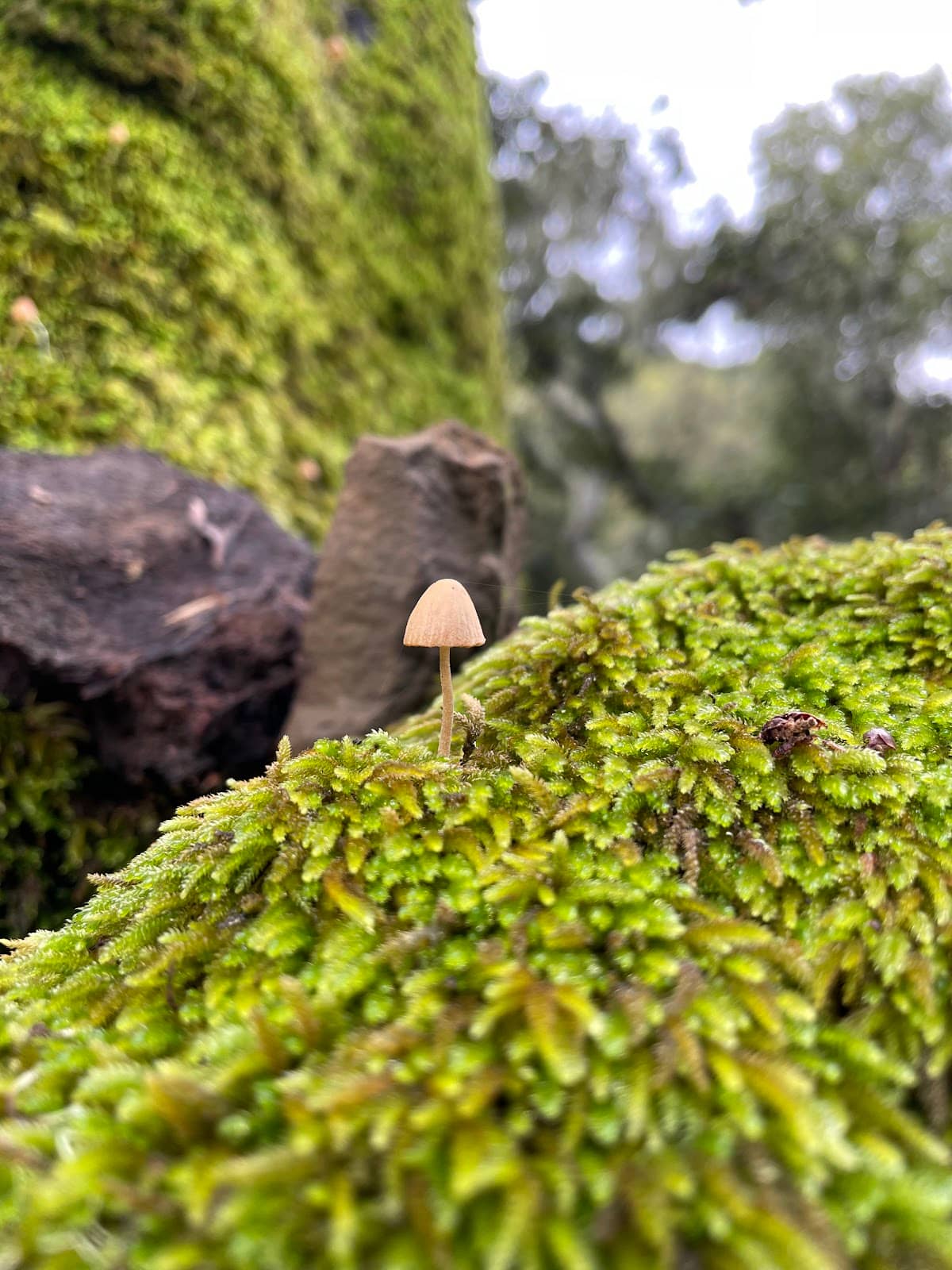
Shady Forested Trails
Various trails
Enjoy a refreshing hike through a cool, shaded forest, perfect for escaping the sun.

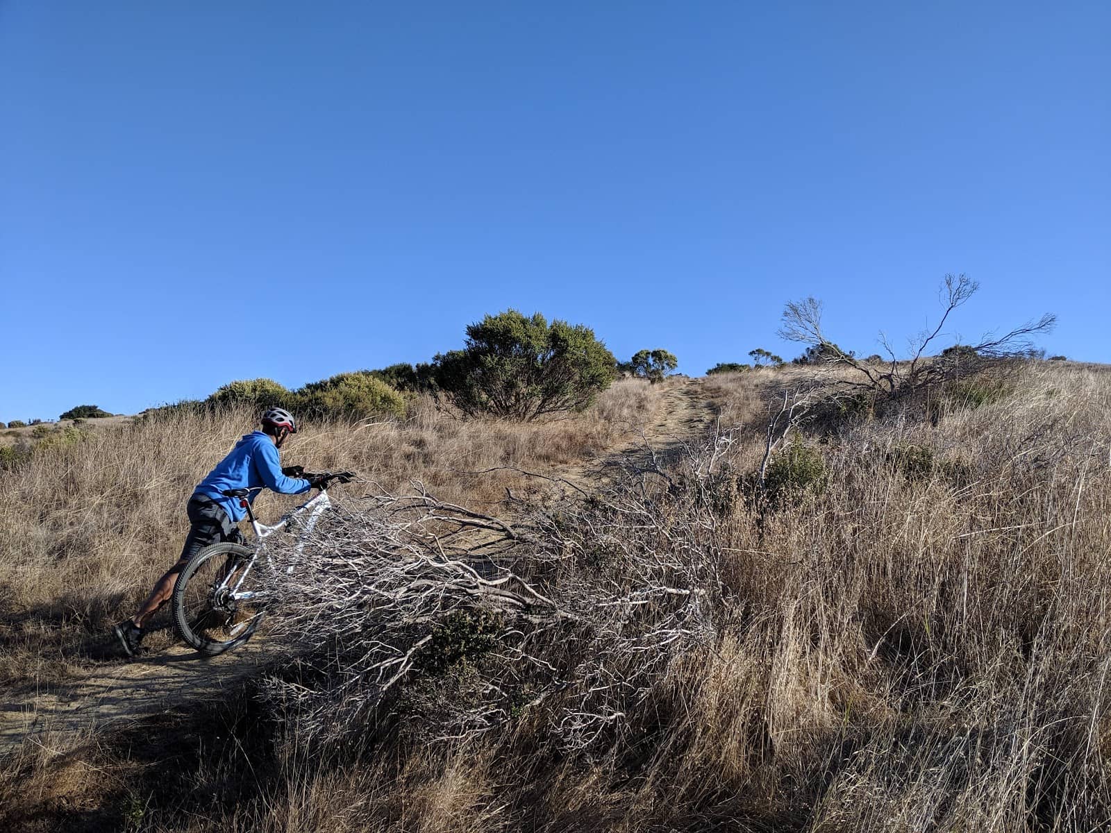
Challenging but Rewarding Climbs
Steep trails
Experience short, steep hikes that offer a good workout with a beautiful payoff.
Plans like a pro.
Thinks like you
Planning Your Visit
Trail Conditions & Footwear
Navigating the Trails
Best Times
Insider Tips
from TikTok, Instagram & Reddit
best walks?
Wear Sturdy Shoes
Trails can be steep and muddy. Good hiking boots are a must! :athletic_shoe:
Bring a Jacket
Mornings can be foggy and cool, even in summer. Layer up! :cloud:
Sometimes you need some perspective
Friend visiting. Will have one day free in San Mateo while I work. Ideas of things to do around area? Already been to San Francisco. Thanks!
Download a Map
Signage is sparse. A trail map app is super helpful for navigation. :iphone:
Check Weather First
Recent rains make trails muddy. Dry days offer the best experience. :umbrellawithrain_drops:
Tips
from all over the internet
Wear Sturdy Shoes
Trails can be steep and muddy. Good hiking boots are a must! :athletic_shoe:
Bring a Jacket
Mornings can be foggy and cool, even in summer. Layer up! :cloud:
Download a Map
Signage is sparse. A trail map app is super helpful for navigation. :iphone:
Check Weather First
Recent rains make trails muddy. Dry days offer the best experience. :umbrellawithrain_drops:
What Travellers Say
Reviews Summary
Visitors rave about the spectacular panoramic views from the summit and the refreshing, shaded trails. While some find the signage lacking and trails muddy after rain, the rewarding vistas and manageable hike lengths make it a popular choice for families and casual hikers alike.
"There isn’t much signage for this trail so it was a bit confusing finding the right way. Trail was steep at points and very muddy due to recent rains, but great views! We saw plenty of kids making it up the trail so isn’t too bad! 2m total"
Stephanie
"A good hike. Few trails are steep but there are easy trails too. All trails are 2 miles round trip. One can see good views of the peninsula and San Francisco from the top."
Rahul Pandey
"Beautiful hiking. Spectacular views."
BabyCat B
What People Like
What People Dislike
Frequently Asked Questions
🚇 🗺️ Getting There
Sugarloaf Mountain is accessible by car, with parking available near the trailheads. Public transport options are limited, so driving is generally recommended. Consider using navigation apps as signage can be minimal.
Yes, there are parking areas available, though they can fill up, especially on weekends. Arrive early for the best chance of securing a spot.
While biking is possible, the trails themselves are primarily for hiking. The surrounding roads offer cycling routes, but be aware of traffic.
🎫 🎫 Tickets & Entry
Sugarloaf Mountain San Mateo is a public park and generally does not require an entrance fee. Enjoy the natural beauty for free!
The park is typically open from dawn until dusk. It's always a good idea to check local park advisories for any temporary closures or changes.
No, tickets are not required as it's a public park. You can visit anytime during its operating hours.
🎫 🧭 Onsite Experience
There are several trails, most around 2 miles round trip. Some are steep and challenging, while others are more moderate. The trails offer great views of the peninsula and San Francisco.
Yes, many families hike here. While some trails are steep, there are easier options suitable for children. Plenty of kids have successfully made it to the top!
You can expect spectacular views of the San Francisco Peninsula and the city skyline. The summit offers panoramic vistas.
The forested areas and open spaces can attract various bird species, making it a pleasant spot for casual birdwatching.
While there aren't designated picnic areas, you can find scenic spots to enjoy a packed lunch, especially near the summit with its great views.
📸 📸 Photography
The summit offers the most iconic panoramic views of the peninsula and San Francisco. The shaded trails also provide beautiful, atmospheric shots with dappled sunlight.
Late afternoons often provide clearer skies and softer light for photography. Mornings can be foggy, which can create a moody, atmospheric effect if that's your preference.
A wide-angle lens is great for capturing the expansive views from the summit. A standard zoom lens is versatile for forest shots. Consider a polarizing filter to enhance sky colors.
For Different Travelers
Tailored advice for your travel style
👨👩👧 Families with Kids
Emphasize the reward of reaching the summit and enjoying the spectacular views together. It's a fantastic way to teach children about nature and the importance of physical activity. Downloading a trail map beforehand is a good idea to keep everyone on track and make the experience smoother. The shaded trails also offer a welcome respite on warmer days.
🚶♀️ Casual Hikers & Nature Lovers
Nature lovers will appreciate the shaded forest environment, which offers a refreshing escape. Keep an eye out for local flora and fauna. The relatively short duration of the hikes makes it perfect for a quick nature fix or as part of a larger day exploring the San Mateo area. Remember to wear appropriate footwear, especially after rain, as trails can become muddy.
Deep Dives
In-depth insights and expert knowledge
Exploring the Trails
Navigating these trails can sometimes be a challenge due to limited signage. It's highly recommended to download a trail map or use a GPS-enabled app on your phone to ensure you stay on the intended path. This is particularly helpful if you're exploring less-trafficked routes or if you're new to the area. Despite the occasional navigational puzzle, the effort is consistently rewarded with stunning scenery.
For those seeking a good walk in the area, the Sawyer Camp Trail is often mentioned as a pleasant, low-impact option, though it's paved. Sugarloaf Mountain provides a more natural, sometimes challenging, alternative with the potential for ridge walks and varied terrain, making it a popular choice for local hikers looking for a dose of nature and exercise.
Capturing the Views
Beyond the summit, the shaded trails themselves present unique photographic opportunities. The dappled sunlight filtering through the trees creates a serene and atmospheric environment, perfect for capturing the tranquility of the forest. Even on foggy mornings, the mist can lend a dramatic and moody quality to your shots, adding another layer of visual interest.
When planning your photo expedition, consider bringing a wide-angle lens to fully encompass the expansive views from the top. For the forest trails, a standard zoom lens offers versatility. A polarizing filter can be a valuable addition to enhance the colors of the sky and foliage, especially on brighter days. Remember to check the weather forecast, as clear days offer the best visibility for those iconic peninsula shots.


Social
from TikTok, Instagram & Reddit