
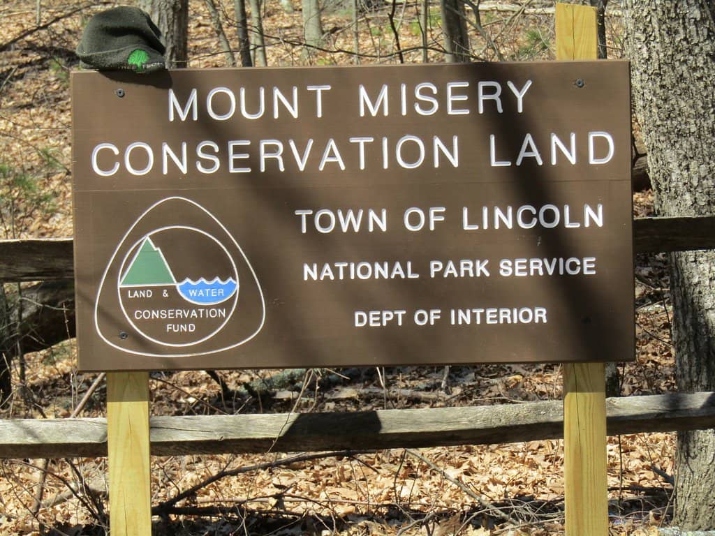
Mount Misery Trail
A scenic trail near Phoenixville, PA, offering waterfalls, historic ruins, and a mix of challenging and easy paths.

Highlights
Must-see attractions

Social
From TikTok & Reddit
Best Time
Beat the crowds and enjoy nature
Mount Misery Trail
Best Time
Beat the crowds and enjoy nature
Highlights
Must-see attractions
A scenic trail near Phoenixville, PA, offering waterfalls, historic ruins, and a mix of challenging and easy paths.
"Despite its name, Mount Misery Trail offers a rewarding experience with beautiful forest views and historical significance."
🎯 Park Smartly
Some trailheads lack parking. Try Knox Quarters or Pike Springs Rd for better access. :car:
👟 Wear Sturdy Shoes
The trail has steep inclines and wooden steps, especially at the start. :athletic_shoe:
Highlights
Discover the most iconic attractions and experiences
Valley Creek Trail
Valley Creek Trail
A scenic, mostly flat path alongside a beautiful creek, perfect for a relaxed stroll or family outing.
Colonial Springs Bottling Plant Ruins
Horseshoe Trail
Explore the intriguing ruins of a historic bottling plant, adding a touch of history to your hike.
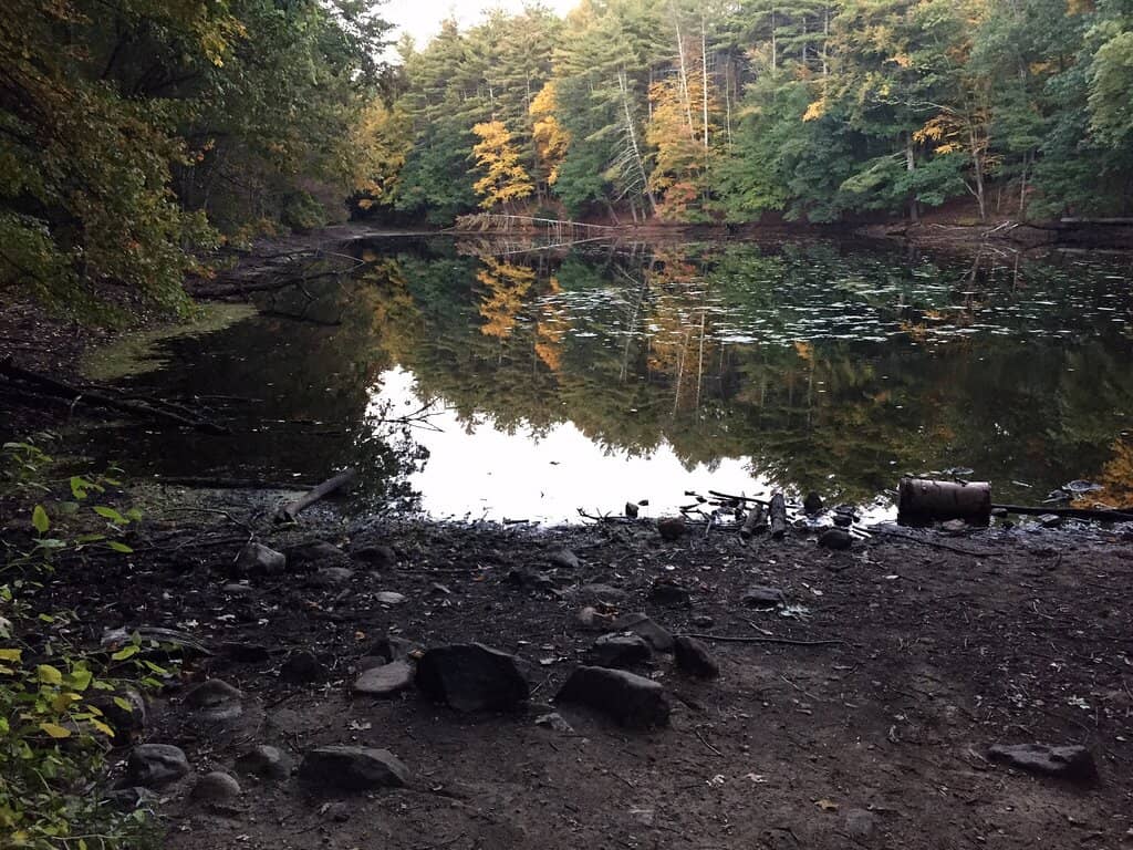
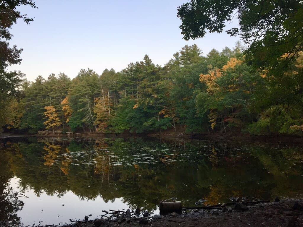
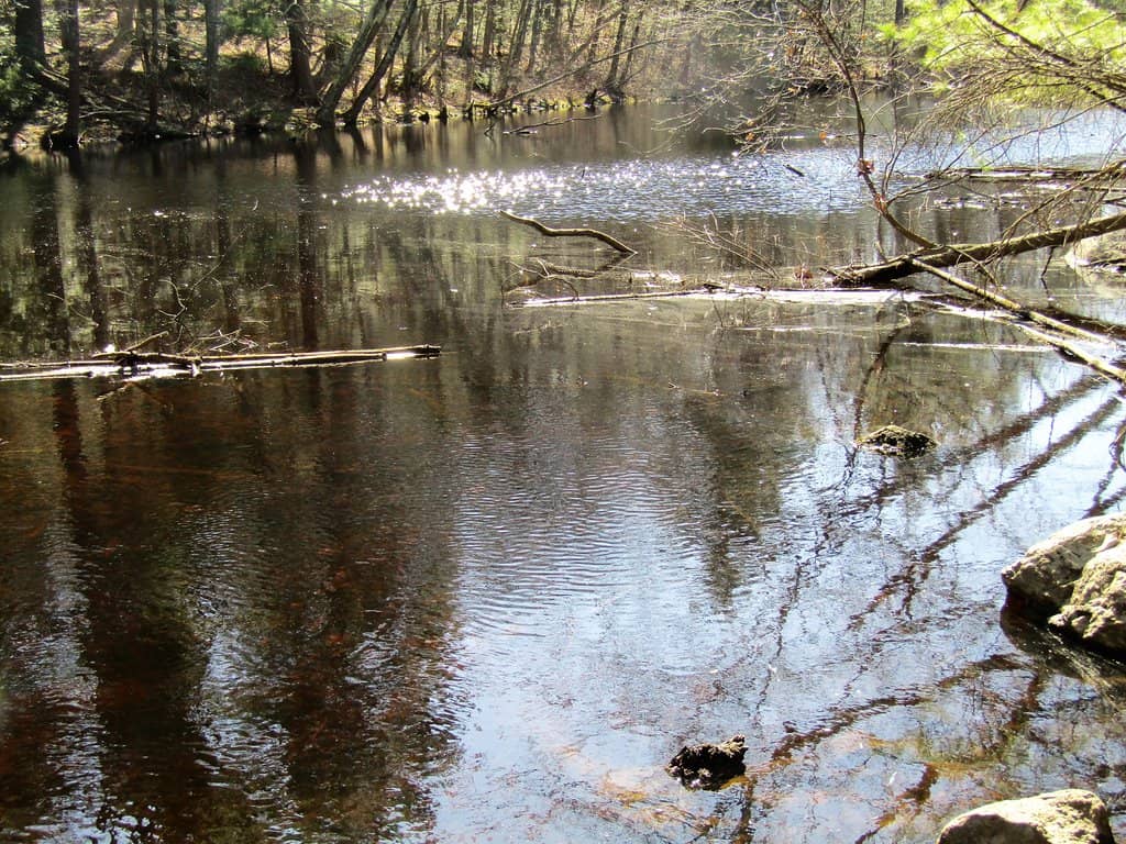
Waterfalls
Various points along the trail
Discover charming waterfalls that add to the natural beauty and tranquility of the Mount Misery Trail.
Plans like a pro.
Thinks like you
Planning Your Visit
Finding the Right Trailhead
Navigating the Terrain
Best Times
Insider Tips
from TikTok, Instagram & Reddit
🎯 Park Smartly
Some trailheads lack parking. Try Knox Quarters or Pike Springs Rd for better access. :car:
👟 Wear Sturdy Shoes
The trail has steep inclines and wooden steps, especially at the start. :athletic_shoe:
🐶 Dog-Friendly Fun
Leashed dogs are welcome! The varied terrain and creek access make it great for furry friends. :dog:
📸 Capture the Views
Despite its name, Mount Misery offers stunning forest views and charming waterfalls. :camerawithflash:
Tips
from all over the internet
🎯 Park Smartly
Some trailheads lack parking. Try Knox Quarters or Pike Springs Rd for better access. :car:
👟 Wear Sturdy Shoes
The trail has steep inclines and wooden steps, especially at the start. :athletic_shoe:
🐶 Dog-Friendly Fun
Leashed dogs are welcome! The varied terrain and creek access make it great for furry friends. :dog:
📸 Capture the Views
Despite its name, Mount Misery offers stunning forest views and charming waterfalls. :camerawithflash:
💧 Stay Hydrated
Bring water, especially on warmer days. Benches are available for rest stops. :water_wave:
What Travellers Say
Reviews Summary
Visitors praise Mount Misery Trail for its beautiful scenery, including waterfalls and forest views, and its historical ruins. It's considered a great spot for dog owners and families, with a mix of challenging inclines and easier riverside paths. Some find parking difficult to locate and note that the trails can get busy on weekends.
"Been here quite a few times. Easy hike for the most part. Very beautiful scenery."
Michael Majewski
"This trail was initially hard to find after Google took us to the trail head which does not have parking but once we found the parking lot near it we were able to easily walk to it. The trail starts out with a steep incline of wooden steps to go up. We then ended up at the crossroad heading right on the wolfinger trail and back to the beginning by taking the valley Creek trail path along the water. It was perfect for our dog and younger child as it kept his interest with every turn and there were even a few benches along the way to rest and give the dog water. It is quite busy during a nice weekend day so most be aware of the extra traffic during peak times."
Jessica Cornell
"Mount Misery Trailhead in Pennsylvania is the starting point for a popular 2.9-mile out-and-back trail near Chesterbrook. It’s a moderately challenging hike, taking about 1 hour and 33 minutes to complete, and is frequented by bird watchers, hikers, and runners. The trail is accessible year-round and is known for its beautiful forest views, wildflowers, and wildlife. Despite its daunting name, Mount Misery Trail offers a rewarding experience with its varied terrain and historical significance, as it includes the ruins of the Colonial Springs Bottling Plant"
Anwar M Hossain
What People Like
What People Dislike
Frequently Asked Questions
🚇 🗺️ Getting There
Finding the correct parking can be a bit confusing. While some sources might point to a trailhead without parking, it's recommended to look for parking near Knox Quarters or along Pike Springs Road for easier access to the main trails.
Public transport options to the immediate trailhead are limited. It's best to drive or use a ride-sharing service to reach the parking areas.
Mount Misery Trail is conveniently located about 30 minutes from Philadelphia. Driving is the most practical option.
Parking at the recommended trailheads is generally free. However, be aware that some parking lots may have potholes.
GPS can be helpful, but be cautious as it might lead you to trailheads without adequate parking. Cross-referencing with local maps or community advice is recommended.
🎫 🎫 Tickets & Entry
No, Mount Misery Trail is a public park and does not require tickets for entry. It's free to explore.
The trail is accessible year-round, offering beautiful scenery in every season. There are no set operating hours as it's an outdoor public space.
There is no entrance fee to access Mount Misery Trail. Enjoy the natural beauty without any cost.
While the trail is technically accessible, hiking at night is not recommended due to safety concerns and lack of lighting.
No permits are required for general hiking on Mount Misery Trail.
🎫 🏞️ Onsite Experience
The trail is generally considered moderately challenging. It features steep inclines with wooden steps at the beginning, but the Valley Creek Trail section is much flatter and easier.
A popular loop combining Mount Misery and Valley Creek trails is about 3 miles and typically takes 1 to 1.5 hours to complete, depending on your pace and stops.
Restroom facilities are not widely available directly on the trails. It's advisable to use facilities before you start your hike.
Yes, Mount Misery Trail is frequented by bird watchers due to its beautiful forest environment and diverse wildlife.
Absolutely! Mount Misery Trail is very dog-friendly, provided your dog is on a leash. It's a great spot for them to explore. :dog:
📸 📸 Photography
Capture the charming waterfalls, the historic ruins of the Colonial Springs Bottling Plant, and the lush forest scenery. The Valley Creek Trail also offers picturesque riverside shots. +1
Yes, the varied terrain, water features, and forest canopy provide excellent opportunities for landscape photography throughout the year.
Early morning or late afternoon light can create beautiful, soft lighting for photography, especially around the waterfalls and creek.
Drone usage regulations can vary. It's best to check with local park authorities or the Valley Forge National Historical Park for specific rules regarding drone operation.
The area around the waterfalls and the ruins of the bottling plant are particularly photogenic. The scenic views from the higher parts of the trail are also noteworthy. +1
For Different Travelers
Tailored advice for your travel style
👨👩👧 Families with Kids
While the initial climb can be steep, it's a manageable challenge for most families, and there are benches along the way for rest stops. Bringing snacks and water is recommended, and leashed dogs are welcome, making it a fun outing for the whole family.
🐶 Dog Owners
The Valley Creek Trail is especially enjoyable for dogs, offering easy access to water and a pleasant walking surface. Many dog owners report their pets love exploring the different sights and sounds of the trail.
🚶♀️ Casual Hikers & Nature Lovers
Opt for the Valley Creek Trail for a more leisurely stroll, or tackle the steeper sections for a bit more of a workout. The trail is well-regarded for its natural beauty and the peaceful atmosphere, making it a great escape for a few hours.
Deep Dives
In-depth insights and expert knowledge
Exploring the History of Mount Misery Trail
The name 'Mount Misery' itself hints at a challenging past, though modern hikers often find the trails quite pleasant. The area has seen various uses over time, and exploring the ruins offers a glimpse into this history. It's a reminder that even seemingly wild places often have stories to tell about human endeavors.
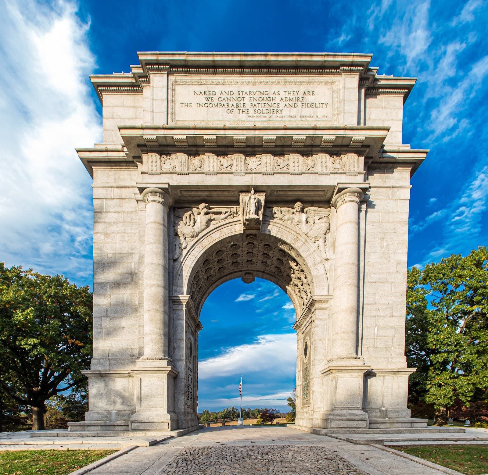
For those interested in local history, combining a hike with a visit to the nearby Valley Forge National Historical Park can provide a more comprehensive understanding of the region's significance. The trails around Mount Misery offer a more intimate, natural exploration compared to the grander historical narratives of Valley Forge, but the ruins provide a tangible link to the past.
Navigating the Trails: From Steep Climbs to Riverside Strolls
Once you reach the higher points, the trails can lead to various points of interest, including the aforementioned ruins. For a more relaxed experience, the Valley Creek Trail provides a contrasting, mostly flat path that meanders alongside the picturesque Valley Creek. This section is ideal for families with young children, dog walkers, or anyone seeking a gentler walk amidst nature.
Many visitors enjoy creating a loop by combining the steeper sections with the riverside path. This allows for a varied 3-mile hike that offers both a challenge and a serene, scenic conclusion. The accessibility of the Valley Creek Trail makes it a great option for those who want to experience the beauty of the area without a strenuous climb.
Social
from TikTok, Instagram & Reddit