Dry Fork Flume Interpretive Trail
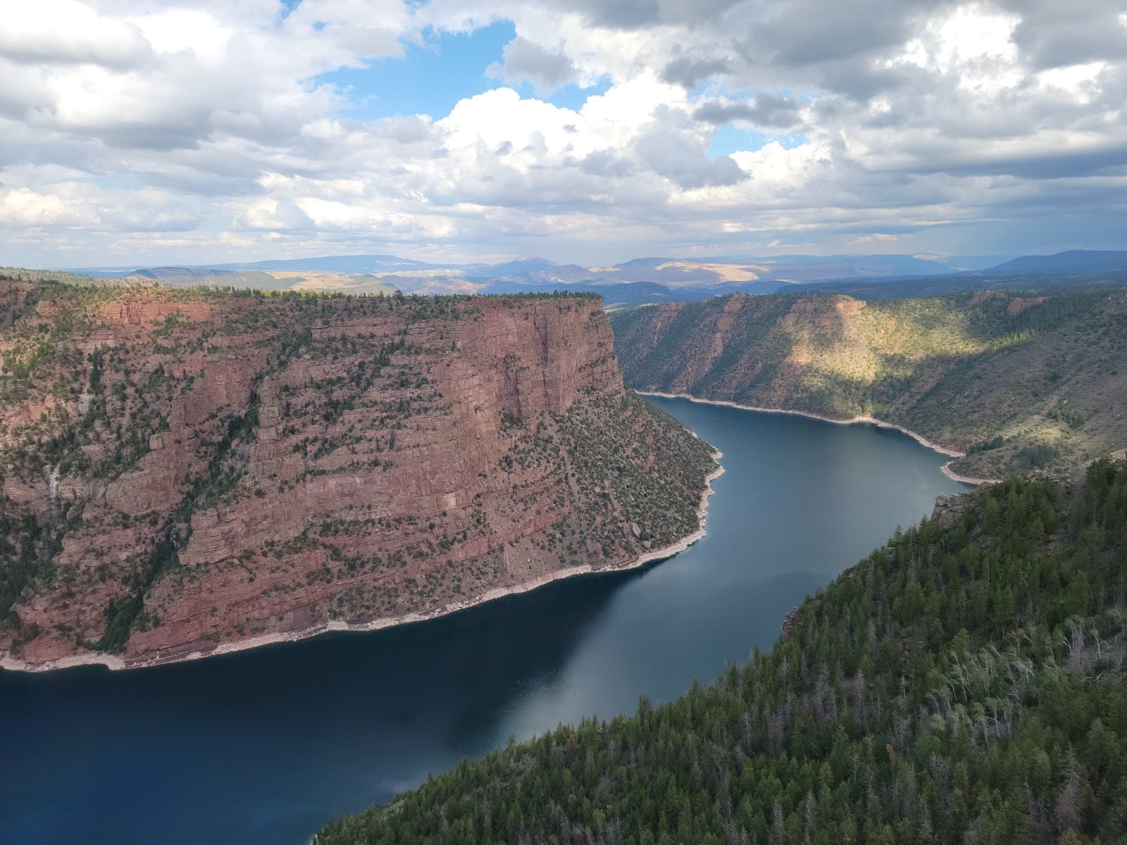
Discover history and nature on the Dry Fork Flume Interpretive Trail, featuring old flumes, riverbeds, and mountain scenery.
Highlights
Must-see attractions

Social
From TikTok & Reddit
Best Time
Pleasant temperatures, fewer crowds
Dry Fork Flume Interpretive Trail
Best Time
Pleasant temperatures, fewer crowds
Highlights
Must-see attractions
Discover history and nature on the Dry Fork Flume Interpretive Trail, featuring old flumes, riverbeds, and mountain scenery.
"This trail is great for hiking, biking, and horse back riding with tons of cool things to see."
🗺️ Plan Your Route
The trail is long and has varied terrain. Know your endpoint and estimated time to avoid getting caught in the dark.
👟 Wear Sturdy Footwear
Some sections are rugged and unimproved. Good hiking boots are recommended for comfort and safety.

Highlights
Discover the most iconic attractions and experiences
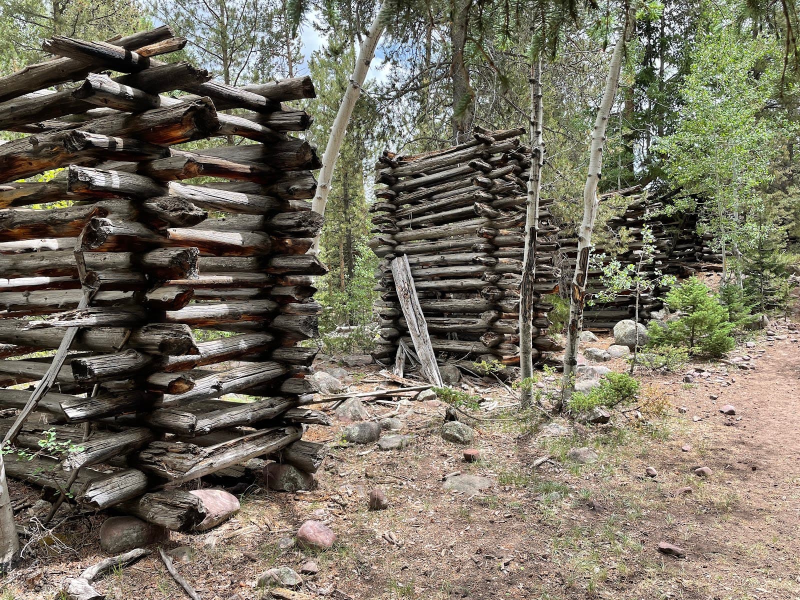
Historic Flume Structures
Upper sections of the trail
Discover remnants of old flumes, a testament to historical engineering in the canyon.
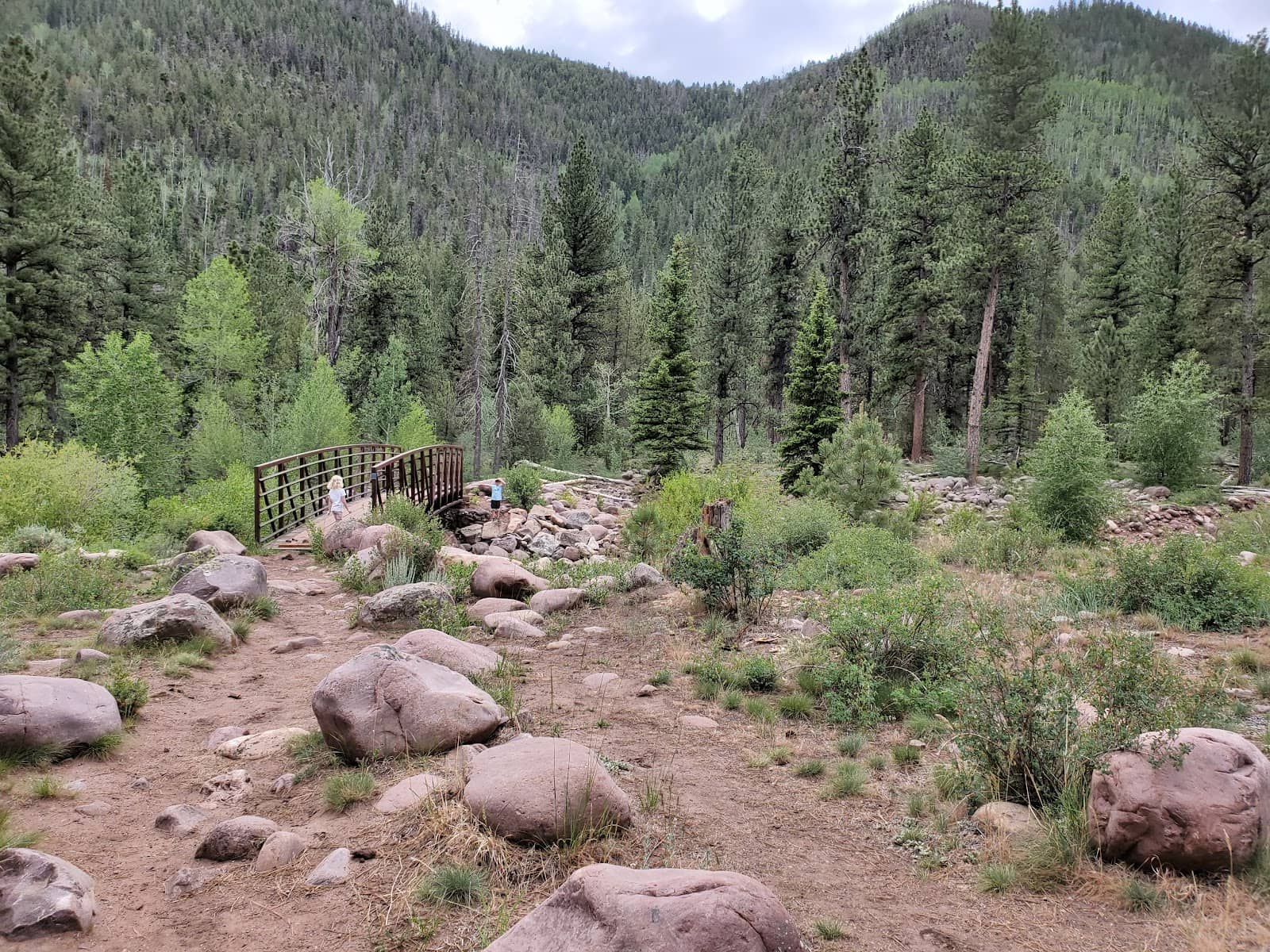
River Access & Scenery
Trail's end or along the river
Enjoy the scenic riverbed, bridge crossings, and surrounding mountains and greenery.

Aspen Groves
Various points along the trail
Seek out vibrant aspen trees, especially beautiful during autumn for a splash of color.
Plans like a pro.
Thinks like you
Planning Your Visit
Trail Conditions & Access
Trail Length & Navigation
Best Times
Insider Tips
from TikTok, Instagram & Reddit
🗺️ Plan Your Route
The trail is long and has varied terrain. Know your endpoint and estimated time to avoid getting caught in the dark.
👟 Wear Sturdy Footwear
Some sections are rugged and unimproved. Good hiking boots are recommended for comfort and safety.
💧 Check River Conditions
The riverbed can be dry or shallow. If you're seeking water features, check recent reports.
🚗 Multiple Access Points
There are various places to start your hike, offering different experiences and views.
Tips
from all over the internet
🗺️ Plan Your Route
The trail is long and has varied terrain. Know your endpoint and estimated time to avoid getting caught in the dark.
👟 Wear Sturdy Footwear
Some sections are rugged and unimproved. Good hiking boots are recommended for comfort and safety.
💧 Check River Conditions
The riverbed can be dry or shallow. If you're seeking water features, check recent reports.
🚗 Multiple Access Points
There are various places to start your hike, offering different experiences and views.
🐴 Horseback Riding Friendly
The upper section is an unimproved horse trail, making it suitable for equestrian activities.
What Travellers Say
Reviews Summary
Visitors generally love the Dry Fork Flume Interpretive Trail for its scenic beauty, historical remnants, and varied terrain suitable for hiking, biking, and horseback riding. However, some find certain sections too rugged or the trail longer than expected, advising careful planning.
"We love this trail. There are multiple places you can start and see tons of cool things. At the very top you can see where they built flumes forever ago. Just beyond that you get to the river which was shallow when we went. Hike goes along the river, bridge crossings, camping spots, mountains, and greenery. This trail is great for hiking, biking, and horse back riding."
Justin B
"We hiked up into the canyon instead of down toward the camp areas. Very tretrous & we hiked for so long, we ended up turning around because it was dark & we still didn't find the end of the trail. Still beautiful hike."
Mia D
"The trail was way to tame for mountain biking. Good for a short family jaunt. Upper section was an unimproved horse trail."
C D
What People Like
What People Dislike
Frequently Asked Questions
🚇 🗺️ Getting There
The trail has multiple access points. Visitors often start near camping areas or specific trailheads. It's recommended to use GPS coordinates or a detailed map to find your preferred starting point, as signage can be minimal.
Parking availability varies by access point. Some trailheads have designated parking areas, while others might have limited roadside parking. Arrive early, especially on weekends, to secure a spot.
Most main access points are reachable by regular vehicles. However, some unpaved roads leading to more remote trailheads might require a vehicle with higher clearance, especially after rain.
Directions depend on your starting point. Many visitors use navigation apps to find trailheads near campgrounds or specific canyon entrances. It's wise to download offline maps as cell service can be spotty.
Larger RVs might find access challenging at some trailheads due to narrow roads or limited parking. Smaller campers or trailers may be more manageable. Check specific access road conditions beforehand.
🎫 🎫 Tickets & Entry
No, the Dry Fork Flume Interpretive Trail is generally free to access. There are no admission fees required to enter the trail system.
The trail is open year-round, from dawn to dusk. There are no official operating hours, but it's advisable to plan your visit during daylight for safety and enjoyment.
While day hiking is typically free, camping may require a permit depending on the specific area and regulations. It's best to check with local land management agencies for current camping rules.
Guided tours are not commonly offered for this trail. Most visitors explore independently, using interpretive signs along the route.
There are no entrance fees for the Dry Fork Flume Interpretive Trail itself. However, if you access it via a national forest or park that has an entrance fee, that fee would apply.
🎫 🧭 Onsite Experience
The trail offers diverse experiences. For history buffs, focus on the upper sections with flume remnants. For nature lovers, explore the riverbed and surrounding mountains. It's great for hiking, biking, and horseback riding.
The duration varies greatly depending on your starting point and how far you go. Some sections are a short family jaunt, while others can be a long, strenuous hike. Plan for several hours if you aim for the furthest points.
Yes, certain sections are tame and suitable for a short family outing. However, be aware that other parts are more rugged and may not be ideal for very young children.
You might encounter local wildlife such as deer, birds, and smaller mammals. Always maintain a safe distance and do not feed the animals.
Facilities are generally limited along the trail itself. Restrooms are more likely to be found at designated campgrounds or main access points. Pack out everything you pack in.
📸 📸 Photography
Capture the historic flume structures, scenic riverbeds (even when dry), vibrant aspen groves, and panoramic mountain views. The varied terrain offers diverse photographic subjects.
Golden hour, shortly after sunrise and before sunset, offers the most flattering light for landscape photography. Midday can be harsh, but good for capturing details of the flumes.
A versatile lens like a 24-70mm is useful for landscapes and details. Consider a wide-angle lens for grand vistas and a macro lens for close-ups of flora. A sturdy tripod is helpful for low-light conditions.
The areas around the historic flume remnants and along the river offer excellent vantage points. Look for elevated spots for wider canyon views.
Drone usage is subject to regulations by the governing land management agency (e.g., U.S. Forest Service). Always check current rules and restrictions before flying to ensure compliance.
For Different Travelers
Tailored advice for your travel style
👨👩👧 Families with Kids
Tips for families: Stick to the more developed parts of the trail, especially near campgrounds, for easier access and less challenging terrain. Bring plenty of snacks and water, as facilities are scarce. Be mindful of the trail's length; some visitors have found it much longer than anticipated, so plan a turnaround point before little ones get too tired.
🏞️ Nature Enthusiasts & Photographers
Photography tips: The historic flume structures provide unique subjects, blending history with nature. The riverbed, even when dry, offers interesting textures and patterns. Golden hour light can create magical shots of the mountains and canyon. Remember to bring a versatile camera setup to capture both grand vistas and intricate details.
🐎 Equestrians & Bikers
Recommendations: Equestrians and bikers should be aware of the trail's varied conditions and potential for shared use with hikers. It's wise to check for any specific regulations regarding equestrian or bicycle use in certain sections. Always prioritize safety and be respectful of other trail users.
Deep Dives
In-depth insights and expert knowledge
Exploring the Historic Flumes
Understanding the context of these flumes enhances the hiking experience. Imagine the effort involved in constructing and maintaining them in this rugged terrain. While some sections are well-preserved, others may be overgrown or partially collapsed, adding to the sense of discovery. Always tread carefully around historical sites to preserve them for future visitors.
For those interested in history, dedicating time to explore these remnants is highly recommended. They serve as a tangible connection to the area's past and are a unique feature that many visitors rave about.
Navigating the Trail's Varied Terrain
Key considerations for navigation include the trail's length and the presence of unimproved sections, especially the upper parts which are noted as unimproved horse trails. This suggests uneven ground, potential obstacles, and a less defined path. Visitors have reported turning back due to darkness, highlighting the importance of planning your hike duration and carrying adequate lighting.
For hikers, bikers, and horseback riders, understanding these variations is crucial. It's advisable to check recent trail reports or consult with local rangers about current conditions before setting out. Proper footwear, navigation tools, and a clear understanding of your physical limits will ensure a safer and more enjoyable experience.


Social
from TikTok, Instagram & Reddit