Mount Umunhum
A historic peak in the Santa Cruz Mountains, offering panoramic Bay Area views and a unique Cold War-era radar tower.

Highlights
Must-see attractions

Social
From TikTok & Reddit
Best Time
Best visibility for views
Mount Umunhum
Best Time
Best visibility for views
Highlights
Must-see attractions
A historic peak in the Santa Cruz Mountains, offering panoramic Bay Area views and a unique Cold War-era radar tower.
"The views of the Bay Area are unmatched on a clear day. The drive up is curvy, narrow, and steep, but is well worth the effort."
Check the Weather First
Fog can obscure views, but also creates magical scenes! Check forecasts for clear days or embrace the mist.
Drive Carefully Uphill
The road is winding and steep. Take your time and enjoy the scenic drive.
Highlights
Discover the most iconic attractions and experiences
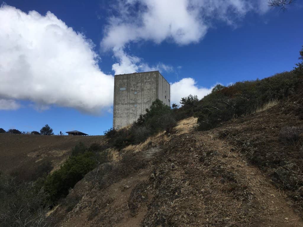
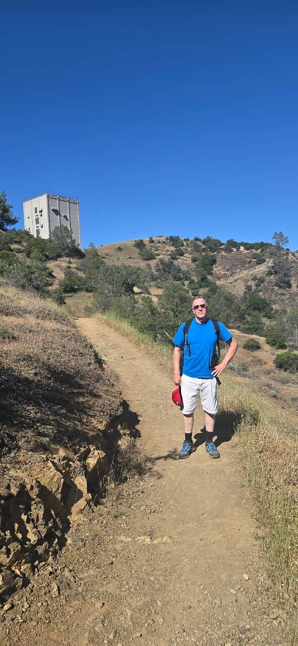
The Iconic Radar Tower
Summit
A unique Cold War-era radar station, this 'cube' offers a glimpse into history and a stunning backdrop for photos.
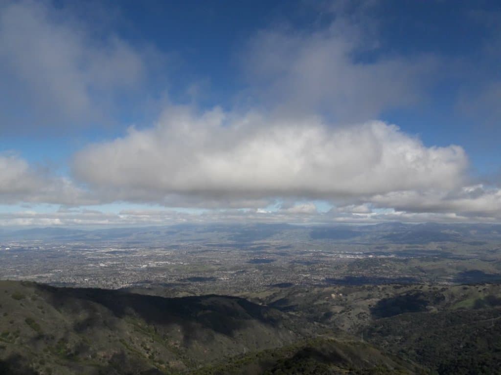
Panoramic Bay Area Views
Summit
On clear days, witness breathtaking 360-degree views stretching across the Bay Area and towards the Pacific.

Historic and Sacred Ground
Throughout the mountain
Explore a site revered by Native Americans and later used as a strategic Air Force base.
Plans like a pro.
Thinks like you
Planning Your Visit
Timing is Everything for Views
Know Your Drive and Trail
Best Times
Insider Tips
from TikTok, Instagram & Reddit
Check the Weather First
Fog can obscure views, but also creates magical scenes! Check forecasts for clear days or embrace the mist. +1
Drive Carefully Uphill
The road is winding and steep. Take your time and enjoy the scenic drive.
Cell Service is Spotty
Download maps offline before you go, as service is limited.
Wear Comfortable Shoes
Whether hiking or exploring the summit, good footwear is essential. :athletic_shoe:
Tips
from all over the internet
Check the Weather First
Fog can obscure views, but also creates magical scenes! Check forecasts for clear days or embrace the mist. +1
Drive Carefully Uphill
The road is winding and steep. Take your time and enjoy the scenic drive.
Cell Service is Spotty
Download maps offline before you go, as service is limited.
Wear Comfortable Shoes
Whether hiking or exploring the summit, good footwear is essential. :athletic_shoe:
Pack Water & Snacks
There are no facilities at the summit, so come prepared. :water_wave:
What Travellers Say
Reviews Summary
Visitors consistently praise Mount Umunhum for its breathtaking panoramic views and the unique historical significance of its radar tower. The scenic drive and the opportunity to explore a site with deep cultural roots are major draws. While the winding roads can be challenging, most agree the effort is well worth the spectacular scenery and historical insights.
"I asked someone from station member where can I go to see Mountain View, and he suggested Mount Umunhum, which was about 1 hour from where I was staying at.
After an hour driving on top of the mountain, I was able to view one of the most beautiful views I've seen in California and one of the highest mountains to drive up. I highly highly recommend visiting this place because it's such a beautiful view on top of the mountain and definitely worth the drive up the mountain with so many different views.
The Best Thing I Did In California"
Kamran
"Iconic peak overlooking Almaden Valley is a unique blend of history from the Native Americans who revered this sacred mountain to the Cold War period and its strategic importance in protecting the West Coast from Soviet attack. The views of the Bay Area are unmatched on a clear day. The drive up is curvy, narrow, and steep, and not for inexperienced drivers, but is well worth the effort."
Brian Blake
"Amazing view and one of my favorite hiking spots, wallked the 3.7 mile trail from bald mountain and it was totally worth it. We get to see some snow even on April."
Alex Lopez
What People Like
What People Dislike
Frequently Asked Questions
🚇 🗺️ Getting There
Mount Umunhum is accessible by car via a winding, steep road. Parking is available at the summit for those who drive up. For hikers, the trailhead is often accessed from the Sierra Azul Open Space Preserve. Some visitors consider biking from the Peninsula, though it's a challenging ride.
Public transportation options are limited. While Caltrain can get you to the general Bay Area, you'll likely need to arrange further transport or a long bike ride to reach the mountain itself.
The drive is scenic but features narrow, winding, and steep roads. It's recommended for experienced drivers. The journey offers beautiful views as you ascend.
Parking is available at the summit for those driving directly to the top. If you're hiking from a trailhead like Bald Mountain, parking is available at the preserve.
It typically takes about 45 minutes to an hour to drive from San Jose to Mount Umunhum, depending on traffic and your starting point.
🎫 🎫 Tickets & Entry
No, Mount Umunhum is free to visit. The roads and trails are open to the public without an admission fee.
Mount Umunhum is generally open from 7 a.m. until sunset. It's always a good idea to check the official Midpeninsula Open Space District website for any seasonal or unexpected closures.+1
No, tickets are not required. Mount Umunhum is an open space preserve and does not require advance booking for general access.
Visitors are encouraged to practice 'leave no trace' principles. Be mindful of wildlife, stay on marked trails, and respect the natural environment.
Yes, there is a paved road leading to the radar tower, and a special parking area is available for visitors with physical disabilities [^Review].
🎫 🧭 Onsite Experience
You can hike or bike the trails, explore the historic radar tower, and enjoy panoramic views of the Bay Area and Santa Cruz. It's also a great spot for photography and appreciating nature.+1
The 'cube' is an 84.5-foot radar tower, part of the former Almaden Air Force Station used during the Cold War for national defense.+1
Trails vary in length and difficulty, with options for both casual walkers and experienced hikers. The Mount Umunhum Peak Trail is an 8-mile round trip.
Yes, you can hike to the summit. The Mount Umunhum Peak Trail is a popular option, offering a challenging but rewarding experience.+1
You might spot various birds and potentially larger mammals like mountain lions, though sightings are rare and they typically stay on private property.
📸 📸 Photography
The summit with the radar tower offers iconic shots. The panoramic views are also fantastic, especially during sunrise or sunset.
Golden hour, around sunrise and sunset, provides beautiful lighting. The marine layer fog can also create dramatic and unique photographic opportunities.+1
Drone usage is typically restricted in open space preserves to protect wildlife and visitor experience. Check local regulations before flying.
A wide-angle lens is great for capturing the expansive views and the radar tower. A telephoto lens can be useful for wildlife spotting.
The juxtaposition of the modern radar tower against the natural landscape, the dramatic fog, and the historical significance of the site offer many unique photographic opportunities.
For Different Travelers
Tailored advice for your travel style
👨👩👧 Families with Kids
🚶♀️ Hikers and Outdoor Enthusiasts
📸 Photographers and View Seekers
Deep Dives
In-depth insights and expert knowledge
The History of Mount Umunhum
Today, Mount Umunhum is part of the Sierra Azul Open Space Preserve, managed by the Midpeninsula Open Space District. The preserve protects its natural resources while allowing public access for recreation. The trails wind through diverse landscapes, reflecting the mountain's past from its sacred origins to its military use. Visitors can learn about these different eras through interpretive signage and the very presence of the historic radar tower.
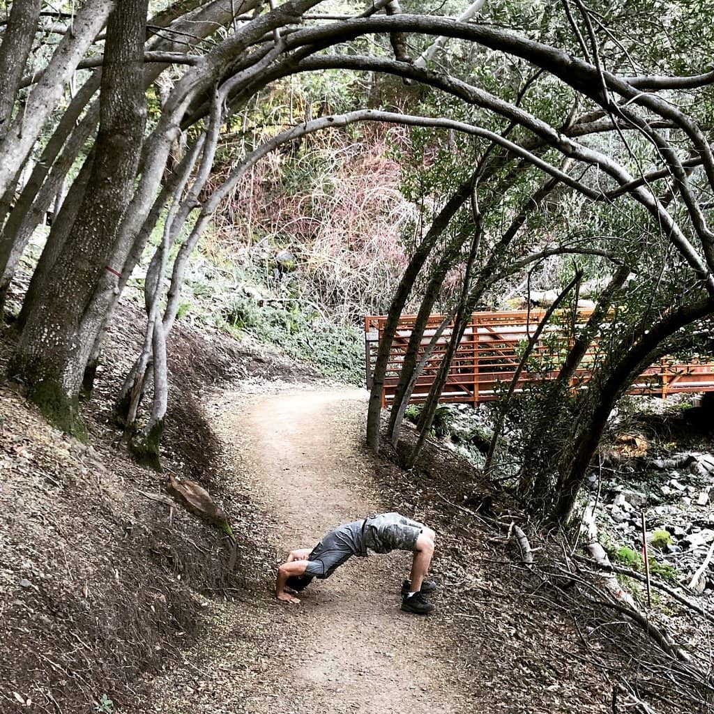
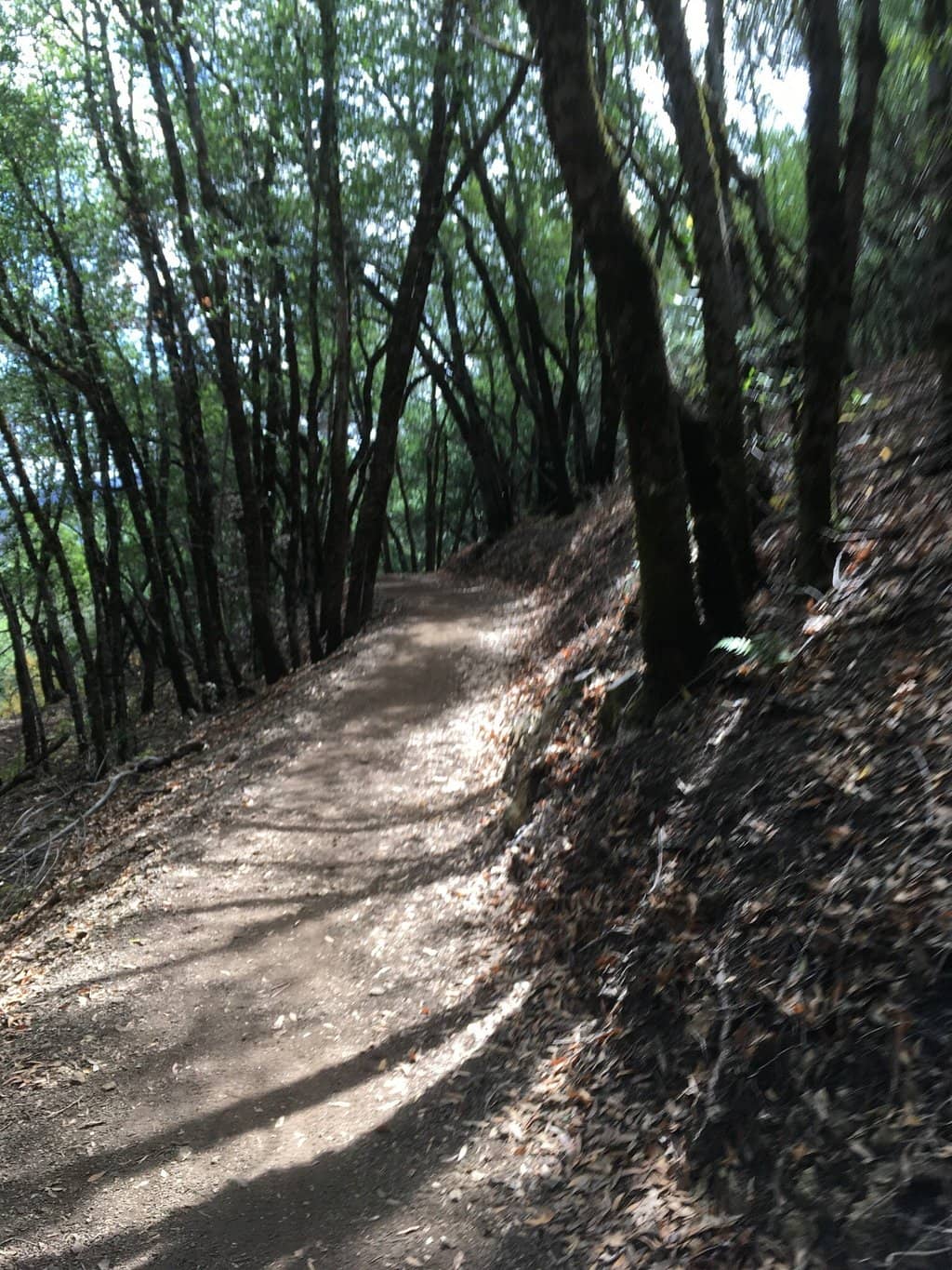
Hiking and Trails at Mount Umunhum
When planning your hike, remember that cell service can be limited, so downloading a trail map beforehand is highly recommended.
Capturing the Magic: Photography at Mount Umunhum
The best times for photography are during the golden hours – sunrise and sunset – when the light is soft and warm, casting a beautiful glow over the landscape.


Social
from TikTok, Instagram & Reddit