Mount Tamalpais
A majestic mountain offering over 100 miles of trails, panoramic Bay Area views, and unique cloud inversion phenomena.
Highlights
Must-see attractions
Social
From TikTok & Reddit
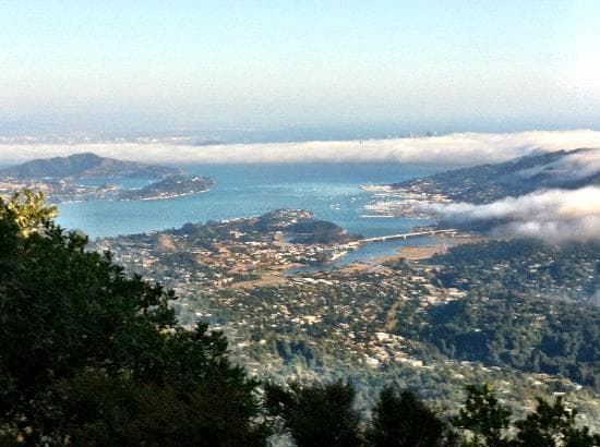
Best Time
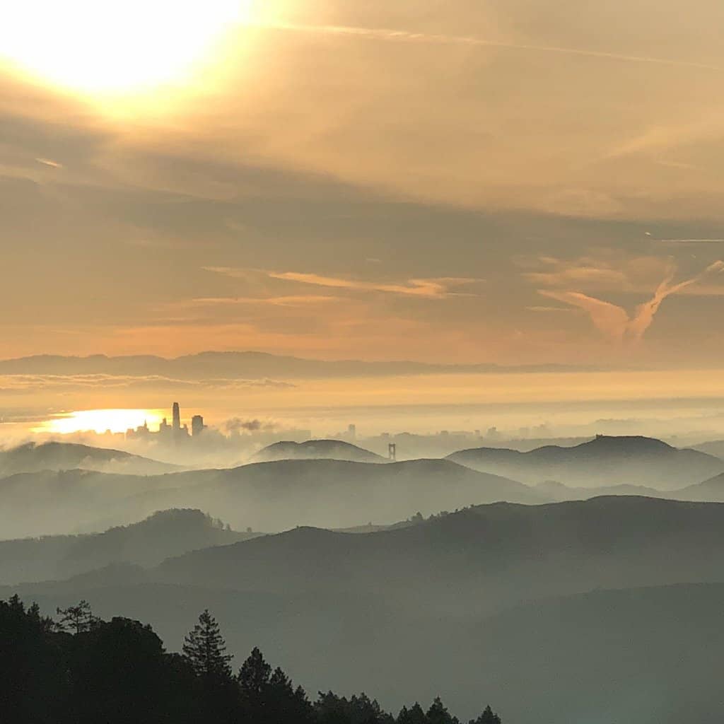
Above the clouds, clear views
Mount Tamalpais
Best Time
Above the clouds, clear views
Highlights
Must-see attractions
A majestic mountain offering over 100 miles of trails, panoramic Bay Area views, and unique cloud inversion phenomena.
"Breathtaking views, misty air, lush trails, and pure calm make this a must-visit."

🎯 Arrive Early for Parking
Lots fill up fast! Aim for before 9 AM on weekends to secure a spot. :car:
👟 Wear Sturdy Hiking Boots
Trails can be steep and uneven. Good grip is essential for safety and comfort. :athletic_shoe:
Highlights
Discover the most iconic attractions and experiences
Verna Dunshee Loop
Near Visitor Center
An easy, paved 0.8-mile loop offering panoramic Bay Area views. Dog-friendly and accessible for most visitors.

Skyline Loop Trail
Near Visitor Center
A popular, scenic trail with stunning vistas. Arrive early to avoid crowds and enjoy the most dramatic views.

Steep Ravine & Dipsea Trail
Various Trailheads
A challenging 6.4-mile loop with significant elevation gain, featuring redwood forests and coastal views.
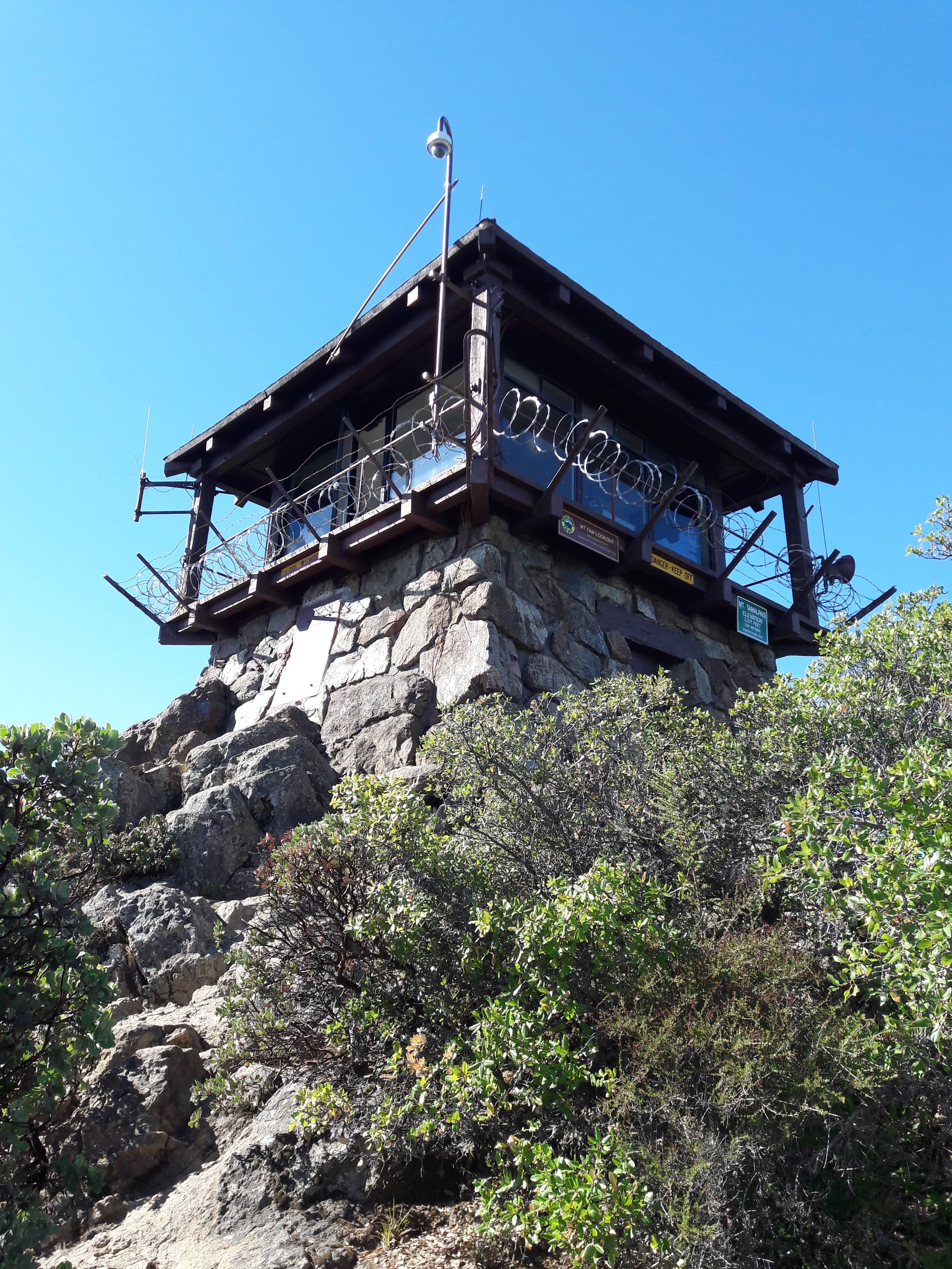
Fire Lookout Station
East Peak
The highest point offering unparalleled 360-degree views of the Bay Area, especially stunning at sunset.
Plans like a pro.
Thinks like you
Planning Your Visit
Beat the Crowds & Parking
Weather & What to Wear
Best Times
Insider Tips
from TikTok, Instagram & Reddit
🎯 Arrive Early for Parking
Lots fill up fast! Aim for before 9 AM on weekends to secure a spot. :car:
👟 Wear Sturdy Hiking Boots
Trails can be steep and uneven. Good grip is essential for safety and comfort. :athletic_shoe:
☁️ Layer Up for Microclimates
Weather changes rapidly. Bring layers to adapt to fog, sun, and wind. :cloud:
📱 Pay for Parking via Phone
Many lots accept phone payments, making it quick and convenient. :iphone:
Tips
from all over the internet
🎯 Arrive Early for Parking
Lots fill up fast! Aim for before 9 AM on weekends to secure a spot. :car:
👟 Wear Sturdy Hiking Boots
Trails can be steep and uneven. Good grip is essential for safety and comfort. :athletic_shoe:
☁️ Layer Up for Microclimates
Weather changes rapidly. Bring layers to adapt to fog, sun, and wind. :cloud:
📱 Pay for Parking via Phone
Many lots accept phone payments, making it quick and convenient. :iphone:
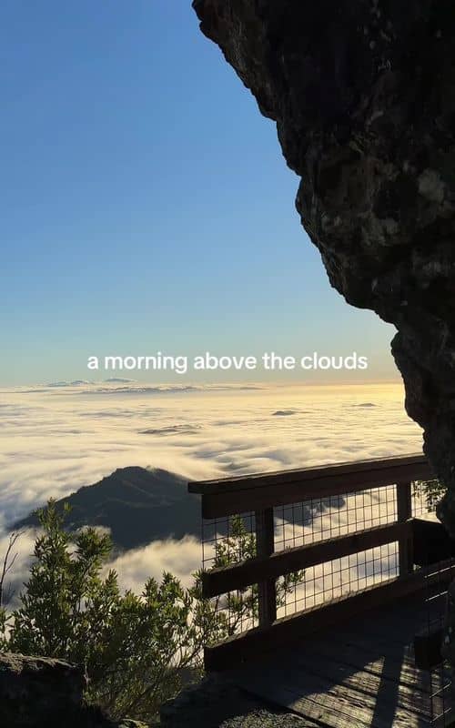
🌅 Chase Cloud Inversions
Summer months offer a chance to hike above the fog for surreal views. :sunrise:
🐶 Dog-Friendly Trails
The Verna Dunshee Loop is a great paved option for you and your furry friend. :dog:
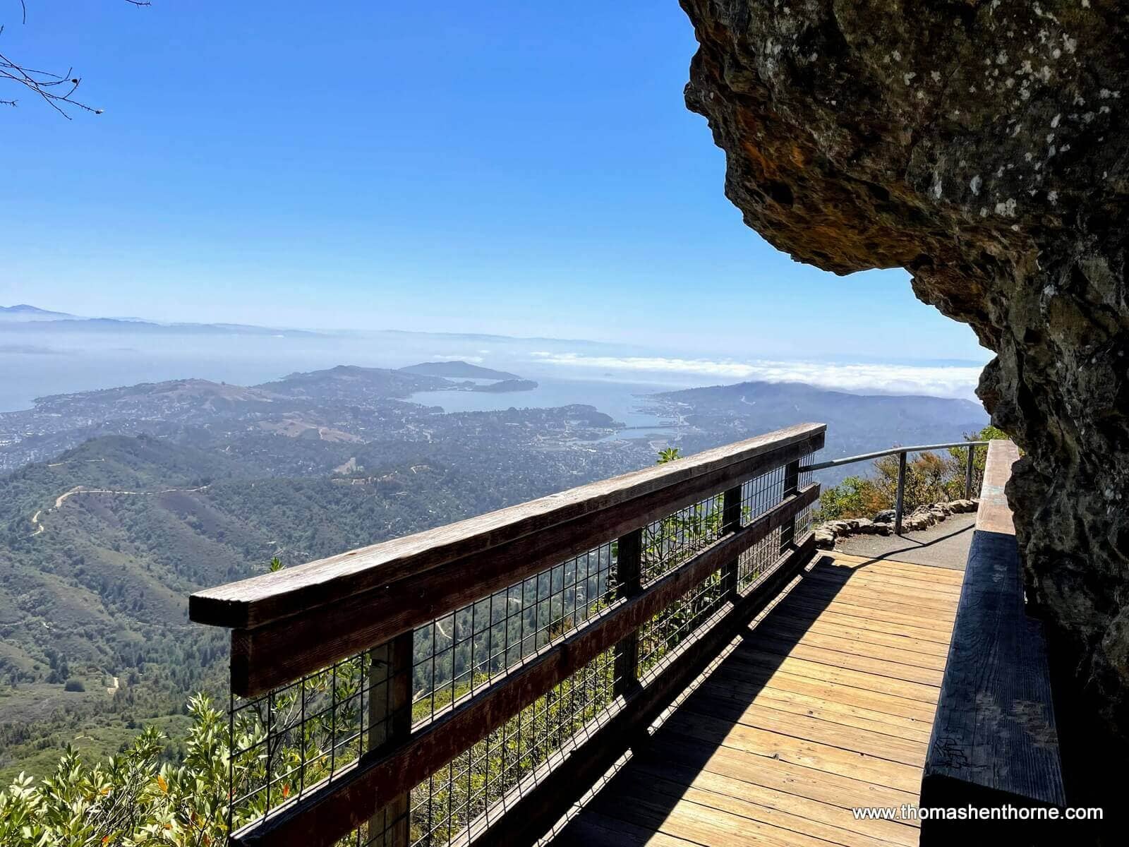
📍 Trojan Point for Views
A popular spot for photos with stunning vistas of San Francisco. :camera:
What Travellers Say
Reviews Summary
Visitors rave about Mount Tamalpais for its breathtaking scenery, peaceful atmosphere, and accessible trails. The stunning Bay Area views, especially during sunset or above the clouds, are frequently highlighted. Many appreciate the convenience of amenities like parking and restrooms, making it a comfortable nature escape. While generally positive, some note that parking can be challenging during peak times.
"This is really nice, especially if you have children. It is a nice chill hike, beautiful scenery. All around and don't forget the history. Behind it enjoy and have fun"
lala avalos
"Hi everyone 👋 this place should be in your bucket list. If you're driving motorcycle, 100% you should visit this place. Lots of sharp turns, stunning views of the road above clouds."
Vladimir Mashukov
"Visited Mount Tamaplas with my cousins and absolutely loved it! The hike was peaceful and the views were breathtaking—misty air, lush trails, and pure calm. Plenty of parking, clean restrooms, and drinking water made everything super convenient. A perfect mix of nature and comfort. Truly unforgettable!"
Ajmal Ayaan
What People Like
What People Dislike
Frequently Asked Questions
🚇 🗺️ Getting There
Public transit options are limited. Marin Transit bus route 61 runs along Panoramic Highway, offering access to trailheads. You can also consider ride-sharing services, though service down the mountain may be unreliable. Cycling is another popular option for those with good fitness. +1
Driving is the most common method. Access points include Pantoll Station, Bootjack Campground, and various trailheads along Panoramic Highway. Be prepared for winding roads and potential traffic, especially on weekends. +1
Parking is available at various trailheads and designated lots, such as Pantoll Station and Bootjack Campground. Many lots have a fee and can be paid via phone. Arrive early, as parking fills up quickly. +1
No direct public transit goes all the way to the peak. Marin Transit bus 61 stops on Panoramic Highway, requiring a hike up from there.
Yes, ride-sharing services can take you to the top, but be aware that service for the return trip might be limited.
🎫 🎫 Tickets & Entry
Yes, there is a parking fee for most lots, which can often be paid via phone. Check the official California State Parks website for current fees.
The park is generally open from sunrise to sunset. Specific facilities like visitor centers may have limited hours. Gates often close shortly after sunset.
No advance ticket booking is typically required for general park access. However, if you plan to camp, reservations are usually necessary.
As a California State Park, an annual California State Parks Pass may cover parking fees at certain locations. It's best to verify coverage for specific lots.
While park access is free, parking at most trailheads incurs a fee. Some trailheads might offer free parking, but these are less common and fill up very quickly.
🎫 🥾 Onsite Experience
Popular choices include the Verna Dunshee Loop (easy, paved), Skyline Loop Trail (scenic), Steep Ravine & Dipsea Trail (challenging loop), and Matt Davis Trail. The Fire Lookout Station at East Peak offers iconic views. +3
For clear, expansive views, aim for summer mornings when you can hike above the fog. Sunsets are also spectacular, but expect more crowds. +2
Yes, many trailheads and popular areas like Pantoll Station have restrooms and drinking water facilities, making it convenient for visitors.
Absolutely! The Verna Dunshee Loop is a gentle, paved trail perfect for families. Many other trails offer beautiful scenery without extreme difficulty.
Dogs are allowed on leash on many trails, including the Verna Dunshee Loop. Always check specific trail regulations.
📸 📸 Photography Spots
Trojan Point is a highly recommended spot for photos of San Francisco. W Ridgecrest Blvd offers various turnouts with stunning views, especially during sunset or cloud inversions. The Fire Lookout Station also provides panoramic backdrops.
Golden hour (shortly after sunrise and before sunset) offers the most dramatic lighting. Summer mornings are ideal for capturing cloud inversions and views above the fog. +2
You can use live webcams like the one at Mt. Tamalpais (search 'Mt. Tam camera') to gauge fog levels and visibility before you go.
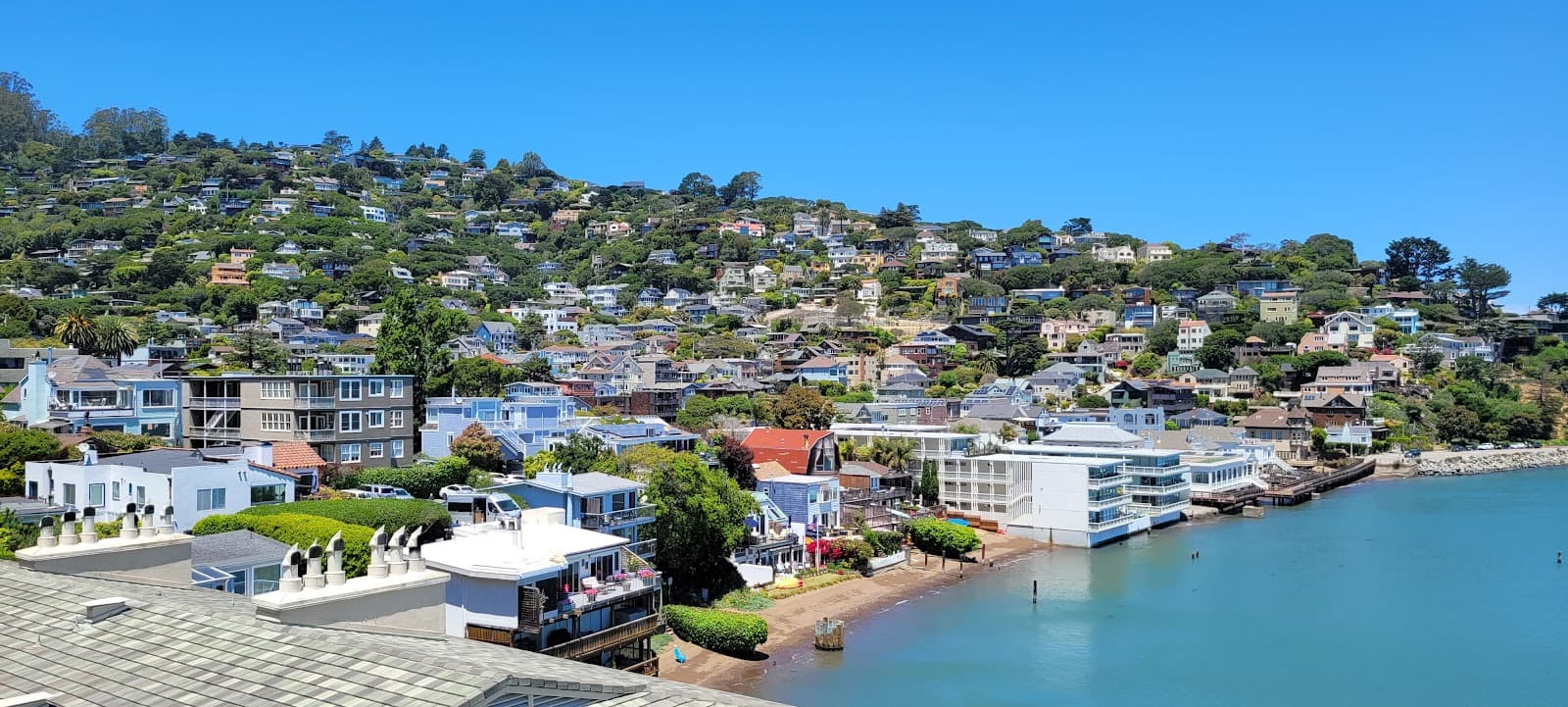
On clear days, the Golden Gate Bridge can be visible from various vantage points on Mount Tamalpais, particularly from higher elevations and along the western ridges.
A wide-angle lens is great for capturing the expansive landscapes. A telephoto lens can be useful for isolating distant features. Don't forget a sturdy tripod for low-light conditions or long exposures.
For Different Travelers
Tailored advice for your travel style
👨👩👧 Families with Kids
🚗 Day-Trippers from San Francisco
🚴 Cyclists
Deep Dives
In-depth insights and expert knowledge
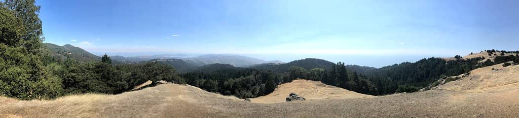
Exploring Mount Tamalpais Trails
Many Reddit users recommend specific trail combinations for unique experiences. The Matt Davis Trail from Pantoll Station down to Stinson Beach provides classic views and leads to restaurants, while the Dipsea Trail offers more views before connecting to Steep Ravine for a redwood-filled descent.
When planning your hike, consider the Fire Lookout Station at East Peak as a destination. It's the highest point and offers unparalleled 360-degree views.
Capturing Mount Tamalpais's Iconic Views
Key viewpoints for capturing these stunning vistas include Trojan Point, a popular spot for photographing the San Francisco skyline, and various turnouts along W Ridgecrest Blvd.
For the best light, aim for the golden hours around sunrise and sunset. The soft, warm light can dramatically enhance the landscape. Remember that weather on Mount Tamalpais can change rapidly, so be prepared for fog, wind, and varying temperatures. A wide-angle lens is ideal for capturing the expansive scenery, and a tripod can be beneficial for low-light photography.
Mount Tamalpais for Families and Casual Visitors
Beyond this loop, many of the park's fire roads and wider trails are suitable for casual strolls. The Fire Lookout Station at East Peak is accessible by car for those who prefer not to hike, offering incredible panoramic views with minimal walking.
While Mount Tamalpais is famous for its challenging hikes, it also provides opportunities for scenic drives along Panoramic Highway, with numerous pull-offs for enjoying the views.


Social
from TikTok, Instagram & Reddit