
Gray Butte
Hike to the summit of Gray Butte for breathtaking 360° views of Mt. Shasta and surrounding landscapes. A rewarding trail with varied terrain.
Highlights
Must-see attractions

Social
From TikTok & Reddit
Best Time
Wildflowers bloom, trails clear
Gray Butte
Best Time
Wildflowers bloom, trails clear
Highlights
Must-see attractions
Hike to the summit of Gray Butte for breathtaking 360° views of Mt. Shasta and surrounding landscapes. A rewarding trail with varied terrain.
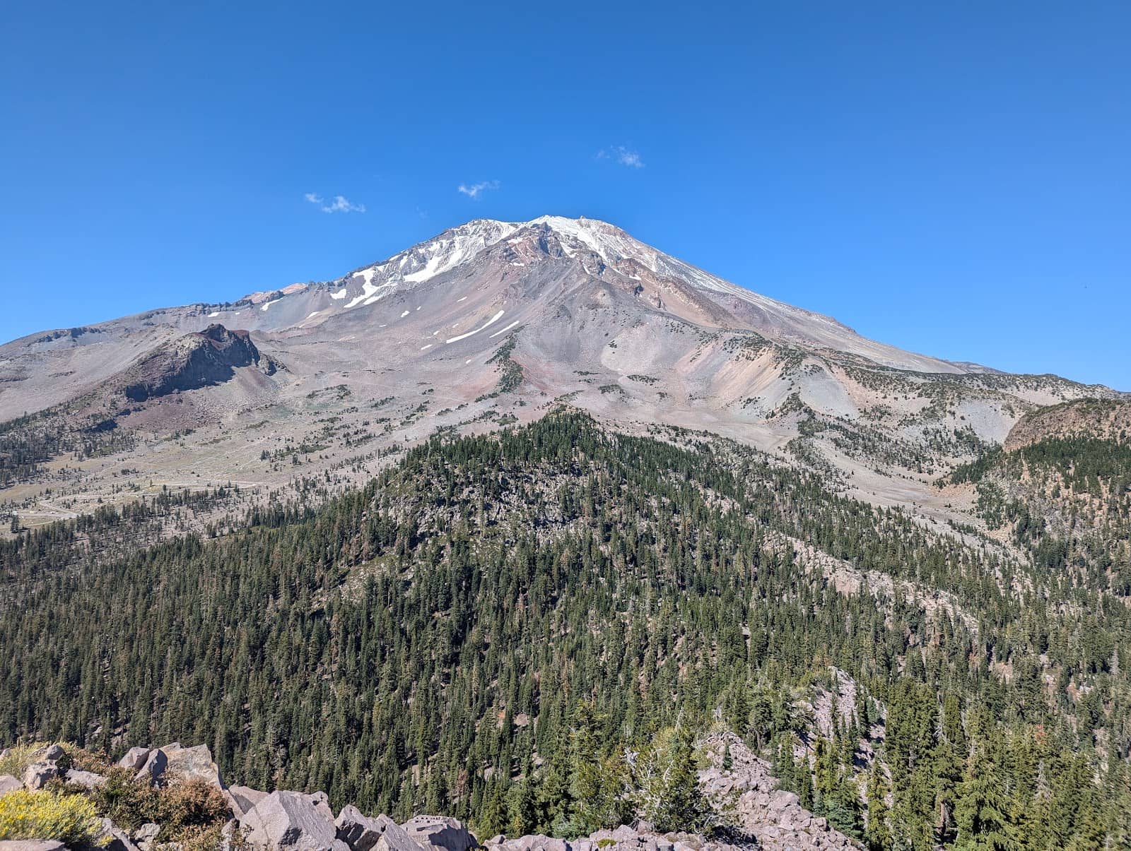
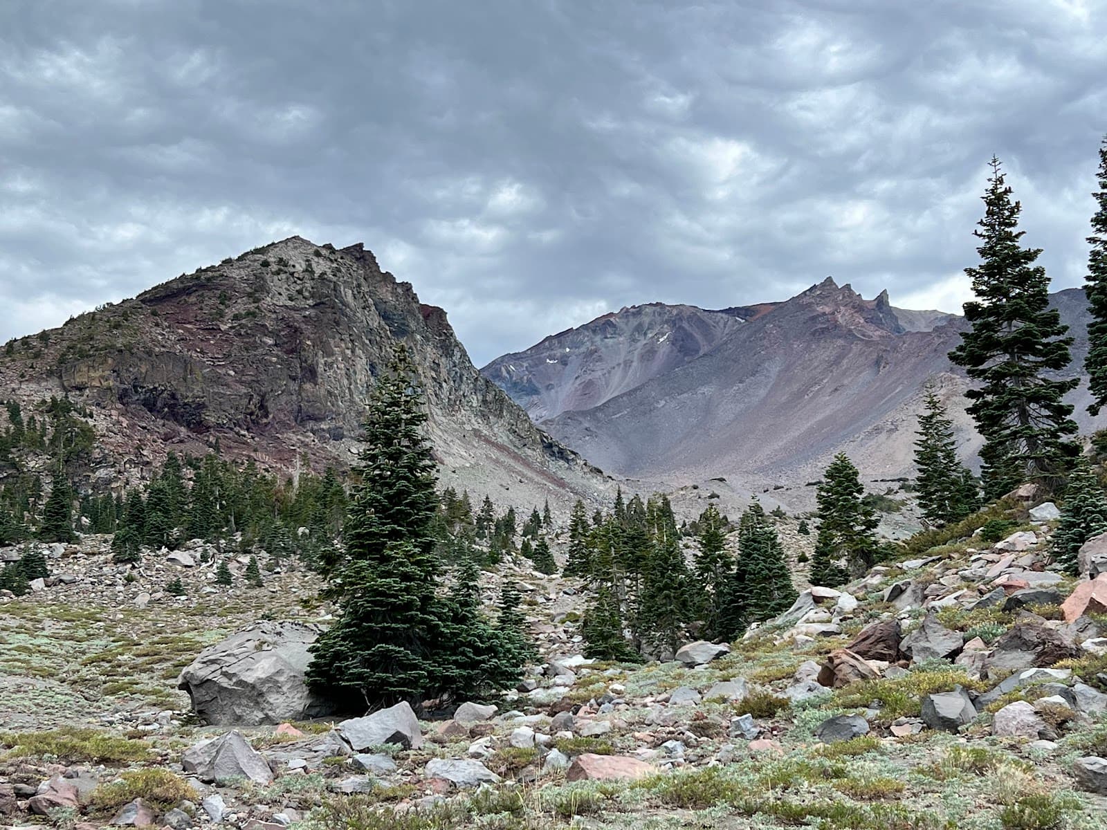
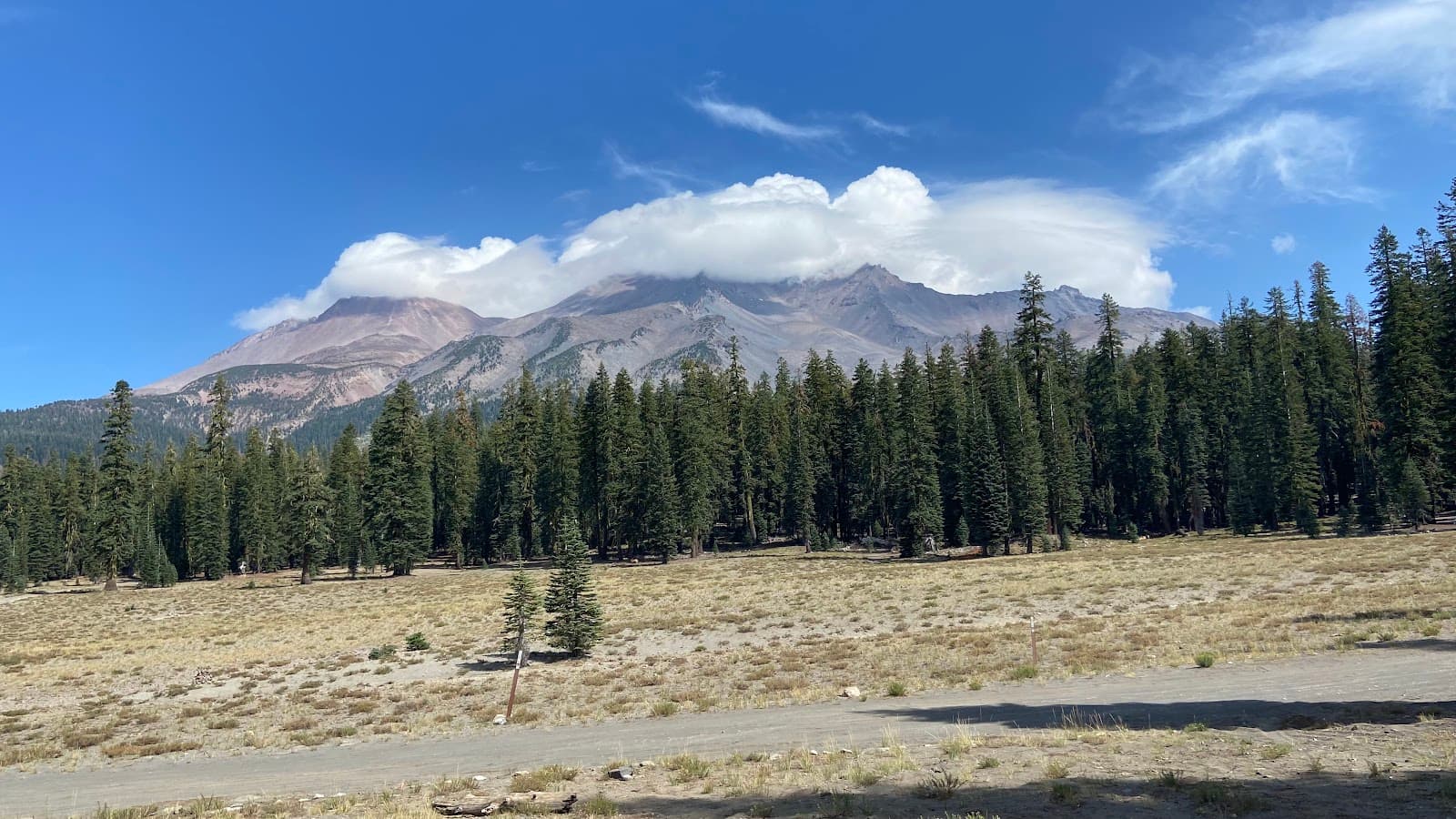
"The summit offers stunning 360-degree panoramic views, including Mount Shasta, Shasta City, and Lake Siskiyou."
👟 Sturdy Footwear is Key
The trail is rocky and can have snow at the summit. Wear good hiking boots!
🐶 Dog-Friendly Adventure
Gray Butte Trail is one of the few dog-permitted hikes in the national forest.
Highlights
Discover the most iconic attractions and experiences
Summit Panorama
Gray Butte Summit
Experience breathtaking 360-degree views of Mount Shasta and surrounding landscapes.
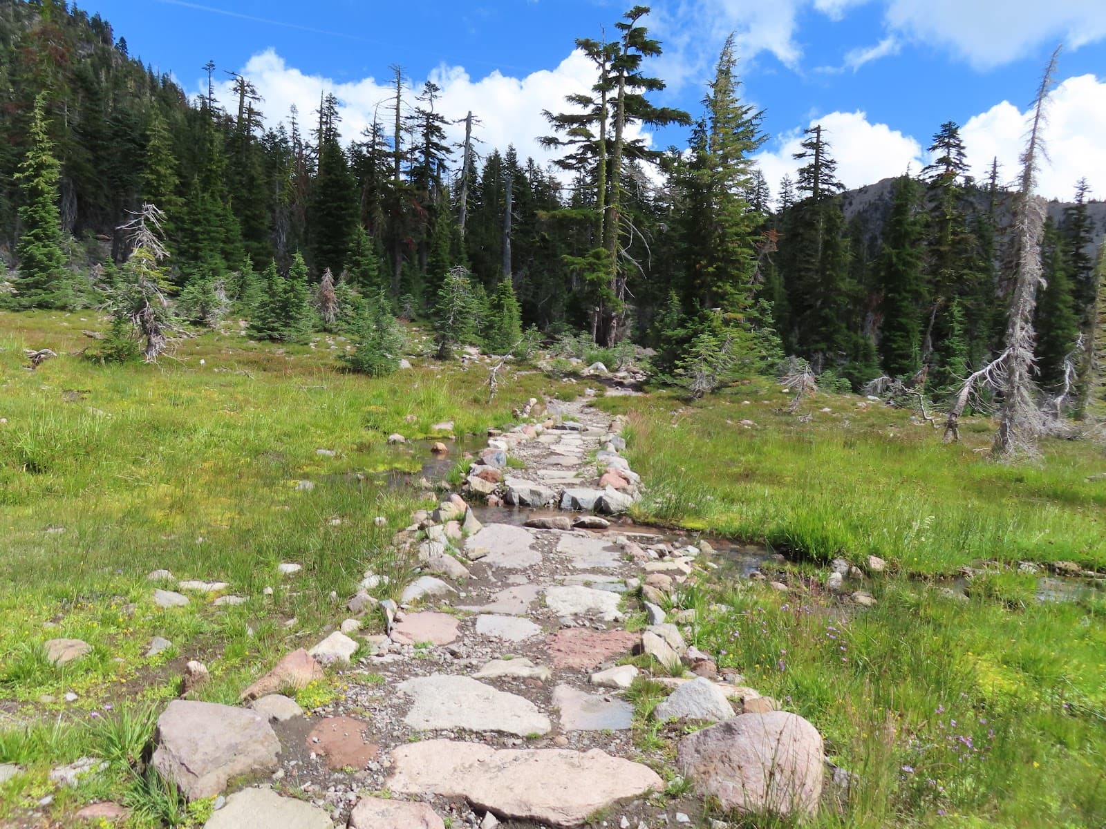
Panther Meadows Start
Trailhead at Panther Meadows
Begin your hike through vibrant alpine meadows, often bursting with wildflowers in summer.

Dog-Friendly Exploration
Gray Butte Trail
This is one of the few dog-permitted trails in the area, making it perfect for furry companions.
Plans like a pro.
Thinks like you
Planning Your Visit
Timing Your Gray Butte Adventure
Navigating Gray Butte's Terrain
Best Times
Insider Tips
from TikTok, Instagram & Reddit
👟 Sturdy Footwear is Key
The trail is rocky and can have snow at the summit. Wear good hiking boots!
🐶 Dog-Friendly Adventure
Gray Butte Trail is one of the few dog-permitted hikes in the national forest.
⬆️ Steep Final Ascent
The last quarter mile is steep, but the summit views are worth the effort.
📍 Trail Markers
Look for rock-wall markers to help navigate sections where the trail is less clear.
Tips
from all over the internet
👟 Sturdy Footwear is Key
The trail is rocky and can have snow at the summit. Wear good hiking boots!
🐶 Dog-Friendly Adventure
Gray Butte Trail is one of the few dog-permitted hikes in the national forest.
⬆️ Steep Final Ascent
The last quarter mile is steep, but the summit views are worth the effort.
📍 Trail Markers
Look for rock-wall markers to help navigate sections where the trail is less clear.
🚗 Road Access Check
The road to Bunny Flat Trailhead can close; check conditions to avoid extra mileage.
What Travellers Say
Reviews Summary
Visitors praise Gray Butte for its stunning 360-degree summit views of Mount Shasta and surrounding areas, making the challenging final ascent well worth the effort. The trail's varied terrain, from meadows to rocky paths, and its status as a dog-friendly hike are frequently highlighted as major positives. Some hikers noted that the road access could be an issue if closed, and trail navigation can be tricky in certain spots.
"First went up to Helen Lake from Bunny Flat trailhead to start the day. Then drove 15 minutes over to Gray Butte. This is an easy trail. You start off in a wide meadow, then start going up. Worth going till the end, even though the last quarter mile is a bit steep. Surprised there weren't more people doing this. Ran the downhill. Total roundtrip was 3.5 miles with 800 ft elevation gain. Can also see Shasta City and Lake Siskiyou from this trail."
Vipul Singh
"We chose Gray Butte Trail because it is the only dog-permitted trail in Trinity Shasta National Forest.
NOTE: when we hiked it on August 1st, the road leading up is closed at Bunny Flat Trailhead, which adds another 1.7 miles in each direction.
The hike itself is definitely worth exploring: it winds up the butte covering various terrains, including patches of butterfly colonies.
At times it can be a little tricky to see where the trail continues on. It’s best to look for the horizontal rock-wall “walls” as a guide.
At the top there is still a decent amount of snow surrounding the trail, so definitely bring the right footwear.
The summit offers stunning 360-degree panoramic views."
Peter Carlesimo
"Ended up spending extra time near Mt Shasta thanks to fires further south and found this trail. Great hike we did with our small children. The views and variation in terrain as you change elevation are great."
Ryan Lewandowski
What People Like
What People Dislike
Frequently Asked Questions
🚇 🗺️ Getting There
The Gray Butte Trail typically starts at the Panther Meadows trailhead, accessible via Bunny Flat. However, the road to Bunny Flat can close, especially in spring, adding about 1.7 miles each way to your hike. It's about a 15-minute drive from Mount Shasta City to the trailhead area.
Access to the Gray Butte Trailhead is usually via Bunny Flat. The road leading up to Bunny Flat can be closed, especially during snow season or early spring, requiring an additional hike to reach the trailhead.
Gray Butte stands at an elevation of approximately 8,091 feet (5,108 ft is also mentioned for a different Gray Butte, but for Mt Shasta context, 8,091 ft is more accurate for the summit). +2
The Mt Shasta Ski Park offers a shuttle service for individuals aged 65 and older on Tuesdays to help avoid the hike to the Gray Butte lift area.
The Gray Butte Trail is approximately 3.3 to 3.5 miles roundtrip. +1
🎫 🎫 Tickets & Entry
Generally, no specific permit is required for day hiking the Gray Butte Trail. However, always check with the local Forest Service for any current regulations or restrictions.
There is typically no entrance fee for hiking the Gray Butte Trail itself. Parking at trailheads like Panther Meadows is usually free.
Gray Butte is an outdoor natural area and is accessible year-round, though weather conditions, especially snow, can affect access and trail usability.
Hiking Gray Butte in winter is possible but requires proper winter gear, avalanche awareness, and knowledge of snow conditions. The Mt Shasta Ski Park operates a lift in the Gray Butte area during winter.
+1
Restrooms are available near the Mt Shasta Ski Park's Gray Butte lift area.
🎫 🏞️ Onsite Experience
The Gray Butte Trail is considered moderate to hard, primarily due to its consistent incline and the steep final ascent. It's a 3.3-mile out-and-back hike with significant elevation gain.
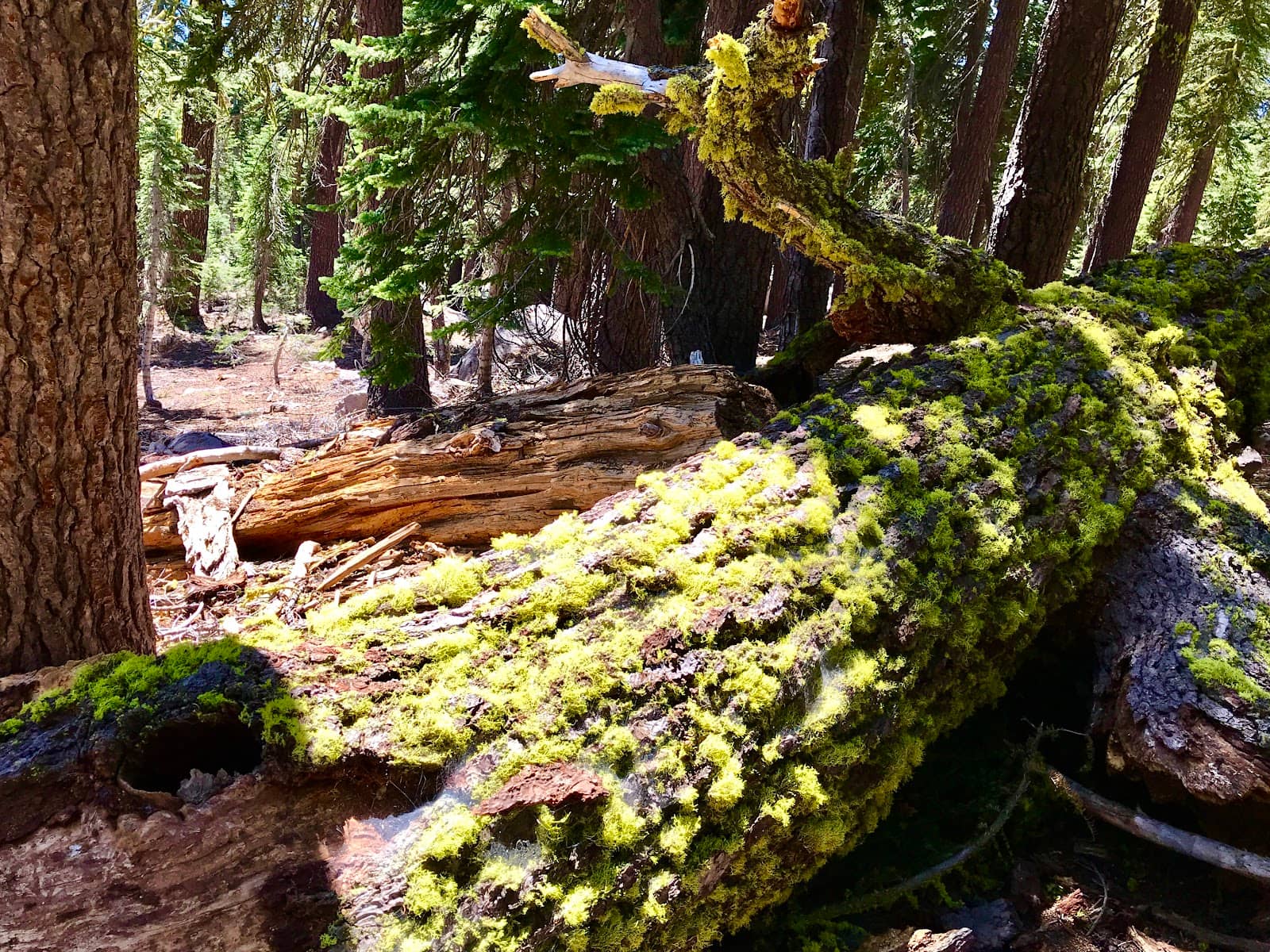
The trail features varied terrain, including wide meadows, pine forests, and rocky sections. The final approach to the summit is particularly steep and rocky.
Yes, the Gray Butte Trail is one of the few dog-friendly hikes in the Trinity Shasta National Forest, but dogs must be kept on a leash.
The summit offers stunning 360-degree panoramic views, including Mount Shasta, Shasta City, and Lake Siskiyou.
While generally followable, the trail can sometimes be tricky to discern, especially in certain sections. Look for horizontal rock-wall markers to guide your way.
📸 📸 Photography
The summit provides incredible panoramic shots of Mount Shasta and the surrounding region. The meadows in summer are also picturesque with wildflowers. +1
Early morning or late afternoon light can offer beautiful golden hour shots, especially with Mount Shasta as a backdrop. Midday can be harsh but still offers clear, expansive views.
A wide-angle lens is great for capturing the expansive panoramas. Consider a tripod for stable shots, especially if you're there during sunrise or sunset.
Drone usage is subject to regulations within national forests. Check with the Shasta-Trinity National Forest for current drone policies before flying.
Beyond the grand vistas, look for alpine wildflowers in summer, interesting rock formations, and the unique textures of the volcanic landscape.
For Different Travelers
Tailored advice for your travel style
👨👩👧 Families with Kids
🐶 Dog Owners
⛷️ Skiers & Snowboarders
Deep Dives
In-depth insights and expert knowledge
The Gray Butte Trail Experience
Elevation and Difficulty: Gray Butte reaches an elevation of approximately 8,091 feet. The 3.3 to 3.5-mile out-and-back trail is classified as moderate to hard due to the consistent incline and the challenging final push.
Navigation and Conditions: While the trail is generally discernible, certain sections can be tricky to follow. Travelers recommend looking for horizontal rock-wall markers as a guide.
Gray Butte in Winter and Ski Season
Winter Access and Activities: For skiers and snowboarders, the Gray Butte lift opens up new possibilities for exploration within the ski park.
Gray Butte for Families and Dogs
Kid-Friendly Aspects: The trail's moderate length (around 3.3-3.5 miles roundtrip) is manageable for children, though the final steep section requires some stamina.
Dog Considerations: For dog owners, Gray Butte is a prime destination. The trail offers ample space for dogs to explore alongside their humans.


Social
from TikTok, Instagram & Reddit