Jake and Bull Mountain Trail System
Explore 36 miles of diverse trails for hiking, biking, and horseback riding in a remote forest setting.
Highlights
Must-see attractions

Social
From TikTok & Reddit
Best Time
Fewer crowds on trails
Jake and Bull Mountain Trail System
Best Time
Fewer crowds on trails
Highlights
Must-see attractions
Explore 36 miles of diverse trails for hiking, biking, and horseback riding in a remote forest setting.
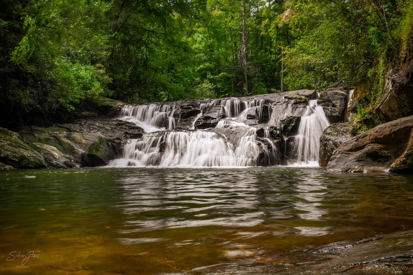
"It's a great place to adventure the forest service roads and hike to waterfalls. So much to offer!"
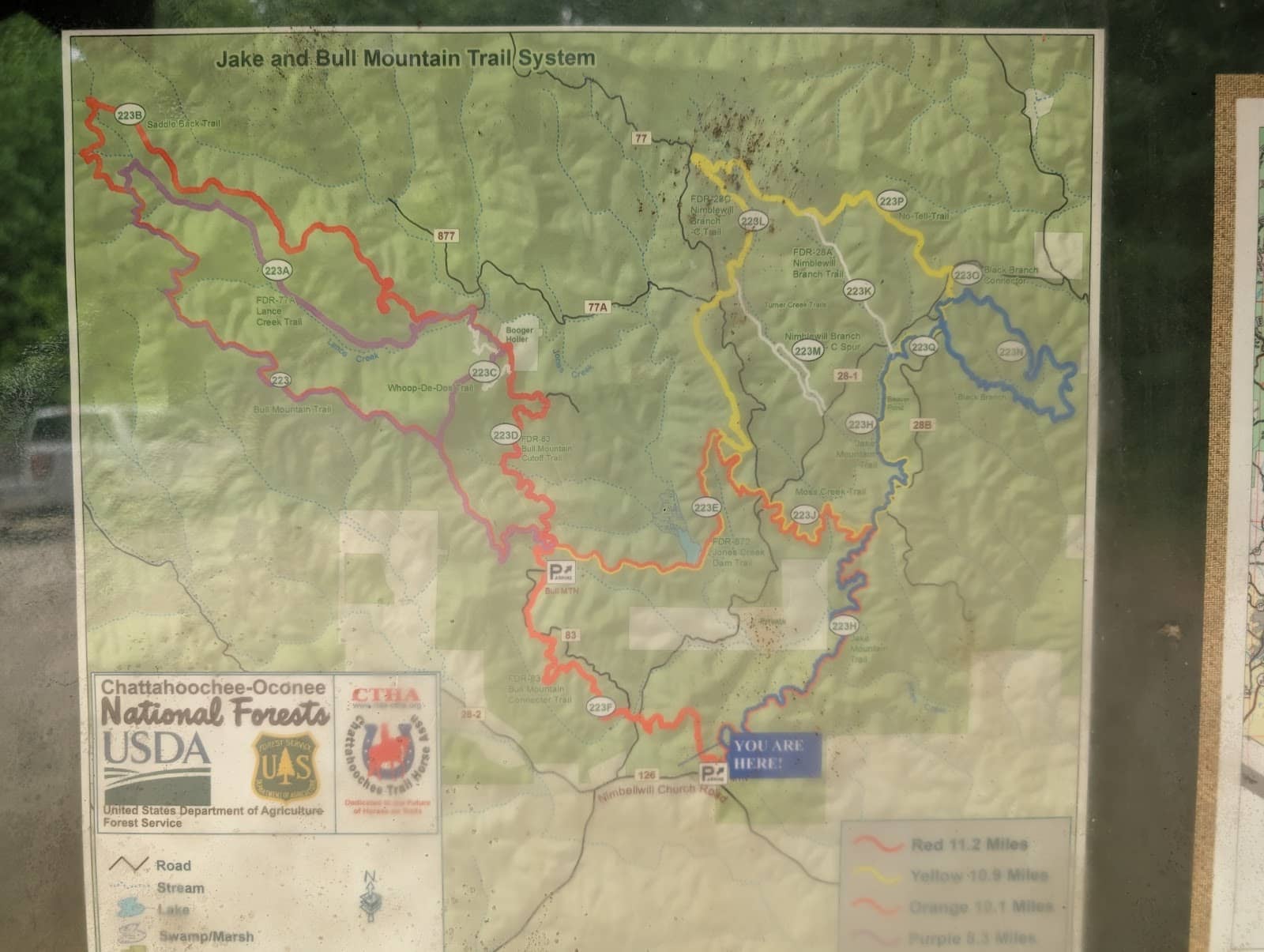
🗺️ Download GPX File
Essential for navigating the extensive 36-mile trail system. Don't rely solely on trail markers!
💧 Bring Plenty of Water
No drinking water available. Creeks can be used with a filter, but always carry more than you think you'll need.
Highlights
Discover the most iconic attractions and experiences
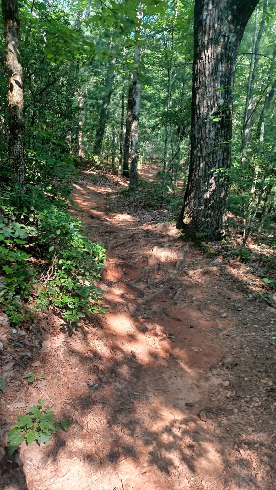
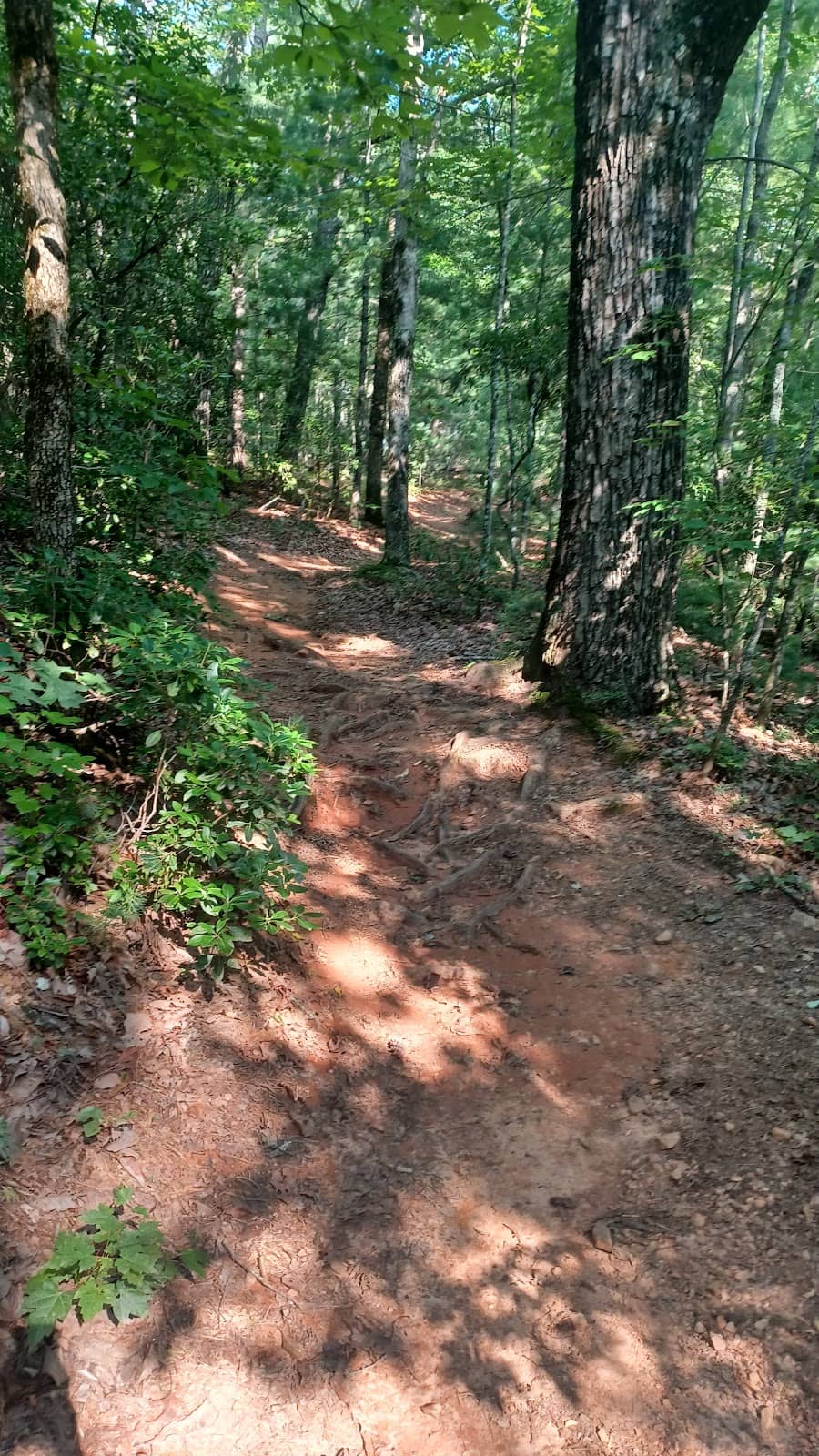
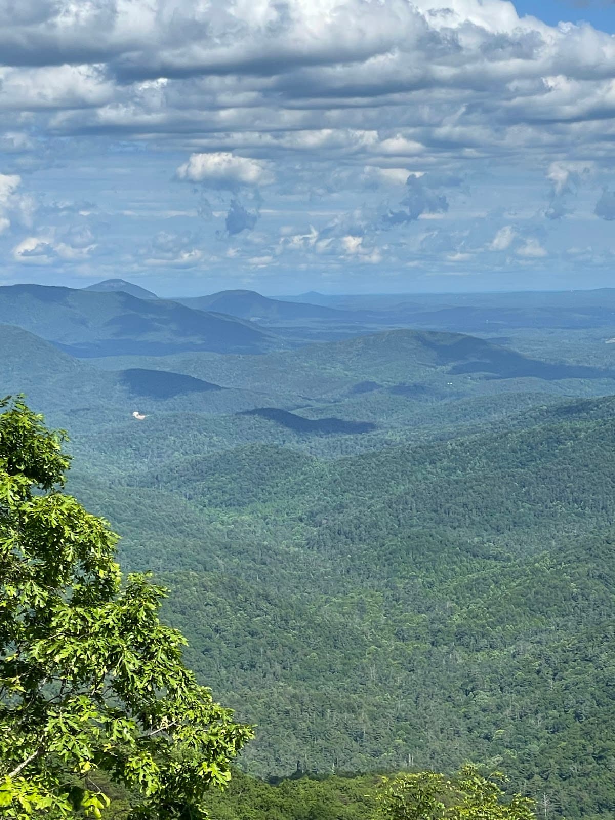
Extensive Trail Network
Explore 36 miles of trails for hiking, biking, and horseback riding through a beautiful forest setting.
Challenging Blue Trail
Blue Trail
A difficult but rewarding 14.25-mile hike with slippery inclines and creek crossings.
Forest Service Roads
Adventure through the surrounding forest service roads for an extended exploration.
Plans like a pro.
Thinks like you
Planning Your Visit
Trail System Navigation
Water & Weather Preparedness
Best Times
Insider Tips
from TikTok, Instagram & Reddit
🗺️ Download GPX File
Essential for navigating the extensive 36-mile trail system. Don't rely solely on trail markers!
💧 Bring Plenty of Water
No drinking water available. Creeks can be used with a filter, but always carry more than you think you'll need.
👟 Wear Appropriate Footwear
Trails can be slippery and rocky, especially after rain. Waterproof boots are recommended for creek crossings.
⏰ Go Early to Avoid Traffic
Beat the crowds and enjoy a more peaceful experience on the multi-use trails.
Tips
from all over the internet
🗺️ Download GPX File
Essential for navigating the extensive 36-mile trail system. Don't rely solely on trail markers!
💧 Bring Plenty of Water
No drinking water available. Creeks can be used with a filter, but always carry more than you think you'll need.
👟 Wear Appropriate Footwear
Trails can be slippery and rocky, especially after rain. Waterproof boots are recommended for creek crossings.
⏰ Go Early to Avoid Traffic
Beat the crowds and enjoy a more peaceful experience on the multi-use trails.
⚠️ Be Wildlife Aware
Watch out for bears, coyotes, and owls, especially if you have kids or pets.
What Travellers Say
Reviews Summary
Visitors praise the Jake and Bull Mountain Trail System for its extensive network of trails, offering ample opportunities for hiking, biking, and horseback riding amidst a beautiful forest setting. The remote nature and challenging terrain are highlights for many, though the lack of amenities and the need for careful navigation are frequently mentioned drawbacks.
"This place is my favorite places to go to ride my mountain bike. It’s a great place to adventure the forest service roads in the area and hike to waterfalls. I would totally recommend this place because it has so much ti offer!"
Brian Blanchard
"I ran the Jake and Bull Mtn Trails in Jan. 2025. The parking at Jake Mtn. has a good amount of space for parking. Bull Mtn. Parking also has sufficient space. I ran on a Sunday morning around 10 a.m. and there were maybe 5 cars in the lot. This is an area used for hiking, mtn biking, and horseback riding. I suggest downloading a GPX file. It helped dramatically on my 23 miles. Trails are marked, but you can miss them if you're not paying attention. The route I took had multiple creek crossings. There were only 2 I wasn't able to go around, so I went through. One was ankle deep, the other knee deep. With the warmer temps, bring plenty of water to drink. I took a filtered water bottle and and I was able to fill it up in the creeks along the way. I also had a 2L water bladder with me. If you haven't hiked this trail, it's worth a look!!"
PJ Sardo
"I hiked the blue trail. AllTrails reported it as 14.25 miles. It took me 5 hours. I would consider this a difficult, but rewarding trail.
There are a few points of slippery, rocky incline, and a segment which you walk on a forest road (28B on the map). No trail markers in the beginning (don't worry, there are clear markers where you need them later on). Two creek passes. The first one is about ~3 miles in and requires getting in the water to cross. The second pass is easily crossed without getting wet. There are some major deadfalls in one section, but nothing you can't get around (horseback riders may have a problem though).
Bring water and snacks!! This is a long trek. Get there early to avoid unnecessary trail traffic. Don't go after a rainy day like I did (rocks get muddy and slippery). Have fun!"
Melissa Brown
What People Like
What People Dislike
Frequently Asked Questions
🚇 🗺️ Getting There
The trail system has two main parking areas: Jake Mountain and Bull Mountain. Both offer sufficient space. Access is via forest service roads, so a GPS or downloaded map is highly recommended.
Yes, both the Jake Mountain and Bull Mountain parking areas have a good amount of space. Parking was noted as sufficient even on a Sunday morning.
While trails are marked, it's highly advised to download a GPX file for navigation, as some markers can be missed.
The area is accessed via forest service roads. It's best to check local conditions, especially after rain, as they can become muddy and slippery.
Using a GPS device or a reliable navigation app with downloaded maps is the most effective way to locate the trailheads and navigate the extensive network.
🎫 🎫 Tickets & Entry
There are no admission fees or tickets required to access the Jake and Bull Mountain Trail System. It's a free recreational area.
The trail system is generally open from dawn to dusk, as it is an outdoor recreational area. There are no specific posted hours.
No, there is no entrance fee. The Jake and Bull Mountain Trail System is a public access area.
Parking is first-come, first-served. Arriving early, especially on weekends, is recommended to secure a spot.
No permits are required for day use of the hiking, biking, or equestrian trails.
🎫 🏞️ Onsite Experience
The trail system is designed for hiking, mountain biking, and horseback riding, offering approximately 36 miles of recreational trails.
The trails are not exclusively for beginners. While some sections are manageable, the extensive network and challenging terrain make it more suitable for intermediate to advanced users.
Trails are marked, but it's easy to miss them. Downloading a GPX file is highly recommended for accurate navigation.
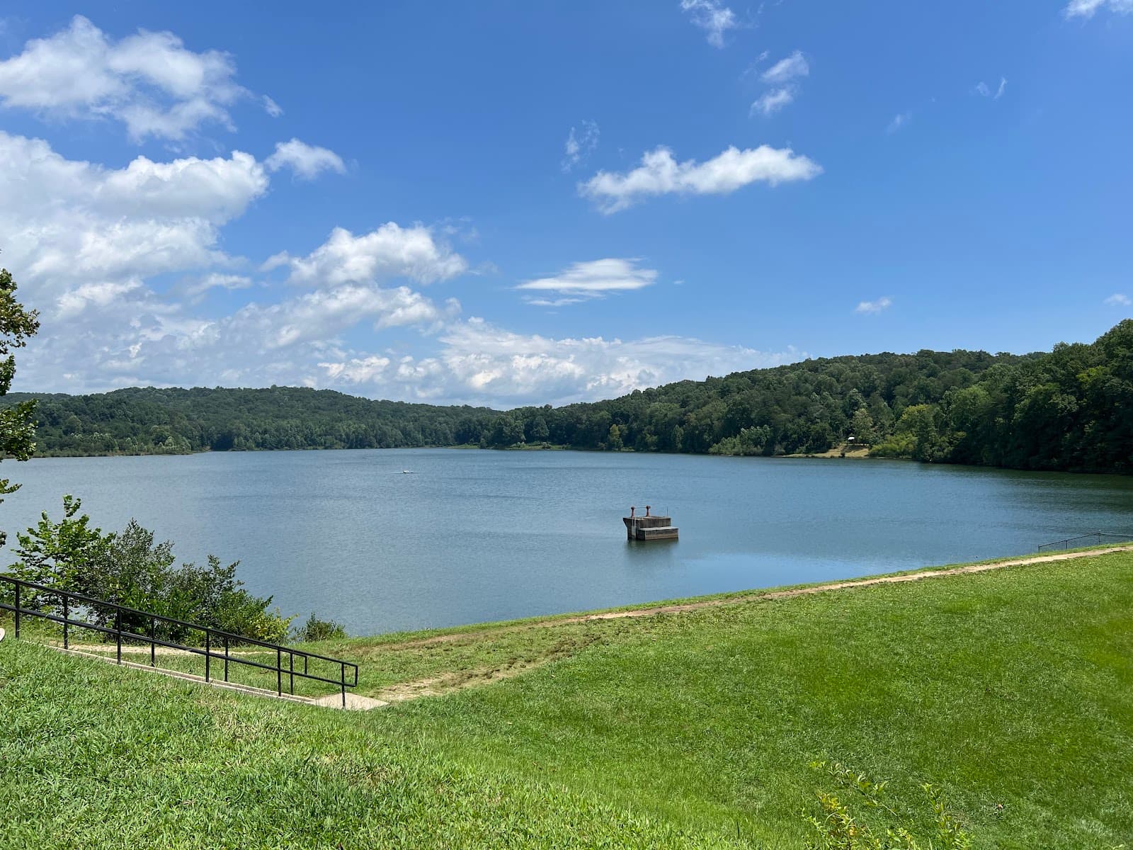
There are multiple creek crossings. Some can be deep (knee-deep) and require getting into the water, while others are easily crossed without getting wet.
No, this is not a good place for swimming as there is no water available for that purpose.
🍽️ 🍽️ Food & Dining
No, there are no restaurants, cafes, or food services available within the Jake and Bull Mountain Trail System. It's a remote area.
Yes, visitors are encouraged to bring their own food and drinks, as there are no facilities on-site. Pack out all trash.
No, there is no potable water available. You can filter water from the creeks, but it's best to carry all the water you'll need.
There are no designated picnic areas. You can find spots to stop and eat along the trails or at the parking areas.
For longer treks, pack high-energy snacks, sandwiches, and at least 2-3 liters of water per person, or a reliable water filter.
📸 📸 Photography
The forest scenery, creek crossings, and expansive trail views offer great photo opportunities. Look for scenic overlooks and unique trail features.
It can be challenging to take photos while actively biking or hiking. It's best to stop at designated points or scenic spots to capture images.
Landscape photography, nature photography, and action shots (for bikers and equestrians) are well-suited for this trail system.
While not explicitly marked, keep an eye out for natural clearings and elevated points along the trails that offer panoramic views of the forest.
Early morning or late afternoon often provide the best light for photography, with softer shadows and warmer tones.
For Different Travelers
Tailored advice for your travel style
👨👩👧 Families with Kids
Key considerations for families:
* Water and Snacks: Pack more than you think you'll need, as there are no facilities.
* Footwear: Ensure children wear sturdy, closed-toe shoes suitable for uneven terrain.
* Wildlife Awareness: Keep a close eye on children and pets, as wildlife is present in the area.
* Navigation: Consider downloading a GPX file even for shorter hikes, as trail markers can be missed.
This destination is best suited for families with older children who are accustomed to hiking and can handle more rugged terrain. The adventure of creek crossings can be a highlight for kids, but ensure they are properly supervised.
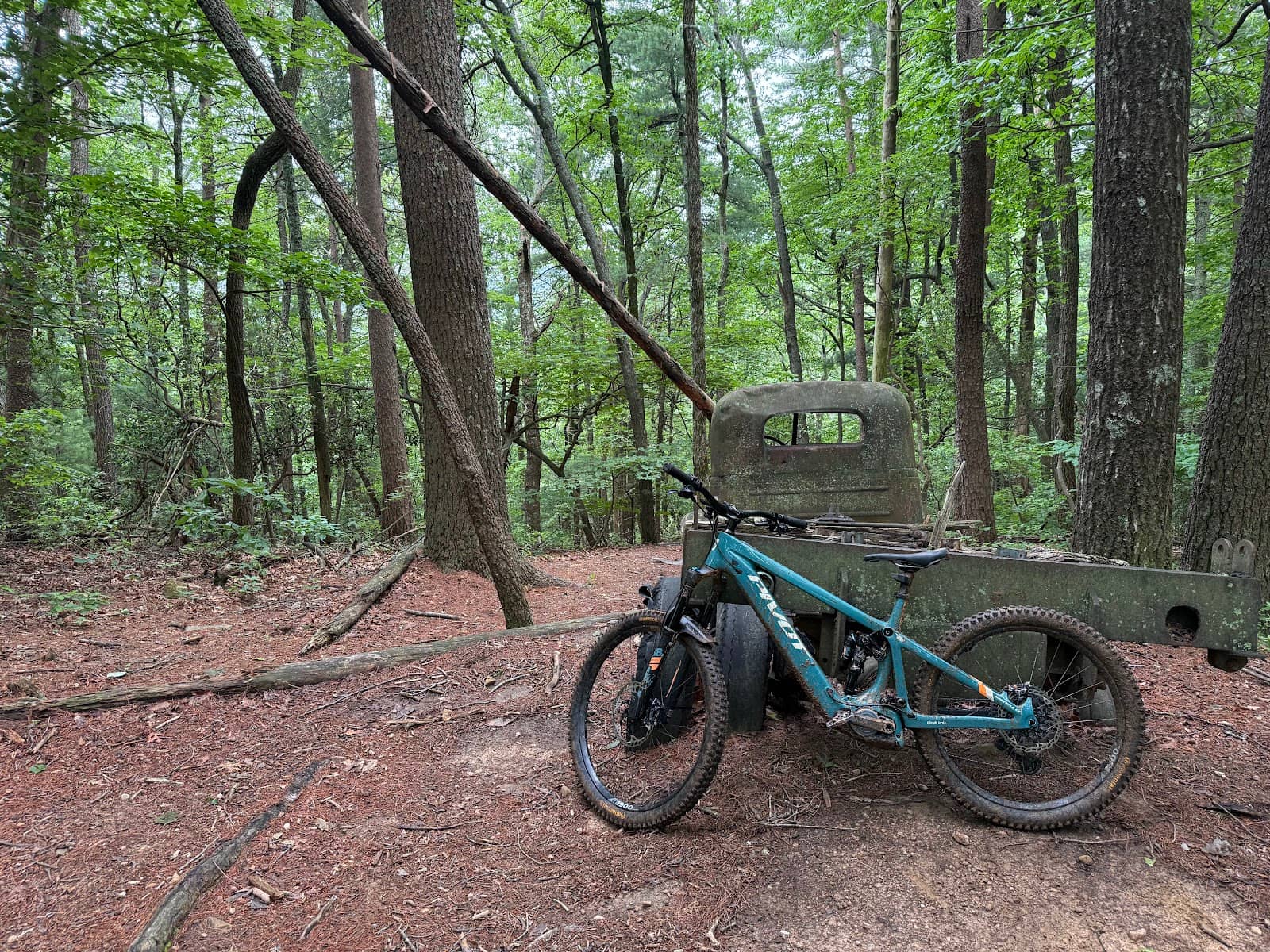
🚴 Mountain Bikers
Tips for bikers:
* GPX File: Absolutely essential for navigating the extensive network and avoiding dead ends.
* Bike Condition: Ensure your bike is in good working order, as repairs are not an option in this remote location.
* Creek Crossings: Be prepared to dismount and carry your bike through deeper crossings, or assess if your bike handling skills are sufficient.
* Multi-use Trails: Share the trails respectfully with hikers and equestrians.
This system offers a great escape for those looking for a challenging and immersive mountain biking experience away from crowded parks.
Deep Dives
In-depth insights and expert knowledge
Navigating the Trails
Be prepared for creek crossings, which are a common feature of the trails. Depending on recent rainfall, these can range from ankle-deep to knee-deep. While some crossings are easily navigated without getting wet, others will require you to step into the water. For those on horseback, significant deadfalls in certain sections might pose a challenge, though hikers and bikers can usually find ways around them. The presence of multi-use trails means you'll likely encounter other users, so be courteous and aware of your surroundings.
Key takeaway: Proper navigation is paramount. Don't underestimate the trail system's size and complexity. A reliable GPS device or a well-downloaded map on your phone is your best friend here.
Essential Preparations for Your Visit
Footwear is another critical consideration. The trails can become muddy and slippery, especially after rain, and rocky inclines are common. Wearing sturdy, waterproof hiking boots is highly recommended to ensure comfort and safety, particularly if you anticipate needing to cross creeks. Be aware of the potential for wildlife encounters; black bears, coyotes, and owls have been reported in the area, so take necessary precautions, especially if you have children or pets.
Pro-tip: Check the weather forecast and consider visiting on a drier day to minimize trail slipperiness and make creek crossings more manageable. Arriving early, particularly on weekends, is also advised to avoid potential trail congestion and secure parking.


Social
from TikTok, Instagram & Reddit