La Garita Wilderness
A vast, rugged Colorado wilderness offering unparalleled solitude, challenging hikes, and breathtaking alpine scenery. True backcountry adventure awai...
Highlights
Must-see attractions

Social
From TikTok & Reddit
Best Time
Best weather window
La Garita Wilderness
Best Time
Best weather window
Highlights
Must-see attractions
A vast, rugged Colorado wilderness offering unparalleled solitude, challenging hikes, and breathtaking alpine scenery. True backcountry adventure awaits.
"This is the Colorado backcountry at its finest – wild, remote, and utterly spectacular."
Offline Maps are Crucial
Download maps before you go! No cell service here. Gaia GPS or AllTrails are lifesavers. :iphone:
Bear Safety First
Proper food storage is essential. Use bear canisters or hang your food properly. Be bear aware. 🐻
Quick Facts
Hours
Rating
5 · 2 reviews
Type
Hiking Area
Highlights
Discover the most iconic attractions and experiences
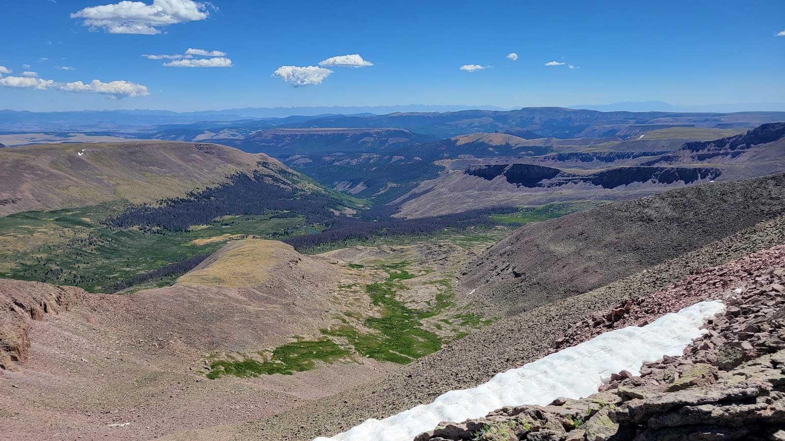
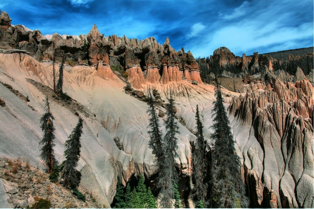
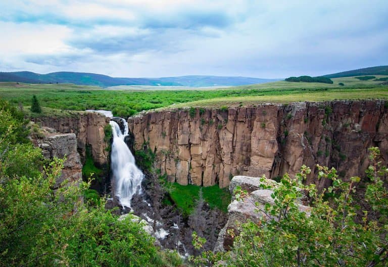
Wapiti Creek Trail
Northern La Garita
A classic route leading to stunning alpine lakes and dramatic peaks. Offers a true taste of the wilderness.
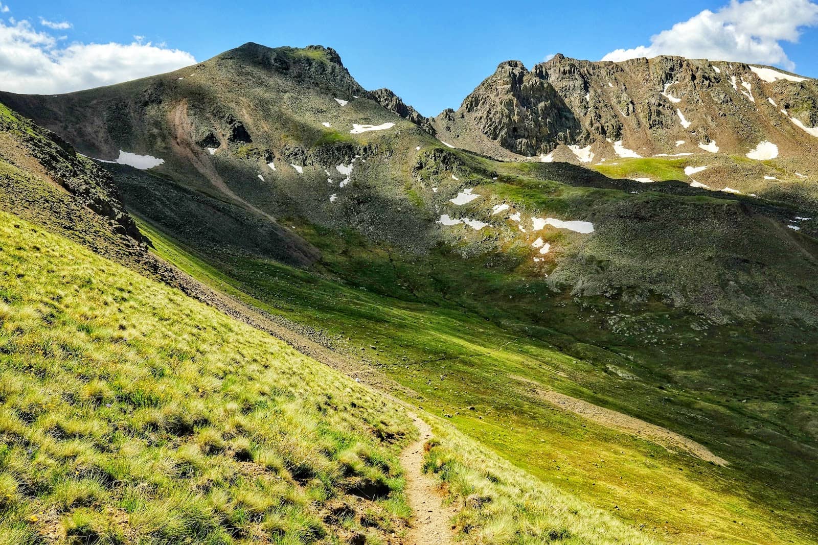
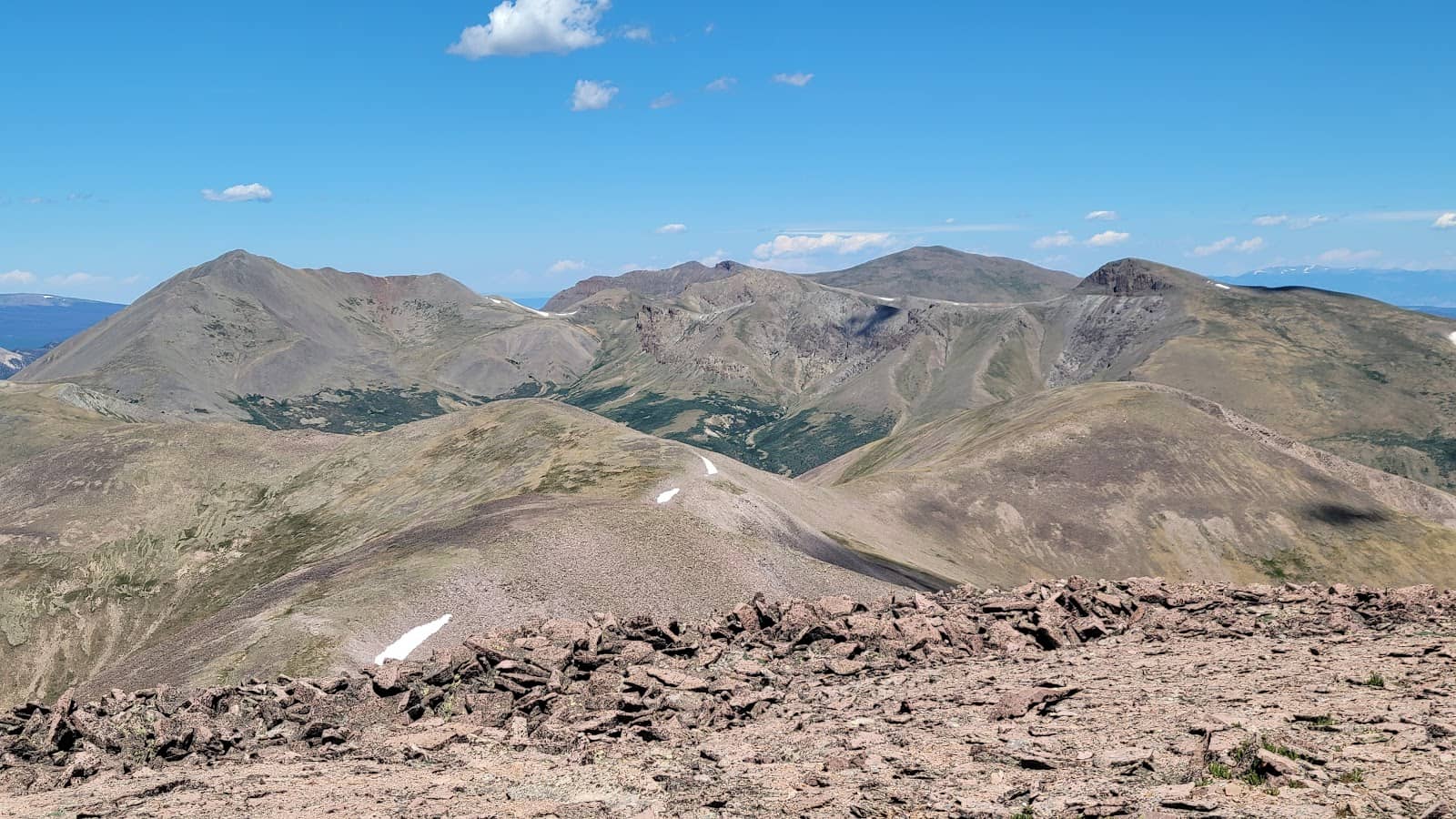
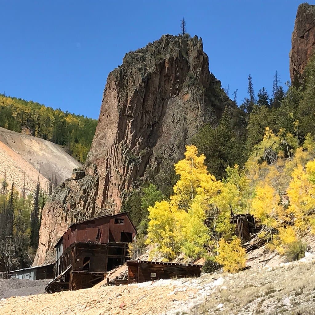
Stewart Peak
Central La Garita
Challenging but rewarding summit with panoramic views of the San Juan Mountains. A true test for experienced hikers.
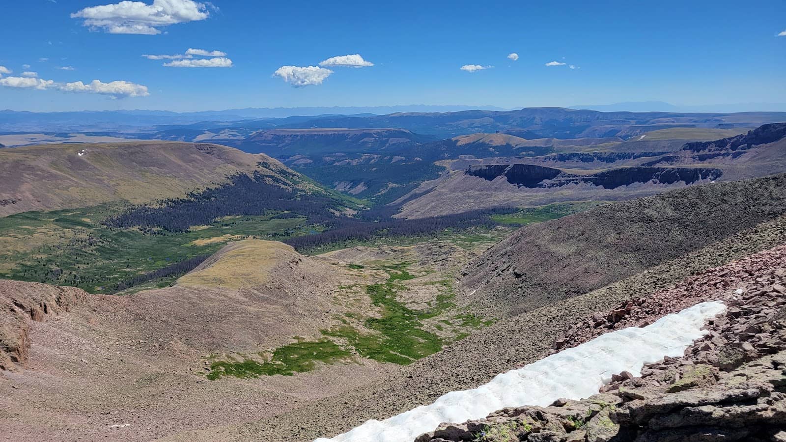
Alpine Lakes
Various locations
Discover pristine, often unnamed alpine lakes reflecting the rugged peaks. Perfect for serene reflection and photography.
Plans like a pro.
Thinks like you
Planning Your Visit
Prepare for Remote Adventure
Gear Up for the Backcountry
Best Times
Insider Tips
from TikTok, Instagram & Reddit
Offline Maps are Crucial
Download maps before you go! No cell service here. Gaia GPS or AllTrails are lifesavers. :iphone:
Bear Safety First
Proper food storage is essential. Use bear canisters or hang your food properly. Be bear aware. 🐻
Water Filter is Non-Negotiable
Bring a reliable water filter or purification tablets. Streams are plentiful but treat all water. :droplet:
Pack for All Seasons
Mountain weather changes fast. Expect sun, rain, and even snow, sometimes all in one day. :cloudwithsnow:
Tips
from all over the internet
Offline Maps are Crucial
Download maps before you go! No cell service here. Gaia GPS or AllTrails are lifesavers. :iphone:
Bear Safety First
Proper food storage is essential. Use bear canisters or hang your food properly. Be bear aware. 🐻
Water Filter is Non-Negotiable
Bring a reliable water filter or purification tablets. Streams are plentiful but treat all water. :droplet:
Pack for All Seasons
Mountain weather changes fast. Expect sun, rain, and even snow, sometimes all in one day. :cloudwithsnow:
Leave No Trace
Pack out everything you pack in. Stay on trails where they exist. Protect this pristine environment. :evergreen_tree:
What Travellers Say
Reviews Summary
Visitors consistently praise La Garita Wilderness for its raw, untamed beauty and profound solitude. It's a haven for those seeking true backcountry immersion, with stunning alpine lakes and challenging peaks. However, the remoteness and ruggedness mean it's not for the unprepared, with navigation and weather being significant considerations.
""
Alec CaptCo
""
Colin-Darby Bryan
What People Like
What People Dislike
Frequently Asked Questions
🚇 🗺️ Getting There
Access is primarily via Forest Service roads off US-50 and CO-149. The main trailheads are often reached via rough dirt roads requiring high-clearance vehicles. Check road conditions with the local Forest Service office before you go.
Key access points include the La Garita Trailhead (near the historic La Garita townsite) and the Wagon Gulch Trailhead. These serve as starting points for many popular backcountry routes.
While some trailheads might be accessible with a standard vehicle in good conditions, many Forest Service roads are rough and unmaintained. A high-clearance vehicle is strongly recommended, and a 4x4 can be beneficial for certain routes.
No, there is no public transportation that reaches the La Garita Wilderness. You will need your own vehicle, and ideally one suited for backcountry travel.
The closest small towns offering basic services are Creede and Lake City, Colorado. These towns are a good place to stock up on supplies before heading into the wilderness.
🎫 🎫 Tickets & Entry
No, permits are not required for day use or overnight backpacking in the La Garita Wilderness. It is part of the San Juan National Forest and is managed under dispersed recreation rules.
There are no entrance fees to access the La Garita Wilderness. However, some trailheads may have small parking fees or donation boxes for maintenance.
The La Garita Wilderness is open year-round. However, access can be severely limited by snow from late fall through late spring, especially for higher elevation trailheads.
Yes, dispersed camping is allowed throughout the La Garita Wilderness. Follow Leave No Trace principles and be aware of any specific fire restrictions or designated camping areas near water sources.
There is no dedicated visitor center within the La Garita Wilderness itself. For information, maps, and current conditions, contact the nearest San Juan National Forest Ranger District office.
🎫 🧭 Onsite Experience
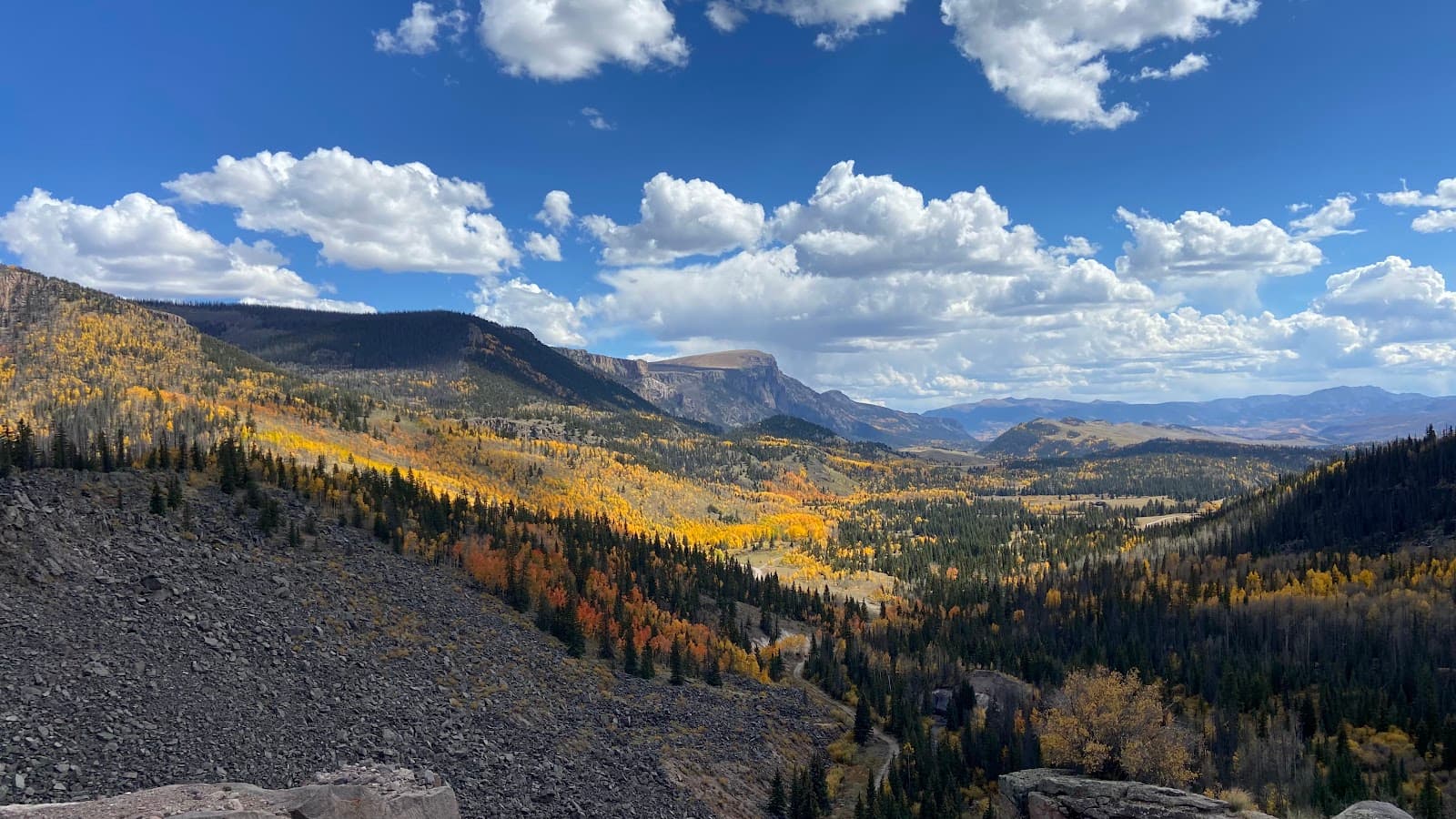
The trails range from moderate to strenuous, often following creek beds or climbing to high alpine passes. Many are primitive and unmaintained, requiring good navigation skills. Expect rugged terrain and significant elevation changes.
Absolutely! La Garita is a premier destination for backpacking, offering remote solitude and stunning scenery. Popular routes include the Wapiti Creek Trail and sections of the Continental Divide Trail.
You can encounter a variety of wildlife, including elk, deer, bighorn sheep, marmots, and various bird species. Black bears are also present, so proper food storage is crucial.
While dispersed camping is the norm, there are a few primitive campgrounds near some trailheads, like the La Garita Campground. These are basic and often first-come, first-served.
Elevations vary significantly, from around 8,000 feet in the lower valleys to over 13,000 feet for the highest peaks. Be prepared for altitude sickness and significant temperature fluctuations.
📸 📸 Photography
Anywhere with a view! Alpine lakes, dramatic peaks like Stewart Peak, and wildflower meadows in early summer offer incredible photographic opportunities. Sunrise and sunset light can be spectacular.
A wide-angle lens is great for landscapes, while a telephoto can capture wildlife. A sturdy tripod is useful for low-light conditions. Ensure your gear is protected from the elements.
As with any remote wilderness, exercise caution. Keep your gear secure and protected. The remoteness means help is far away, so be mindful of your surroundings.
The 'golden hours' around sunrise and sunset offer the most dramatic light. Midday can be harsh, but can work well for capturing the stark beauty of the alpine terrain.
Yes, unpredictable weather can change light conditions rapidly. Also, the rugged terrain and potential for long hikes mean you need to pack light and efficiently.
Social
from TikTok, Instagram & Reddit