
Chief Mountain Trail
A moderate, 2.8-mile hike near Denver offering breathtaking 360-degree summit views and a scenic journey through forest and alpine tundra.
Highlights
Must-see attractions

Social
From TikTok & Reddit
Best Time
Beat the crowds and secure parking.
Chief Mountain Trail
Best Time
Beat the crowds and secure parking.
Highlights
Must-see attractions
A moderate, 2.8-mile hike near Denver offering breathtaking 360-degree summit views and a scenic journey through forest and alpine tundra.
"The views from the top are just amazing. Overall a moderately challenging hike with almost 1300 ft elevation gain."
🎯 Arrive Early for Parking
Park on the north side of Hwy 103; the trailhead is unmarked. Arrive before 11 am on weekends.
🧥 Pack Layers for Summit
Weather changes fast! It can be warm at the trailhead and freezing with high winds at the top.
Highlights
Discover the most iconic attractions and experiences
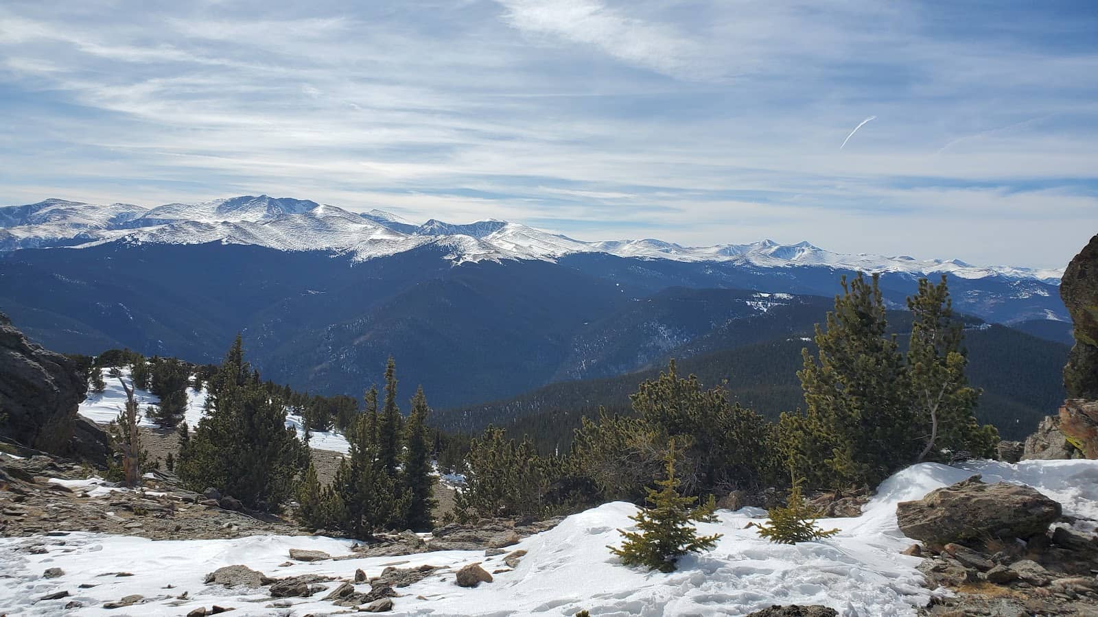
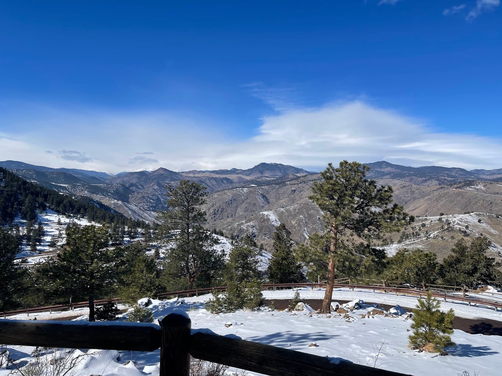
Panoramic Summit Views
Summit
Experience breathtaking 360-degree views of the Front Range and surrounding mountains.
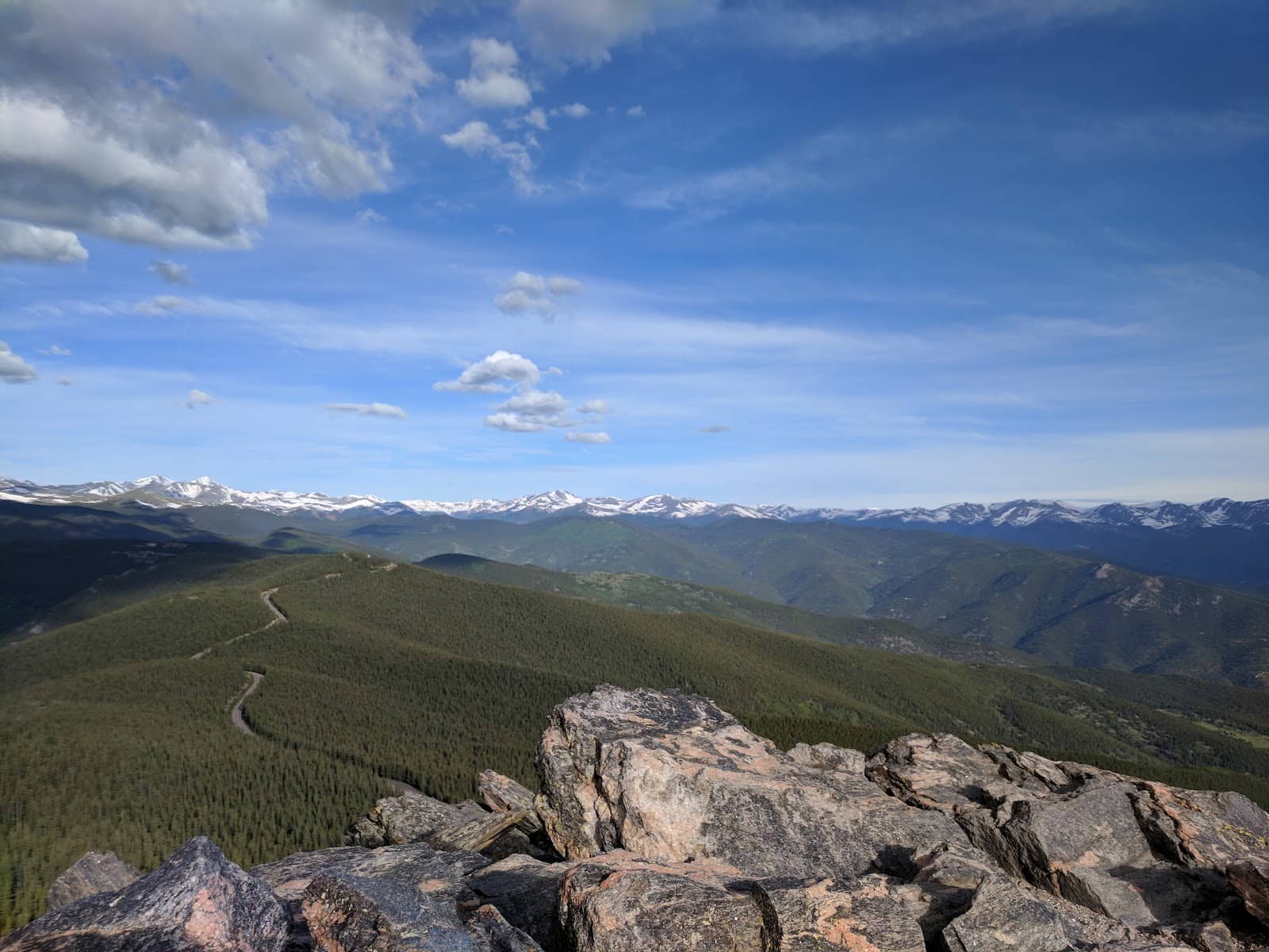
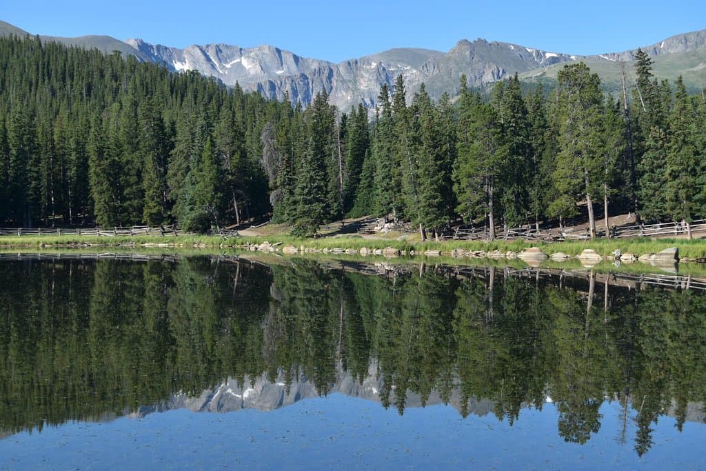
Alpine Tundra Landscape
Upper trail
Hike through a beautiful alpine tundra carpeted with fragile plants as you ascend.
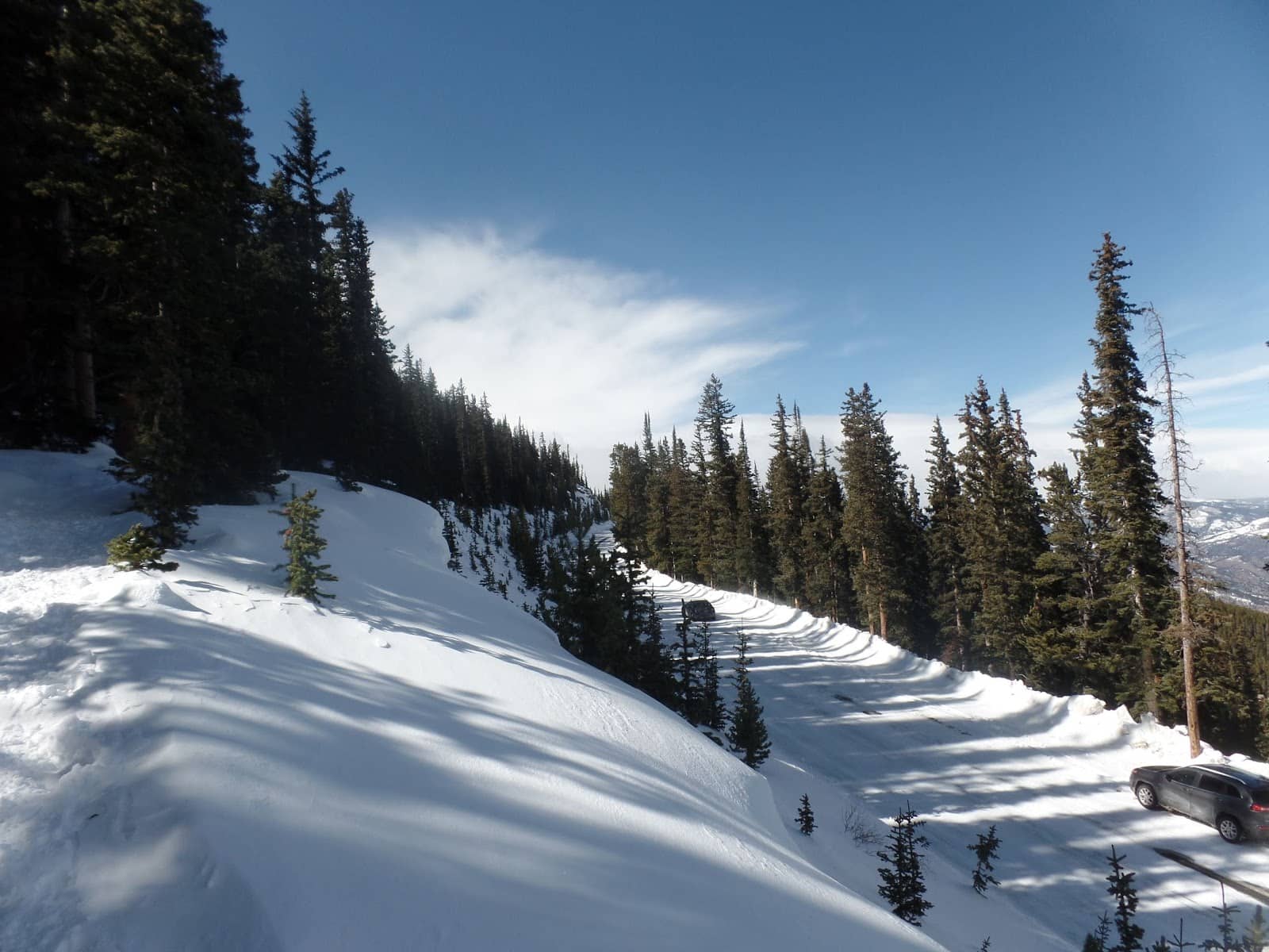
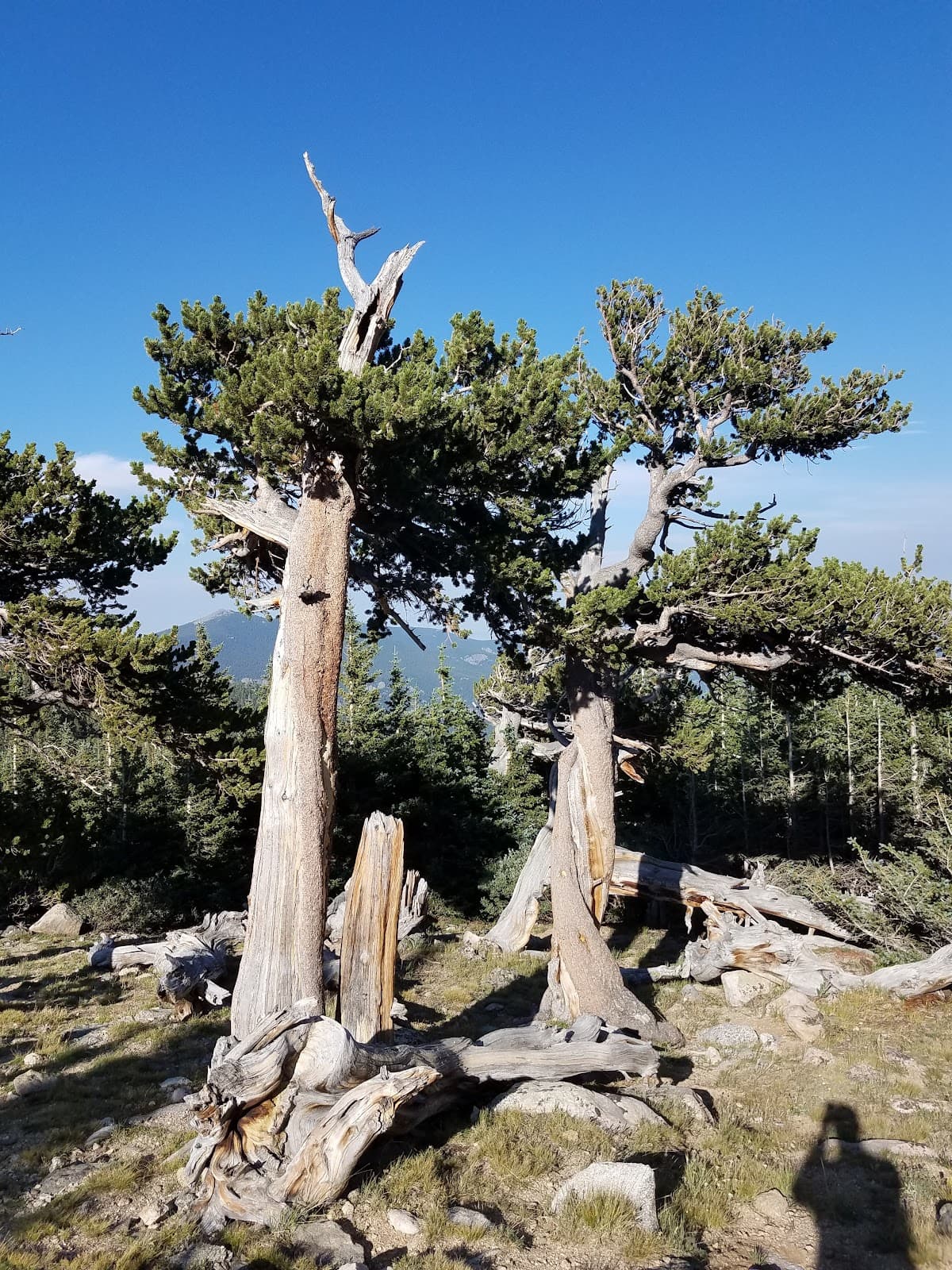
Forest to Summit Transition
Trail
Enjoy the scenic transition from a spruce-fir forest to open alpine terrain.
Plans like a pro.
Thinks like you
Planning Your Visit
Timing is Everything
Trailhead & Conditions
Best Times
Insider Tips
from TikTok, Instagram & Reddit
🎯 Arrive Early for Parking
Park on the north side of Hwy 103; the trailhead is unmarked. Arrive before 11 am on weekends. +1
🧥 Pack Layers for Summit
Weather changes fast! It can be warm at the trailhead and freezing with high winds at the top.
👟 Winter Gear Recommended
Crampons or microspikes are a must for winter hikes to navigate icy conditions safely.
💧 No Facilities Available
There are no bathrooms or water sources on the trail. Plan accordingly!
Tips
from all over the internet
🎯 Arrive Early for Parking
Park on the north side of Hwy 103; the trailhead is unmarked. Arrive before 11 am on weekends. +1
🧥 Pack Layers for Summit
Weather changes fast! It can be warm at the trailhead and freezing with high winds at the top.
👟 Winter Gear Recommended
Crampons or microspikes are a must for winter hikes to navigate icy conditions safely.
💧 No Facilities Available
There are no bathrooms or water sources on the trail. Plan accordingly!
📸 Capture the 360 Views
The summit offers incredible panoramic views; bring your camera!
What Travellers Say
Reviews Summary
Visitors consistently praise Chief Mountain Trail for its stunning 360-degree summit views and its accessibility as a relatively short hike near Denver. Many appreciate the scenic transition from forest to alpine tundra. However, some note the trail's steepness and the unpredictable, often windy, summit weather, advising visitors to come prepared with layers and sturdy footwear.
"Great trail! Cool 360 view of the mountains"
Jenna Leach
"One of my favorite hikes. Fairly easy, and with a beautiful view up top."
Daves World
"The views from the top is just amazing. Overall a moderately challenging hike with almost 1300 ft elevation gain. During winter crampons or microspikes are definitely recommended."
Asha Shibu
What People Like
What People Dislike
Frequently Asked Questions
🚇 🗺️ Getting There
The trailhead is located off Colorado Highway 103, about an hour west of Denver. Parking is available along the roadside. Trust your GPS as signage is minimal. +1
Yes, Chief Mountain Trail is conveniently located less than an hour's drive from Denver, making it a popular day trip destination. +1
The trailhead is unmarked and can be tricky to spot. Look for a pull-off on the north side of Highway 103, often near Epic Mountain.
Public transportation options to the trailhead are very limited. Driving is the most practical way to access this hike.
Squaw Pass Road (Hwy 103) is generally open year-round, but can experience closures due to heavy snowfall in winter. Always check road conditions before you go.
🎫 🎫 Tickets & Entry
No, there are no permits or entrance fees required to hike the Chief Mountain Trail. It's a free public access trail.
The trail is open year-round from dawn to dusk. However, access can be affected by winter weather conditions.
There is no entrance fee for Chief Mountain Trail. Access is free for all visitors.
While technically possible, hiking at night is not recommended due to the unmarked trail, potential for wildlife, and rapidly changing weather conditions.
Dogs are generally allowed on the Chief Mountain Trail, but they must be kept on a leash at all times. Please be a responsible pet owner and clean up after your dog.
🎫 🧭 Onsite Experience
Chief Mountain Trail is considered moderate. It's a relatively short hike (2.8 miles round trip) but features a consistent and steep elevation gain of about 941 feet. +2
Most hikers complete the Chief Mountain Trail in 1.5 to 2.5 hours, depending on their pace and how long they spend at the summit.
You'll be rewarded with stunning 360-degree panoramic views of the Front Range, surrounding mountains, and alpine landscapes.
No, there are no bathroom facilities or water sources available on the Chief Mountain Trail. Be sure to bring all necessary supplies with you.
While moderate, beginners can tackle it if they are prepared for the steep ascent. Taking it slow and steady is key.
📸 📸 Photography
The summit offers incredible panoramic vistas, perfect for landscape photography. The transition from forest to alpine tundra also provides unique shots.
Early morning or late afternoon light can create beautiful golden hour shots. However, be mindful of rapidly changing weather at the summit.
Drone usage regulations can vary. It's best to check with local authorities or the Forest Service for current rules regarding drone operation in this area.
A wide-angle lens is great for capturing the expansive views. Consider a sturdy tripod for stable shots, especially in windy conditions.
The entire summit area provides excellent viewpoints. Don't be afraid to explore a bit to find your perfect angle.
For Different Travelers
Tailored advice for your travel style
👨👩👧 Families with Kids
Key tips for families: Pack plenty of snacks and water, as there are no facilities. Dress children in layers to adapt to changing summit temperatures. The stunning summit views offer a great payoff and a memorable experience for kids, but ensure they are comfortable with heights and wind.
🚶 Budget Travelers
To keep costs down: Pack your own food and drinks from home. Since there are no facilities, you'll need to bring everything you need. The primary cost will be transportation to the trailhead, making it a very affordable outdoor adventure.
📸 Photography Enthusiasts
Photography tips: Bring a wide-angle lens to capture the expansive landscapes. Consider a tripod for stable shots, as the summit can be windy. Golden hour (early morning or late afternoon) offers beautiful lighting, but always be prepared for rapidly changing weather conditions at higher elevations.
Deep Dives
In-depth insights and expert knowledge
Navigating the Chief Mountain Trailhead
The trail itself begins with a transition from a dense spruce-fir forest, offering some shade and a cooler start. As you gain elevation, the landscape opens up dramatically into the alpine tundra. This transition is a visual treat, showcasing the rugged beauty of the Colorado Rockies.
Be prepared for the trail's steepness. While the total distance is only about 2.8 miles round trip, the nearly 1,000 feet of elevation gain is concentrated, making it a good workout. The path is generally well-trodden, even after fresh snow, but proper footwear is always recommended.
Summit Experience and Weather Preparedness
However, the summit is also exposed to the elements. Visitors frequently emphasize the importance of wearing layers. Even on a warm day at the trailhead, the summit can be significantly colder, windy, and even experience rapid weather changes. Packing a windbreaker, hat, and gloves is highly advisable, especially outside of peak summer months.
It's also important to note that there are no facilities at the summit or along the trail, including restrooms or water sources. Ensure you carry enough water and any snacks you might need for the hike.
Best Times to Visit and Crowd Management
For a more serene hike, consider visiting on a weekday. You'll likely encounter fewer people on the trail and have a more peaceful experience. The drive on Squaw Pass Road itself is also scenic, and a less crowded road allows for more leisurely stops.
During winter, the trail offers a different kind of beauty with snow-covered landscapes. However, this is when specialized gear like crampons or microspikes becomes essential for safety due to icy conditions. While fewer people hike in winter, those who do often enjoy the solitude and unique scenery.

Social
from TikTok, Instagram & Reddit