
Go John Trail
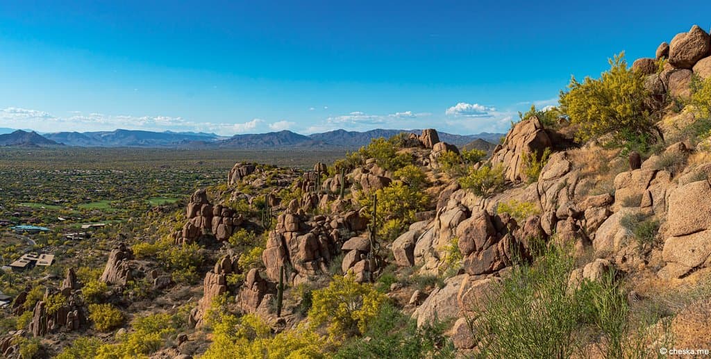
Hike or bike the 6-mile Go John Trail through the iconic Sonoran Desert, featuring giant saguaros and breathtaking panoramic views.
Highlights
Must-see attractions

Social
From TikTok & Reddit
Best Time
Beat the desert heat
Go John Trail
Best Time
Beat the desert heat
Highlights
Must-see attractions
Hike or bike the 6-mile Go John Trail through the iconic Sonoran Desert, featuring giant saguaros and breathtaking panoramic views.
"Experience the heart of the Sonoran Desert with stunning saguaros and vast panoramic views on the Go John Trail."

💧 Carry Ample Water
Crucial for the 6-mile Go John Trail. Stay hydrated to enjoy the desert scenery.
☀️ Sun Protection Essential
Wear sunscreen, a hat, and sunglasses. The Arizona sun is intense.

Highlights
Discover the most iconic attractions and experiences
Giant Saguaro Cacti
Throughout the trail
Towering saguaros create an iconic Sonoran Desert landscape. A true Arizona spectacle!
Panoramic Desert Vistas
Higher elevations
Soak in breathtaking views of the surrounding desert and mountains. Perfect for photos!

Historic Mining Vestiges
Along the trail
Discover remnants of past mining operations, adding a unique historical layer to your hike.
Plans like a pro.
Thinks like you
Planning Your Visit
Hydration is Key
Trail Etiquette & Safety
Best Times
Insider Tips
from TikTok, Instagram & Reddit
💧 Carry Ample Water
Crucial for the 6-mile Go John Trail. Stay hydrated to enjoy the desert scenery.
☀️ Sun Protection Essential
Wear sunscreen, a hat, and sunglasses. The Arizona sun is intense.
🥾 Sturdy Hiking Shoes
Recommended for the varied terrain of the Go John Trail.
🗺️ Download Trail Map
Cell service can be spotty. A downloaded map ensures you stay on track.
Tips
from all over the internet
💧 Carry Ample Water
Crucial for the 6-mile Go John Trail. Stay hydrated to enjoy the desert scenery.
☀️ Sun Protection Essential
Wear sunscreen, a hat, and sunglasses. The Arizona sun is intense.
🥾 Sturdy Hiking Shoes
Recommended for the varied terrain of the Go John Trail.
🗺️ Download Trail Map
Cell service can be spotty. A downloaded map ensures you stay on track.
What Travellers Say
Reviews Summary
Visitors praise the Go John Trail for its stunning Sonoran Desert scenery, iconic saguaro cacti, and panoramic views. It's a popular spot for both hiking and mountain biking, offering a good challenge and a chance to connect with nature. Some find the 6-mile loop demanding, especially in warmer weather, and recommend thorough preparation.
What People Like
What People Dislike
Frequently Asked Questions
🚇 🗺️ Getting There
The Go John Trail is located within Cave Creek Regional Park in Arizona. Access is typically via car. The park is well-marked and accessible from local roads.
Yes, Cave Creek Regional Park offers parking facilities. It's advisable to arrive early, especially on weekends, as parking can fill up.
While GPS can be helpful, cell service can be unreliable in the park. It's recommended to download an offline map of the Go John Trail beforehand.
Cave Creek Regional Park is accessible by car. Use a reliable GPS or mapping service, but be prepared for potential spotty service.
Public transportation options to Cave Creek Regional Park are limited. Driving is the most common and convenient way to access the trail.
🎫 🎫 Tickets & Entry
Cave Creek Regional Park typically has an entrance fee per vehicle. Check the official park website for current rates and operating hours.
Park hours can vary seasonally. It's best to check the official Cave Creek Regional Park website for the most up-to-date information on opening and closing times.
While not always required, some parks offer online booking for entry or specific activities. Check the park's website for any advance reservation options.
Information on discounts for park entry, such as for seniors or military, is usually available on the park's official website.
Entrance fees are typically per vehicle. The exact cost can be found on the Cave Creek Regional Park's official website.
🎫 🥾 Onsite Experience
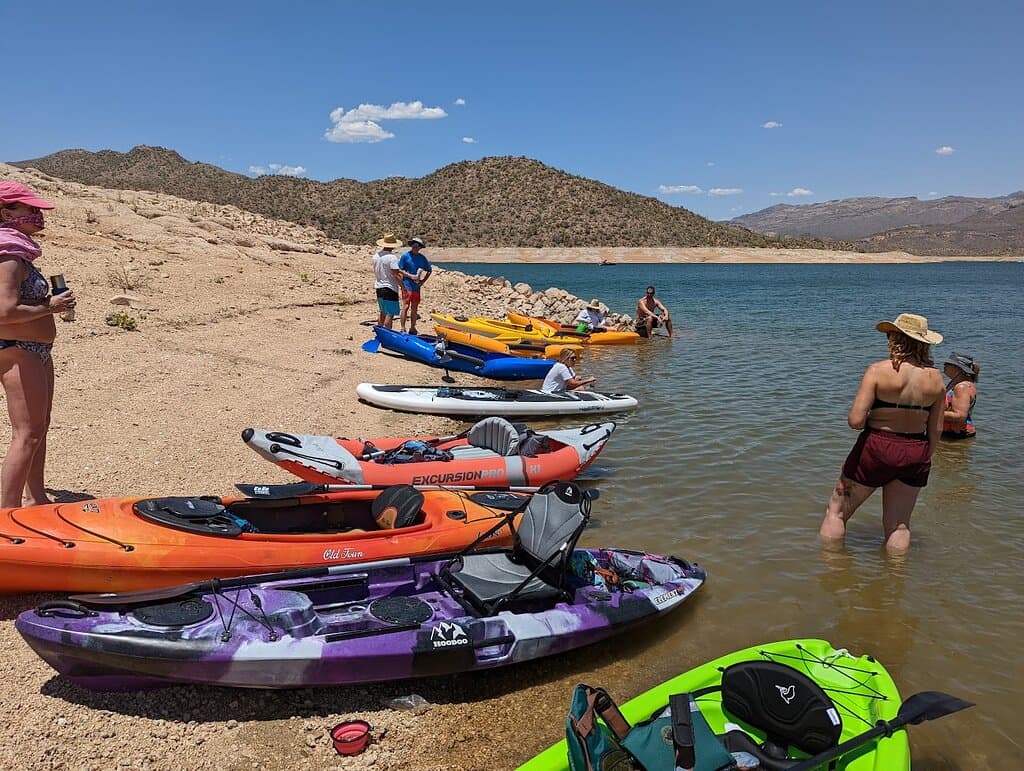
The Go John Trail is approximately 6 miles long, offering a moderate to challenging hiking experience through the Sonoran Desert.
The trail features varied desert terrain, including rocky sections, sandy washes, and some inclines. Sturdy footwear is recommended.
Yes, the Go John Trail is also popular for mountain biking. Be aware of other trail users and consider your skill level, as some sections can be challenging.
You might spot desert wildlife such as coyotes, roadrunners, lizards, and various bird species. Always observe from a safe distance.
Restroom facilities are typically available at the park's main entrance or visitor center, but not usually along the trail itself. Plan accordingly.
📸 📸 Photography
Look for elevated points offering panoramic desert vistas and areas with dense saguaro cactus formations. The mining vestiges also make for unique shots.
Early morning and late afternoon offer the best light for photography, with softer shadows and a warm glow.
Drone usage is often restricted in national and regional parks. Check the specific regulations for Cave Creek Regional Park before flying a drone.
A wide-angle lens is great for landscapes, while a telephoto lens can be useful for wildlife. A sturdy tripod can help with low-light conditions.
Don't miss the chance to photograph the iconic saguaro cacti against the desert backdrop, especially during sunrise or sunset.
For Different Travelers
Tailored advice for your travel style
👨👩👧 Families with Kids
Encourage kids to look for desert wildlife like lizards and birds, which can make the hike more engaging. The historical mining vestiges might also spark their curiosity. If hiking with very young children, a carrier might be necessary for certain sections. Always supervise children closely and be mindful of the desert heat.
⛰️ Adventure Seekers & Hikers
Consider exploring the trail during the cooler months for the most pleasant hiking conditions. The Go John Trail map is a valuable tool for navigating the loop and understanding its contours. For those looking for an extra challenge, exploring offshoot paths (where permitted and safe) can add to the adventure.
Deep Dives
In-depth insights and expert knowledge
Hiking the Go John Trail
Hikers often recommend carrying ample water, wearing sun protection, and donning sturdy footwear due to the desert climate and trail conditions. Keep an eye out for local wildlife like coyotes and roadrunners, but always maintain a safe distance. The trail also passes by remnants of old mining operations, adding a historical element to the journey.
For those seeking a more immersive experience, consider visiting during the cooler months of fall, winter, or spring. The desert blooms can be spectacular after winter rains. Remember to check the park's operating hours and any potential entrance fees before your visit.
Mountain Biking on the Go John Trail
Bikers should be aware of the trail's varied terrain, which can include loose gravel, rocks, and ascents. It's crucial to have a well-maintained mountain bike and appropriate safety gear, including a helmet. Sharing the trail with hikers means practicing courtesy and yielding when necessary.
For those new to more challenging trails, scouting the route via videos or riding with experienced bikers can be beneficial. The Go John Trail map is essential for navigation, and downloading an offline version is highly recommended due to potential spotty cell service.


Social
from TikTok, Instagram & Reddit