
Stour Valley Path Suffolk and Essex
Explore the tranquil beauty of the River Stour's unspoiled watermeadows and charming villages in Suffolk and Essex.
Highlights
Must-see attractions

Social
From TikTok & Reddit
Best Time
Fewer crowds, pleasant weather
Stour Valley Path Suffolk and Essex
Best Time
Fewer crowds, pleasant weather
Highlights
Must-see attractions
Explore the tranquil beauty of the River Stour's unspoiled watermeadows and charming villages in Suffolk and Essex.
"Absolutely amazing place… such calm soothing atmosphere. ❤️"
🥾 Wear Sturdy Boots
Mud can be sticky near the river after rain. Waterproof walking boots are essential for comfort.
☀️ Avoid Peak Summer
The path can get surprisingly congested with walkers during the height of summer.
Highlights
Discover the most iconic attractions and experiences
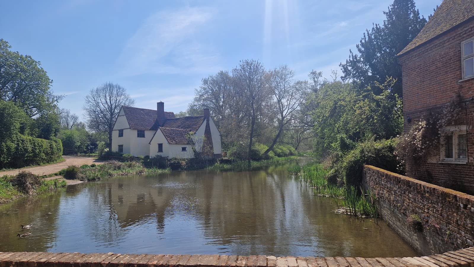
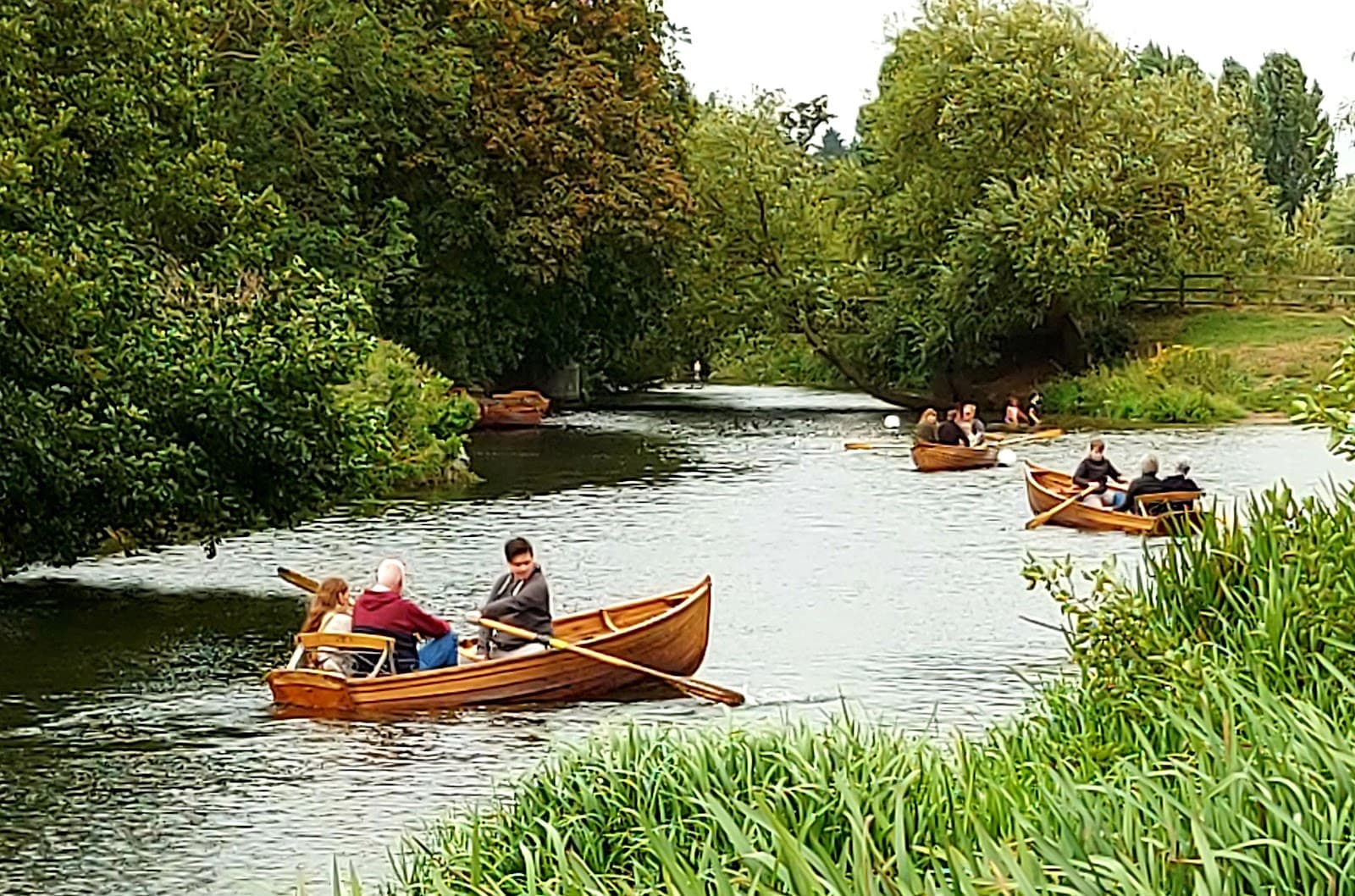
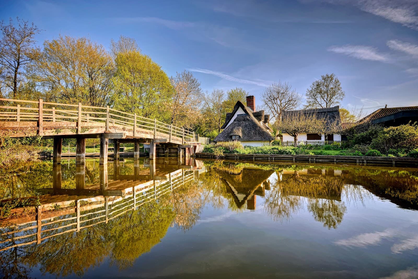
Scenic Watermeadows
Along the River Stour
Meander through unspoiled lowland landscapes, enjoying the tranquil beauty of the river and its surrounding meadows.
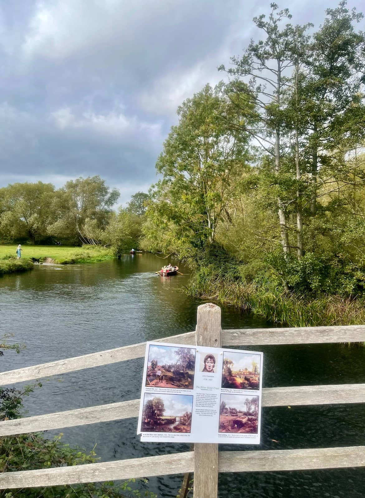
St. Edmund's Way Section
Long Melford to Lavenham
Explore a picturesque stretch on a disused railway line, offering a unique perspective of the countryside.
Plans like a pro.
Thinks like you
Planning Your Visit
Best Footwear for the Trail
Seasonal Considerations
Best Times
Insider Tips
from TikTok, Instagram & Reddit
🥾 Wear Sturdy Boots
Mud can be sticky near the river after rain. Waterproof walking boots are essential for comfort.
☀️ Avoid Peak Summer
The path can get surprisingly congested with walkers during the height of summer.
🗺️ Check Trail Conditions
Some sections, like the middle part, may need foliage clearing. Be prepared for potential overgrowth.
🐶 Dog-Friendly Path
Popular with dogs and their walkers in every season, but keep them under control.
Tips
from all over the internet
🥾 Wear Sturdy Boots
Mud can be sticky near the river after rain. Waterproof walking boots are essential for comfort.
☀️ Avoid Peak Summer
The path can get surprisingly congested with walkers during the height of summer.
🗺️ Check Trail Conditions
Some sections, like the middle part, may need foliage clearing. Be prepared for potential overgrowth.
🐶 Dog-Friendly Path
Popular with dogs and their walkers in every season, but keep them under control.
What Travellers Say
Reviews Summary
Visitors rave about the Stour Valley Path's 'absolutely amazing' and 'calm, soothing atmosphere,' praising its scenic watermeadows and riverbank trails. However, some note that the middle sections can require foliage clearing and that the path becomes 'surprisingly congested' and muddy during peak summer, impacting the experience.
"Absolutely amazing place… such clam soothing atmosphere. ❤️"
Dhiya Wilson
"St Edmund way on disused railway between Long melford and Lavenham.
Middle section desperately needs foliage clearing. Are you reading this Suffolk county and district councils ?"
paul ives
"Exceptionally scenic watermeadow, riverbank trail following The Stour as it meanders through this unspoilt area of lowland Suffolk. Can become surprisingly congested with walkers during the height of Summer. During wet weather the field mud close to the waters edge can become very sticky & almost impassable. Nonetheless, the paths remain popular with dogs & their walkers, in every season..."
Roy
What People Like
What People Dislike
Frequently Asked Questions
🚇 🗺️ Getting There
The Stour Valley Path is a network of trails, with access points in various villages like Long Melford and Lavenham. Parking is available in these villages, and public transport options might be limited, so driving is often recommended.
Public transport can be sparse in this rural area. It's advisable to check local bus routes in advance, but many visitors find driving to a starting point like Long Melford or Lavenham most convenient.
While some sections, like the disused railway line of St. Edmund's Way, are suitable for cycling, other parts of the Stour Valley Path are primarily designed for walkers and may be too narrow or muddy for bikes.
Parking is generally available in the villages that the path passes through, such as Long Melford and Lavenham. Look for local car parks, but be aware they can fill up during peak times.
The disused railway line sections are generally flat and firm, making them more accessible. However, other parts of the path, especially near the river, can be muddy and uneven, making them challenging for wheelchairs and pushchairs.
🎫 🎫 Tickets & Entry
No, the Stour Valley Path is a public right-of-way and is free to access. There are no admission fees.
As a public footpath, the Stour Valley Path is accessible at all times. However, it's best to visit during daylight hours for safety and enjoyment.
No permits are required to walk the Stour Valley Path. It's an open access area for everyone to enjoy.
There is no entrance fee for the Stour Valley Path. It is a public footpath and free to use.
While technically accessible, walking the Stour Valley Path at night is not recommended due to potential hazards, poor visibility, and lack of lighting.
🎫 🧭 Onsite Experience
Using a good Ordnance Survey map or a reliable walking app is recommended, as the path can be extensive and some sections might have overgrown foliage.
Facilities are generally limited directly on the path. It's best to use facilities in the villages like Long Melford or Lavenham before or after your walk.
This depends on the section you choose. A walk between Long Melford and Lavenham might take a couple of hours, while exploring more extensive parts could take a full day.
Expect beautiful watermeadows, riverbanks, and unspoiled countryside. The St. Edmund's Way section offers a unique experience on a former railway line.
Signage can vary. While some sections are well-marked, others might require more attention to navigation. Carrying a map or using a GPS device is advisable.
🍽️ 🍽️ Food & Dining
Directly on the path, dining options are scarce. However, villages like Long Melford and Lavenham offer charming pubs and cafes for refreshments before or after your walk.
Yes, there are many scenic spots along the path perfect for a picnic. Remember to take all your litter with you to keep the area pristine.
Villages like Lavenham and Long Melford boast traditional pubs serving local ales and hearty meals, as well as tea rooms and cafes offering lighter bites.
While direct riverfront dining is rare on the path itself, some pubs in nearby villages may offer views or be situated close to the river.
It's best to stock up on snacks and drinks in the villages before you set off, as shops and kiosks are not common directly on the walking trails.
📸 📸 Photography
The watermeadows, the meandering River Stour, and the charming villages like Lavenham offer fantastic photographic opportunities. The disused railway line also provides unique shots.
Early morning or late afternoon light (golden hour) can create beautiful, soft lighting for landscape photography, especially over the watermeadows.
The picturesque village of Lavenham, with its medieval architecture, is a major photographic draw. The river itself and the surrounding natural beauty are also key subjects.
A versatile lens (like a 24-70mm) is useful for landscapes and village details. A wide-angle lens can capture the expansive watermeadows. Consider a polarizing filter for water.
Drone usage regulations can vary. Always check local bylaws and privacy considerations before flying a drone over private land or near residential areas.
For Different Travelers
Tailored advice for your travel style
👨👩👧 Families with Kids
Pack plenty of snacks and drinks, as facilities directly on the path are limited. Consider a picnic in one of the scenic spots. While the path is dog-friendly, ensure children are supervised, especially near the riverbanks. The natural beauty and open spaces provide a great environment for kids to explore and burn off energy.
🐶 Dog Owners
However, it's crucial to be mindful of the conditions. The riverbank sections can become very muddy, so ensure your dog is prepared for potentially messy conditions and that you have a way to clean them up afterward. Always keep dogs under control, especially in areas where livestock might be present or where the path is narrow.
🚶♀️ Solo Walkers & Nature Lovers
While the path is generally safe, it's always wise for solo walkers to inform someone of their route and expected return time. Carrying a fully charged phone and a map or navigation app is recommended, especially if venturing onto less-traveled sections. The opportunity to immerse yourself in nature and enjoy the tranquility makes it a rewarding experience.
Deep Dives
In-depth insights and expert knowledge
Navigating the Stour Valley Path
When planning your route, it's crucial to be aware of the terrain. While the former railway lines are generally firm, the riverbank sections can become exceptionally muddy and sticky, especially after rainfall. This has led to comments about the need for foliage clearing in certain areas. Therefore, checking local conditions or opting for drier periods is advisable.
For navigation, while the path is generally popular, signage can be inconsistent. Carrying a detailed map, such as an Ordnance Survey map, or using a GPS-enabled walking app on your smartphone is highly recommended to ensure you stay on track and discover the most scenic parts of this beautiful valley.
Experiencing the Natural Beauty
During the height of summer, the path can become surprisingly congested with walkers, which might detract from the peaceful ambiance for some. Visiting during the shoulder seasons, such as spring or autumn, can offer a more serene experience with pleasant weather and fewer people. The changing colours of the landscape in autumn are particularly stunning.
It's worth noting that the path's charm is closely tied to its natural state. While this contributes to its unspoiled feel, it also means that maintenance can be a challenge. Comments have been made about sections needing foliage clearing, which can affect the ease of passage. However, for many, the raw beauty and the feeling of being immersed in nature are well worth any minor inconveniences.


Social
from TikTok, Instagram & Reddit