Hardergrat Brienzergrat Ridge
An epic, challenging ridge hike in the Swiss Alps offering unparalleled panoramic views of Lake Brienz and surrounding peaks.
Highlights
Must-see attractions

Social
From TikTok & Reddit
Best Time
Clear skies, best views
Hardergrat Brienzergrat Ridge
Best Time
Clear skies, best views
Highlights
Must-see attractions
An epic, challenging ridge hike in the Swiss Alps offering unparalleled panoramic views of Lake Brienz and surrounding peaks.
"The best hike I ever did, but be sure to prepare well."
Check Weather Religiously
This hike is dangerous in bad weather. Fog, rain, or wind can make it treacherous.
Start Early!
The trail is long and challenging. Give yourself plenty of daylight to complete it safely.

Highlights
Discover the most iconic attractions and experiences
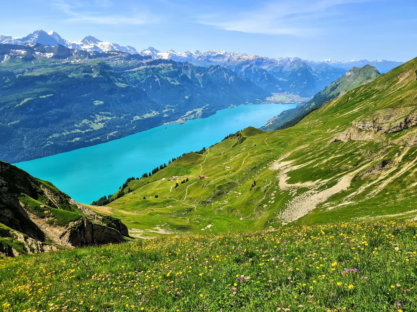
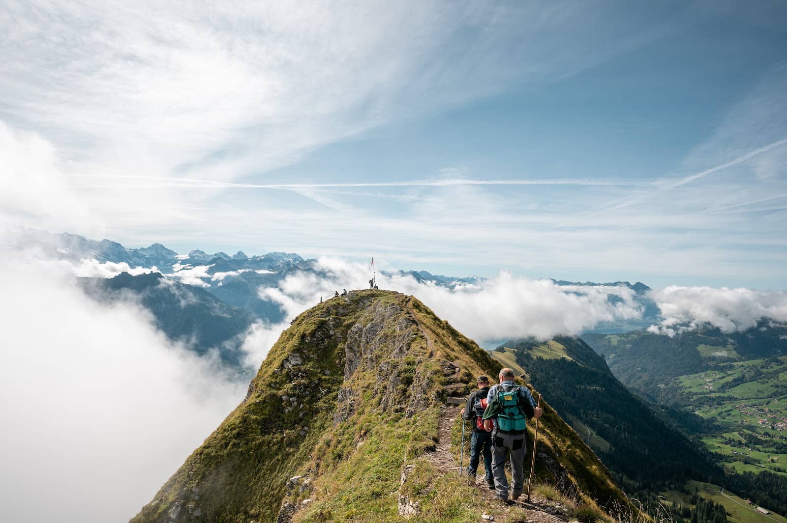
The Exposed Ridges
The main ridgeline
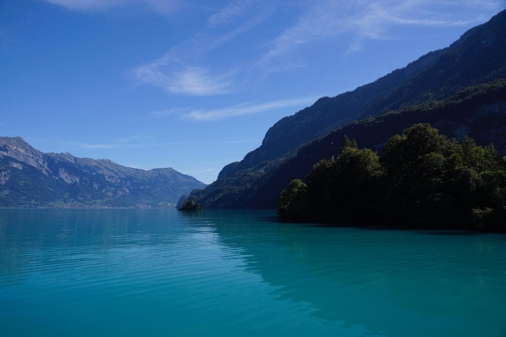
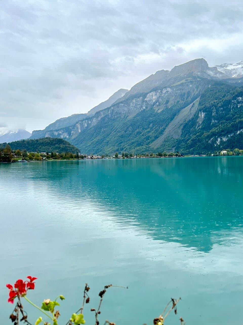
Traverse razor-sharp peaks with breathtaking panoramic views of Lake Brienz and the surrounding Alps.
Augstmatthorn Summit
Augstmatthorn peak
A prominent peak offering stunning vistas, often a key point on the ridge traverse.

Harder Kulm Viewpoint
Harder Kulm
The endpoint (or starting point) offers iconic views over Interlaken and the lakes.
Plans like a pro.
Thinks like you
Planning Your Visit
Prepare for a Challenging Ridge
Timing and Direction Matter
Best Times
Insider Tips
from TikTok, Instagram & Reddit
Check Weather Religiously
This hike is dangerous in bad weather. Fog, rain, or wind can make it treacherous.
Start Early!
The trail is long and challenging. Give yourself plenty of daylight to complete it safely. +1
Hydration is Key
Bring plenty of water; there are no reliable water sources on the main ridge.
Wear Sturdy Footwear
Good grip is essential for the rocky and sometimes slippery terrain. :athletic_shoe:
Tips
from all over the internet
Check Weather Religiously
This hike is dangerous in bad weather. Fog, rain, or wind can make it treacherous.
Start Early!
The trail is long and challenging. Give yourself plenty of daylight to complete it safely. +1
Hydration is Key
Bring plenty of water; there are no reliable water sources on the main ridge.
Wear Sturdy Footwear
Good grip is essential for the rocky and sometimes slippery terrain. :athletic_shoe:
Consider Direction
Hiking from Brienzer Rothorn to Harder Kulm is often recommended for tackling tough ascents first.
What Travellers Say
Reviews Summary
Reviewers consistently praise the Hardergrat Brienzergrat Ridge for its absolutely breathtaking views and the exhilarating, challenging nature of the hike. Many describe it as the best hike they've ever done, a true 'adventure.' However, the difficulty and exposure are frequently highlighted as significant factors, with warnings to prepare thoroughly and check weather conditions meticulously.
"Best hike, challenging, breathtaking views, go on a clear day with good weather, try to get to the peak I'd say about 3 hours from harderkulm where it gets really challenging but offers the best views of both sides"
Eli Aber
"To get to Hardergrat, map to Harder Kulm and take funicular up to restaurant/tourist view point (cost approximately $25 USD round trip). The signs are not very accurate as far as time goes; we took much longer and are regular hikers. We started the hike just uphill from the children’s playground and most of the trail was covered by trees blocking the view. We hiked around 2 hours before the trees opened up and we got to the ridge portion. Check weather! Recently visited and the trail was incredibly muddy and slippery, not safe. However once you get to the ridge, the views are incredible and totally worth it. Oh, and we encountered some mountain goats which was a pleasant surprise."
Melanie Jensen
"Best hiking in my life so far. Not an easy one, be sure to prepare well."
inst 8bit
What People Like
What People Dislike
Frequently Asked Questions
🚇 🗺️ Getting There
The most common starting point is via the Harder Kulm funicular from Interlaken. Alternatively, you can start from Brienzer Rothorn. Public transport is readily available to Interlaken and Brienz. +1
Yes, you can reach the general area by train to Interlaken or Brienz. From there, you'll typically take a funicular or bus to the trailhead.
Many hikers recommend starting at Brienzer Rothorn and hiking towards Harder Kulm. This way, you tackle the most challenging ascents first.
Yes, a 'mini loop' from Lombachalp to Augstmatthorn is possible, offering ridge views with less commitment.
Parking is available at trailheads like Jägerstübli, with fees typically around 5-10 CHF.
🎫 🎫 Tickets & Entry
A round-trip ticket for the Harder Kulm funicular is approximately 40 CHF.
No, the hike itself does not require tickets. However, booking the Harder Kulm funicular in advance might save time during peak season.
There are no specific entrance fees for hiking the ridge itself, but you may incur costs for funiculars or parking. +1
The funicular typically operates from spring to autumn. It's best to check the official website for current operating hours.
Due to its exposed nature and difficulty, the full Hardergrat ridge is generally not recommended for young children or inexperienced hikers. +1
🎫 🥾 Onsite Experience
The full traverse can take anywhere from 6 to 10 hours, depending on your pace and the chosen route. Some sections are very technical. +2
This is a challenging T5-rated hike, involving exposed ridges, scrambling, and significant elevation changes. It requires good fitness and alpine experience. +2
Expect breathtaking panoramic views of Lake Brienz, the surrounding Bernese Alps, and dramatic ridgeline scenery. +1
Limited facilities exist. The Harder Kulm restaurant is at one end, but there are no services on the main ridge itself.
Wear sturdy hiking boots with good grip, layers of clothing, sun protection (hat, sunscreen), and rain gear just in case.
📸 📸 Photography
The entire ridge offers incredible photo opportunities. Key spots include Augstmatthorn, the exposed ridgeline itself, and the views from Harder Kulm. +1
Be extremely cautious when taking photos on the exposed sections. Prioritize safety and secure your footing before reaching for your camera. +1
Morning light offers softer shadows and can be beautiful, while late afternoon light can create dramatic silhouettes. Golden hour is spectacular.
Drone regulations vary. Always check local rules and regulations before flying a drone in the Swiss Alps.
A wide-angle lens is great for capturing the expansive landscapes. A lightweight setup is ideal for this challenging hike.
For Different Travelers
Tailored advice for your travel style
👨👩👧 Families with Kids
However, families can still enjoy the views from the Harder Kulm viewpoint, which is easily accessible via the funicular and offers spectacular panoramas without the hiking risks. There are also easier, shorter trails near the Harder Kulm restaurant that are more suitable for families.
💰 Budget Travelers
Alternatively, focus on the mini loop from Lombachalp, which has a lower parking fee (5-10 CHF) and offers a taste of the ridge views without the expense of the funicular. Bringing your own food and water is also a great way to cut down on costs.
📸 Photography Enthusiasts
For the best results, aim for early morning or late afternoon light to capture the dramatic landscapes. Be mindful of safety when composing shots on exposed sections. Consider bringing a wide-angle lens to capture the vastness of the scenery.
Deep Dives
In-depth insights and expert knowledge
The Challenge of the Hardergrat
Hikers often report that the trail is much longer and more strenuous than anticipated, with trail signs sometimes underestimating the time required. The terrain can be rocky, scree-covered, and at times, very narrow. The constant up-and-down over numerous summits, each with its own climb and descent, contributes to the significant elevation gain and loss, even if the total vertical meters might seem moderate on paper.
Key considerations include the weather, which must be perfect – clear, dry, and not too windy. The lack of shade on much of the ridge means sun protection is vital. While no special climbing equipment is strictly necessary, sturdy hiking boots with excellent grip are non-negotiable. The reward for this effort is unparalleled: truly breathtaking, 360-degree views that make the challenge worthwhile for experienced hikers.
Navigating the Ridge: Routes and Directions
An alternative, shorter option is the 'mini loop' starting from Lombachalp, which can be completed in about 3.5-4 hours and covers around 6-7 km with roughly 600m of elevation gain. This route still offers stunning ridge views without the full commitment of the longer traverse.
Regardless of the chosen route, it's essential to map your route carefully and be aware of the terrain. The trail is well-marked in parts, but the sheer length and complexity mean you should be comfortable with navigation. Always check recent trail conditions, especially after periods of rain or snow, as the ridge can become slippery and hazardous.
What to Pack for the Hardergrat
Sun protection is vital: a wide-brimmed hat, sunglasses, and high SPF sunscreen are essential as there is very little shade on the ridge. Bring plenty of water (at least 2-3 liters per person) as there are no reliable water sources between the start and end points. High-energy snacks and a packed lunch are also necessary, as the hike is long and demanding.
Other essentials include a first-aid kit, a map and compass (or GPS device/app), a fully charged mobile phone, and a headlamp in case of unexpected delays. Trekking poles can be beneficial for stability on descents and ascents.


Social
from TikTok, Instagram & Reddit