Big Hill Track
A challenging yet rewarding hike near Arrowtown, offering breathtaking panoramic views from its summit and diverse trails through forests and along ri...

Highlights
Must-see attractions

Social
From TikTok & Reddit
Best Time
Pleasant temps, fewer crowds
Big Hill Track
Best Time
Pleasant temps, fewer crowds
Highlights
Must-see attractions
A challenging yet rewarding hike near Arrowtown, offering breathtaking panoramic views from its summit and diverse trails through forests and along rivers.
"Absolutely stunning scenery in an easy out-and-back. Highly recommend!"
💧 Hydration is Crucial
Carry plenty of water; shade is scarce on many sections of the Big Hill Track .
👟 Sturdy Footwear Needed
Essential for the steep, dusty, and sometimes slippery terrain, especially on descents .

Highlights
Discover the most iconic attractions and experiences
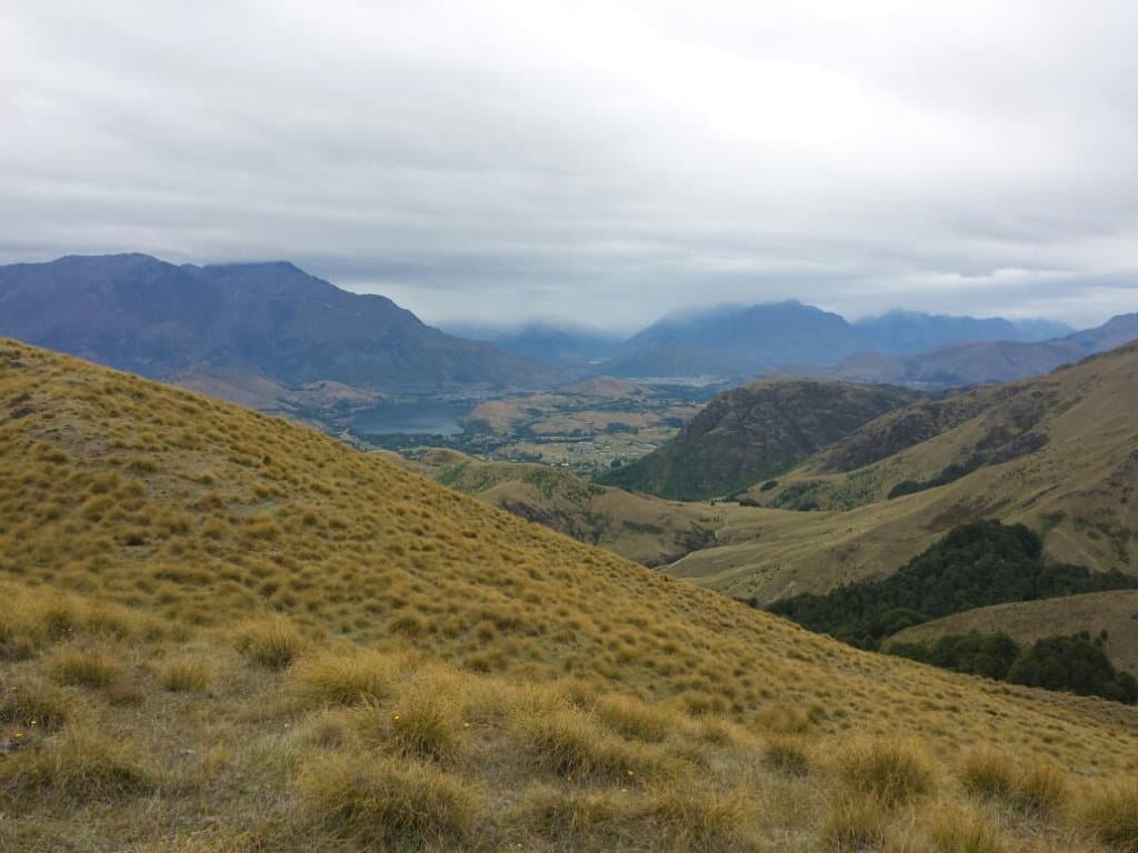
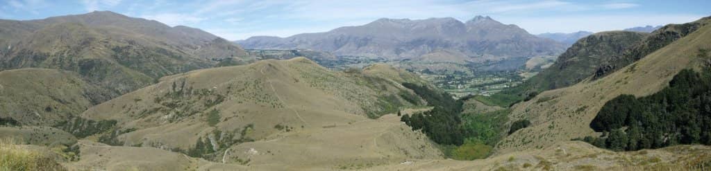
Big Hill Summit Views
Big Hill Summit
Panoramic 360-degree views of Queenstown, Cardrona, and the Richardson Mountains. A true reward!

Eichardt's Flat Climb
Start of the trail
The initial steep ascent is a leg-burner but leads to more manageable terrain and beautiful beech forests.

Arrow River & Hayes Creek
Lower sections of the track
Scenic riverside paths offering a gentler experience with the soothing sound of rushing water.
Plans like a pro.
Thinks like you
Planning Your Visit
Gear Up for the Burn
Route Planning is Key
Best Times
Insider Tips
from TikTok, Instagram & Reddit
💧 Hydration is Crucial
Carry plenty of water; shade is scarce on many sections of the Big Hill Track.
👟 Sturdy Footwear Needed
Essential for the steep, dusty, and sometimes slippery terrain, especially on descents.
🗺️ Check Route Options
Varying difficulty levels exist; research your chosen path beforehand.
📸 Capture the Scenery
Stunning views abound; allow extra time for photos, especially from the summit.
Tips
from all over the internet
💧 Hydration is Crucial
Carry plenty of water; shade is scarce on many sections of the Big Hill Track.
👟 Sturdy Footwear Needed
Essential for the steep, dusty, and sometimes slippery terrain, especially on descents.
🗺️ Check Route Options
Varying difficulty levels exist; research your chosen path beforehand.
📸 Capture the Scenery
Stunning views abound; allow extra time for photos, especially from the summit.
⚠️ River Crossing Alert
Rivers can swell after rain, making some paths impassable. Check conditions.
What Travellers Say
Reviews Summary
Visitors rave about the Big Hill Track's stunning panoramic views and varied terrain, offering everything from challenging climbs to gentle riverside strolls. While the initial ascent can be tough, the rewarding vistas and beautiful natural surroundings make it a highly recommended hike. Some find river crossings tricky after rain, and the lack of shade on certain sections requires preparation.
"I couldn't stop taking pictures! We were expecting an easy walk (which is possible along the road) and were pleasantly surprised at the intermediate level of difficulty by walking through the woods and along the cliffs. Absolutely stunning scenery in an easy out-and-back. Beware that the river makes the road track inaccessible so after we crossed the bridge and discovered we would have to wade through knee-deep water, we decided to go back the way we came. Highly recommend!"
Carrie Jahn Rohrbach
"Big Hill trail:
From the Arrowtown car park this is a 5-6 hour walk up to the top of Big Hill summit.
It follows the Saw Pit Gully trail at first - cross the bridge on the lower car park in Arrowtown.
The first climb up to Eichardts flat (45 mins) is the steepest climb, so don’t get discouraged if you found yourself out of breath.
From here you deviate left and uphill, although the track is fairly flat. There’s a nice beech forest section, then a climb again to the Big Hill saddle. The peak is now close but a bit of uphill again then you are at the top with impressive 360 degree views of Queenstown, Cardrona & the Richardson Mountains. A walk across the summit gives a view down onto Macetown.
I walked back the way I came but you can descend from Big Hill summit east and down to the Arrow river (Hayes creek walkway) to complete a loop - adds around 30 minutes to the total."
Formula T
"We chose this walk specifically because it had a minimal gradient, making it easier to navigate in the rainy conditions. Despite the weather, the experience was quite captivating, with the rain adding a refreshing atmosphere. The rivers along the trail were flowing strongly, creating a mesmerizing sight as they surged with power and energy. The sound of the rushing water combined with the rain made for a peaceful yet invigorating experience. Overall, it was the perfect walk for such weather, allowing us to enjoy nature without the challenge of steep climbs."
Jacob
What People Like
What People Dislike
Frequently Asked Questions
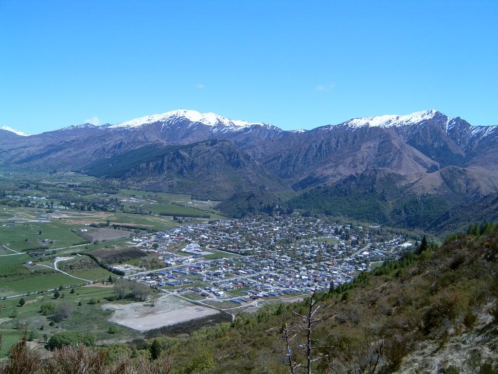
🚇 🗺️ Getting There
The main access point is from the Arrowtown car park. You'll typically cross the bridge on the lower car park to begin the Saw Pit Gully trail, which is the initial part of the Big Hill Track.
Yes, there is parking available at the Arrowtown car park, which serves as the primary starting point for many of the Big Hill Track routes.
While direct public transport to the trailhead might be limited, Arrowtown itself is accessible by bus. From Arrowtown, it's a short walk to the trailhead.
Using a good hiking app or a physical map is recommended, especially if you plan to do the loop or explore less-marked sections. The track can be steep and winding.
Currently, there are no widely advertised shuttle services specifically for the Big Hill Track. Most visitors drive or arrange their own transport to Arrowtown.
🎫 🎫 Tickets & Entry
No, the Big Hill Track is a public walking track and does not require an entry fee or tickets. It's free to access and explore.
The Big Hill Track is open year-round, 24 hours a day. However, it's best to hike during daylight hours for safety and enjoyment.
There is no booking system required for the Big Hill Track. It's an open access trail for all to enjoy.
No permits are required for general hiking on the Big Hill Track. It's managed as a public recreational area.
Yes, the track is accessible year-round. Each season offers a different experience, from lush greenery in spring/summer to potentially frosty conditions in winter.
🎫 🚶 Onsite Experience
The duration varies greatly depending on the route. A full loop or summit hike can take 5-6 hours, while shorter sections along the river are much quicker.
The difficulty ranges from easy (riverside paths) to intermediate/challenging (summit climbs). The initial climb to Eichardt's Flat is particularly steep.
Yes, there are easier sections like the Bush Creek Trail or parts of the Arrow River trail that are suitable for beginners. The summit routes are more demanding.
Restroom facilities are generally limited on the trail itself. It's best to use facilities in Arrowtown before you start your hike.
While tempting, swimming is not generally recommended due to strong currents and cold water. Some sections might be shallow enough for wading, but caution is advised.
📸 📸 Photography
The summit offers breathtaking 360-degree views. The beech forest sections and riverside paths also provide beautiful, serene photo opportunities.
Early morning or late afternoon light (golden hour) provides the most dramatic and flattering light for landscape photography.
A wide-angle lens is great for capturing the expansive views. A sturdy tripod can be useful for low-light conditions or capturing moving water.
The summit of Big Hill is the primary viewpoint. There are also several clearings and higher points along the ascent that offer stunning vistas.
Drone usage regulations can vary. It's essential to check local rules and obtain any necessary permissions before flying a drone in the area.
For Different Travelers
Tailored advice for your travel style
👨👩👧 Families with Kids
Key Advice: Pack plenty of snacks and water, and consider a shorter, out-and-back walk along the river rather than attempting the full loop or summit. Check river levels if planning to cross any streams, as they can be swift and cold.
🚶 Budget Travelers
Tips for saving: Pack a picnic lunch and plenty of water from your accommodation to avoid purchasing expensive snacks on the trail. Wear comfortable, existing walking shoes rather than buying new ones specifically for the hike. The stunning natural beauty is the main attraction, and it costs nothing to enjoy!
Deep Dives
In-depth insights and expert knowledge
Navigating the Trails: Routes and Difficulty
For those seeking a less strenuous outing, the trails along the Arrow River and Bush Creek offer lovely, flatter walks. These are perfect for a more relaxed experience or for families. However, it's crucial to be aware of river conditions; after rain, the river can swell, making some crossings impassable and potentially altering the intended route.
Key Takeaway: Research your chosen route on the Big Hill Track beforehand. The summit offers incredible rewards, but be prepared for the climb. Easier riverside walks are also readily available.
What to Pack: Essential Gear for Big Hill Track
Hydration and sustenance are paramount. Carry more water than you think you'll need, especially during warmer months, as there are few reliable water sources on the upper trails.
Consider sun protection like a hat and sunscreen, even on cloudy days, as the sun can be intense at higher elevations. A light rain jacket is also a good idea, as weather can change quickly in the mountains. For photographers, a camera with a good zoom lens and extra batteries will be invaluable for capturing the stunning vistas.


Social
from TikTok, Instagram & Reddit