
Mount Shiratake
Tsushima's sacred peak, offering a rewarding hike with breathtaking 360-degree views of its unique ria coastline.
Highlights
Must-see attractions

Social
From TikTok & Reddit
Best Time
Good weather, less wind
Mount Shiratake
Best Time
Good weather, less wind
Highlights
Must-see attractions
Tsushima's sacred peak, offering a rewarding hike with breathtaking 360-degree views of its unique ria coastline.
"The view from the summit is unique to Mt. Shiratake and is absolutely stunning. "

🎯 Trailhead Navigation
Don't rely solely on Google Maps; use the Sumo trailhead. Park at Lot 1 if possible to save time. :round_pushpin:
👟 Summit Footing
The final ascent is steep. Go slow, watch your step, and use handholds for safety. :athletic_shoe:
Quick Facts
Rating
4.9 · 50 reviews
Type
Mountain Peak
Highlights
Discover the most iconic attractions and experiences
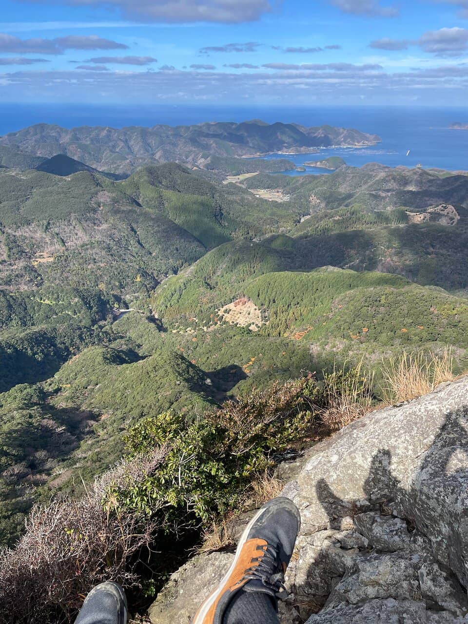
Panoramic Summit Views
Summit
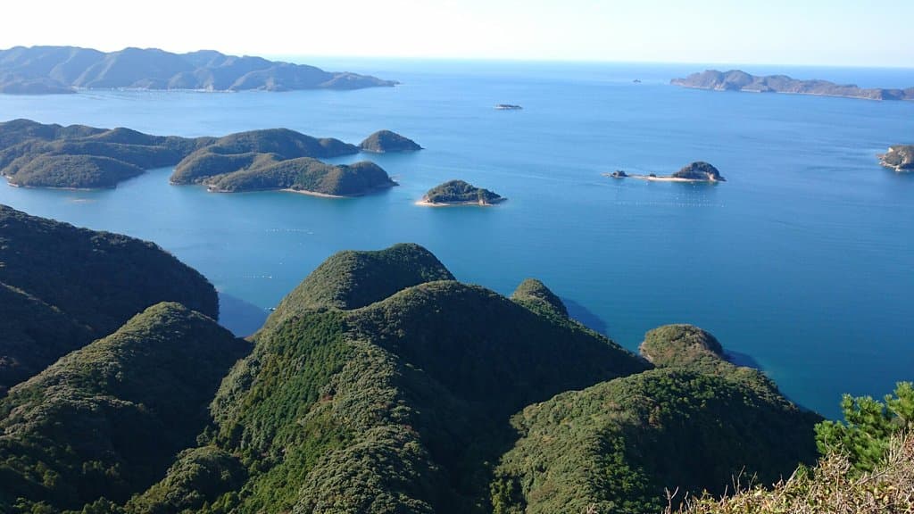
Breathtaking 360-degree vistas of Tsushima's unique ria coastline and surrounding islands. A truly spectacular reward for your climb.

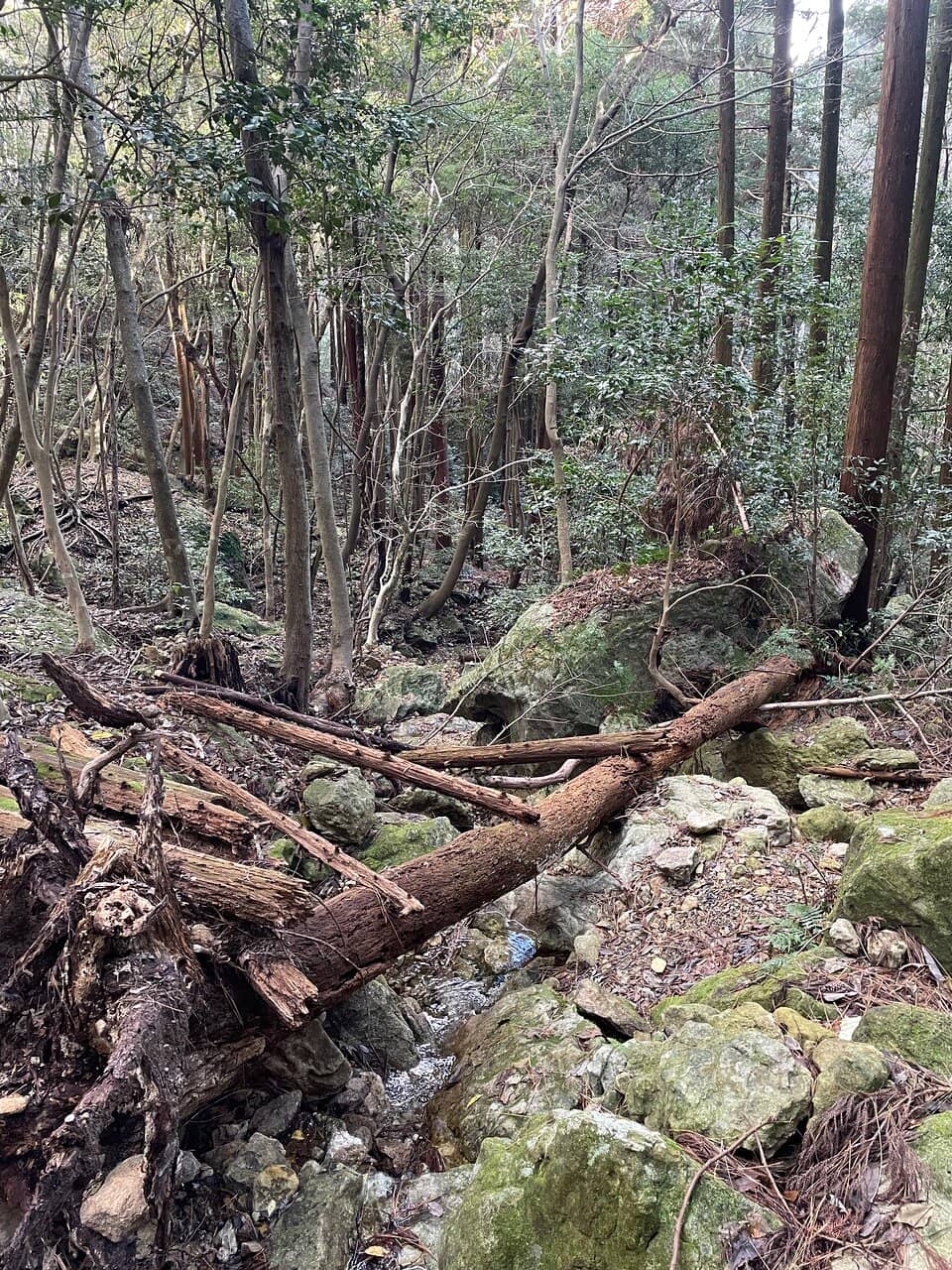
Sacred Peak Ascent
Mount Shiratake trail
Experience a spiritual journey up Tsushima's sacred mountain, a rewarding climb with a balanced distance and difficulty.
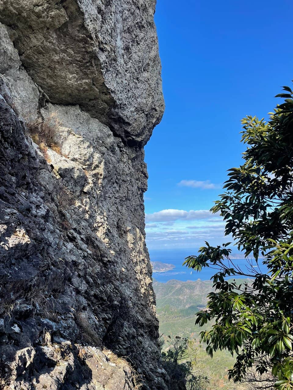
Unique Rock Formations
Near the summit
Navigate the final, steep approach to the peak, where sacred rocky areas require careful climbing with three-point support.
Plans like a pro.
Thinks like you
Planning Your Visit
Trailhead Navigation
Summit Ascent
Best Times
Insider Tips
from TikTok, Instagram & Reddit
🎯 Trailhead Navigation
Don't rely solely on Google Maps; use the Sumo trailhead. Park at Lot 1 if possible to save time. :round_pushpin:
👟 Summit Footing
The final ascent is steep. Go slow, watch your step, and use handholds for safety. :athletic_shoe:
💧 Pack Essentials
No shops near the trailhead. Bring plenty of water and snacks for your hike. :water_wave:
✈️ Airport Views
Time your visit with Tsushima Airport's flights for a unique summit perspective. :airplane_departure:
Tips
from all over the internet
🎯 Trailhead Navigation
Don't rely solely on Google Maps; use the Sumo trailhead. Park at Lot 1 if possible to save time. :round_pushpin:
👟 Summit Footing
The final ascent is steep. Go slow, watch your step, and use handholds for safety. :athletic_shoe:
💧 Pack Essentials
No shops near the trailhead. Bring plenty of water and snacks for your hike. :water_wave:
✈️ Airport Views
Time your visit with Tsushima Airport's flights for a unique summit perspective. :airplane_departure:
⏳ Round Trip Time
Allow approximately 4 hours for the entire round trip hike. :stopwatch:
What Travellers Say
Reviews Summary
Mount Shiratake is celebrated for its breathtaking summit views and the rewarding, spiritual hiking experience. While the final ascent is steep, most visitors find the climb manageable and well worth the effort. The lack of amenities near the trailhead is a minor inconvenience for an otherwise spectacular natural attraction.
"If you are in good shape you can be up and down in 2 hours. Don't try to follow Google maps to this point, it won't take you to the trailhead. Most use the trailhead through Sumo."
Jed B.
"Good view to finish the last yuriko mission. Said she passed away though"
Reuben Haye
"I climbed the mountain at the end of the year. The weather was good and there wasn't much wind, so it was a relatively easy climb. However, it is very steep near the summit, so I recommend going at a slow pace and paying close attention to your footing before climbing.
There are many families with children, so the course itself is safe. The view from the summit is spectacular, and if you time your trip to coincide with the takeoff and landing at Tsushima Airport, you should be able to see a great view. There are no shops near the trailhead, so be sure to prepare in advance."
まぺ
What People Like
What People Dislike
Frequently Asked Questions
🚇 🗺️ Getting There
Navigating to the Mount Shiratake trailhead can be tricky. While Google Maps might not be accurate, many visitors suggest using the trailhead accessible via Sumo. There are two parking lots; Lot 1 is closer, but if it's full, Lot 2 requires an additional 30-minute walk to the trailhead.
Information on direct public transport to the trailhead is limited. It's generally recommended to have a car or arrange transportation to reach the starting point of the hike.
Tsushima Island can be reached by ferry from Fukuoka or Busan, South Korea, or by flight to Tsushima Airport (TSJ).
The trailhead is approximately a 30-minute drive from Tsushima Airport, making it a feasible destination for day-trippers with a car.
While specific directions can vary, look for signs pointing towards the Mount Shiratake hiking trail or the Sumo area. It's advisable to ask locals or your accommodation for the most current guidance.
🎫 🎫 Tickets & Entry
There is no entrance fee to hike Mount Shiratake. The trail and summit are freely accessible to visitors.
Mount Shiratake is accessible year-round during daylight hours. There are no official opening or closing times for the hiking trail.
No advance booking is required for Mount Shiratake. It is a natural hiking trail, and visitors can access it at their leisure.
There isn't a dedicated visitor center at the trailhead. It's recommended to gather all necessary information and supplies before you arrive.
Hiking Mount Shiratake at night is not recommended due to the steep and potentially hazardous terrain, especially near the summit. Stick to daylight hours for safety.
🎫 🥾 Onsite Experience
The hike to the summit and back typically takes around 4 hours, depending on your pace and how long you spend at the top.
The hike is considered moderately difficult. The initial part is gentle, but the final approach to the summit is very steep and requires careful footing.
There are no shops or extensive facilities directly at the trailhead. It's crucial to prepare all your necessities, including water and snacks, beforehand.
The summit offers spectacular 360-degree panoramic views of Tsushima's stunning ria coastline and the surrounding islands.
Yes, many families with children hike Mount Shiratake. The trail is generally safe, but the steep sections near the summit require extra caution and supervision.
📸 📸 Photography
The summit provides the most iconic 360-degree views. The unique rock formations near the peak also make for dramatic shots. Consider capturing the winding trail as well.
Morning light can be beautiful for capturing the coastline, while late afternoon offers golden hour. If you time it right, you might capture planes taking off or landing at Tsushima Airport.
A wide-angle lens is great for the panoramic views. A sturdy tripod can be helpful for low-light conditions or capturing long exposures of the coastline.
There are no specific photography restrictions mentioned for Mount Shiratake. However, always be mindful of other hikers and the natural environment.
While photography is generally permitted, be respectful of the sacred nature of the rocky areas near the summit. Focus on capturing the landscape and your experience.


Social
from TikTok, Instagram & Reddit