
South Canoe Trail System
A diverse network of well-maintained trails for hiking and mountain biking, featuring thrilling downhill runs and scenic forest paths.

Highlights
Must-see attractions

Social
From TikTok & Reddit
Best Time
Fewer crowds, more trail space
South Canoe Trail System
Best Time
Fewer crowds, more trail space
Highlights
Must-see attractions
A diverse network of well-maintained trails for hiking and mountain biking, featuring thrilling downhill runs and scenic forest paths.
"Awesome MTB trails, well kept and range from beginner to expert."

🗺️ Download Trail Maps
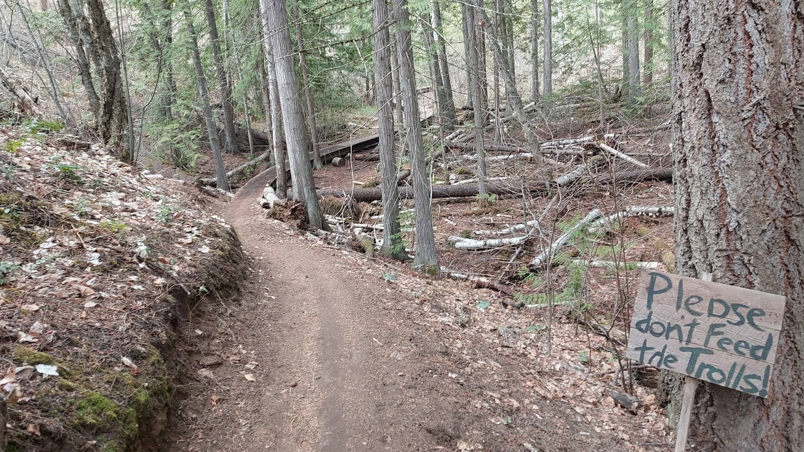
Intersections can be confusing; grab a downloadable map online before you go! :iphone:
🤝 Share the Trails
Be courteous to hikers, runners, and equestrians. Respect trail use designations. :peopleholdinghands:

Highlights
Discover the most iconic attractions and experiences
Schizo & Flying Nun Downhill
Mountain Biking Trails
Experience exhilarating downhill rides on these well-maintained, fun-filled trails. Perfect for a thrilling descent.
Spiderweb of Trails
Various Sections
Explore a diverse network offering a variety of adventures for all skill levels. Connects to Larch Hills trails.
Well-Kept Trails
Entire System
Enjoy meticulously maintained paths suitable for biking, hiking, and running, from beginner to expert.
Plans like a pro.
Thinks like you
Planning Your Visit
Trail Map Savvy is Key
Multi-Use Trail Etiquette
Best Times
Insider Tips
from TikTok, Instagram & Reddit
🗺️ Download Trail Maps
Intersections can be confusing; grab a downloadable map online before you go! :iphone:
🤝 Share the Trails
Be courteous to hikers, runners, and equestrians. Respect trail use designations. :peopleholdinghands:
🛠️ Bike Repair Station
A handy bike repair station is available at the parking lot for quick fixes. :tools:
🚗 Watch for Traffic
The forestry road is active; be aware of motorized vehicles. :red_car:
Tips
from all over the internet
🗺️ Download Trail Maps
Intersections can be confusing; grab a downloadable map online before you go! :iphone:
🤝 Share the Trails
Be courteous to hikers, runners, and equestrians. Respect trail use designations. :peopleholdinghands:
🛠️ Bike Repair Station
A handy bike repair station is available at the parking lot for quick fixes. :tools:
🚗 Watch for Traffic
The forestry road is active; be aware of motorized vehicles. :red_car:
What Travellers Say
Reviews Summary
Visitors consistently praise the South Canoe Trail System for its well-maintained network of trails, offering diverse routes for hikers and bikers alike. The downhill mountain biking sections are a particular highlight, providing thrilling descents. While the trail system is generally well-marked, some users suggest downloading a map to navigate trickier intersections. The multi-use nature of the trails means respecting other users is key.
"Visiting from Calgary and thought I'd hit the MTB! Really loved the well cared for trail system here. Got a bit lost on my way up, there's a few intersections that aren't super clear. But once I sorted it out, the downhill on Schizo and Flying Nun were so much fun. Cruisey! Nice work South Canoe Trail Assc."
Brent Downey
"Went there for first time today. It’s a very good trail system. I have to get better at reading trail maps. I took one trail up for about 40 min and then came back down. I wasn’t sure how long the trail actually was, I will go again"
Terri Cummings
"A well-used/ marked trail system close to Salmon Arm.
Multiple users (hikers, runners, bikers and equestrians) share the spiderweb of trails that give you a variety of adventures.
Outhouse, doggy bag station, garbages, trail map and bike repair station are available at parking lot.
The trails can connect to the Larch Hills trails (including the Larch Hills Traverse)
The forestry road is in use so be aware of all motorized traffic.
Some trails are marked for bike/equestrian use only for safety and trail maintenance.
Downloadable trail map can be found online"
Melissa Hassard
What People Like
What People Dislike
Frequently Asked Questions
🚇 🗺️ Getting There
The South Canoe Trail System is located near Salmon Arm. Access is typically via a parking lot off a forestry road. Be aware that this road is in use by motorized traffic, so drive cautiously.
Yes, there is a parking lot available at the trailhead, which also serves as a hub for amenities like an outhouse and bike repair station.
Absolutely! The South Canoe trails can connect to the Larch Hills trails, including the Larch Hills Traverse, offering extended exploration options.
The terrain varies across the spiderweb of trails, offering a mix of climbs and descents suitable for different activities. Some trails are specifically marked for bike or equestrian use.
The parking lot at the South Canoe Trail System is equipped with an outhouse, doggy bag station, garbage bins, a trail map, and a bike repair station.
🎫 🎫 Tickets & Entry
No, the South Canoe Trail System is generally free to access and use. It's a community-maintained resource for outdoor enthusiasts.
The trails are open year-round during daylight hours. There are no official operating hours, but it's best to visit when there's sufficient light for safety.
There is no entrance fee to access the South Canoe Trail System. It's a public recreational area.
No booking is required or available. You can visit anytime during daylight hours. It's recommended to check trail conditions before heading out.
Generally, no permits are required for recreational use of the South Canoe Trail System. However, always check local regulations for any specific event or group use.
🎫 🧭 Onsite Experience
Many riders rave about the downhill sections like 'Schizo' and 'Flying Nun' for their fun and flow. The system offers a range from beginner to expert.
Yes, the system is well-used by hikers, runners, and bikers. The variety of trails offers enjoyable routes for all levels of hikers.
While generally well-used, some users have noted that certain intersections can be unclear, making a trail map essential.
Yes, dogs are generally welcome, and there are doggy bag stations available at the parking lot. Remember to keep your dog under control.
Yes, there is a bike repair station located at the parking lot, which is a convenient amenity for cyclists.
📸 📸 Photography
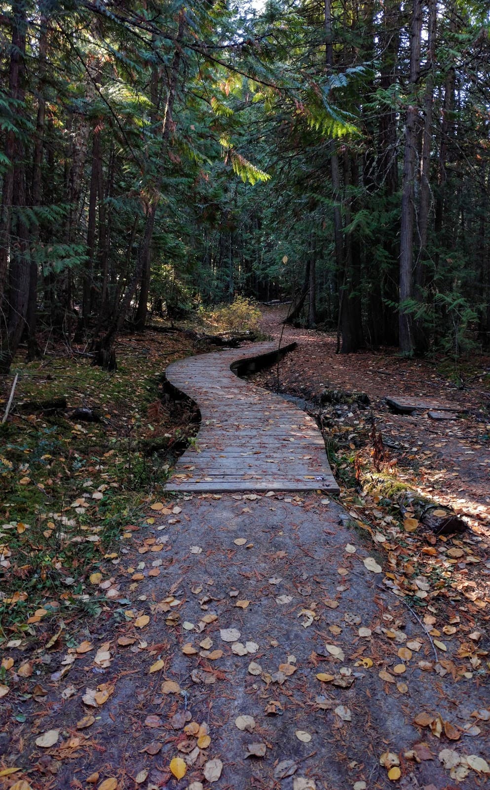
Look for scenic viewpoints along the trails, especially where the forest opens up or offers interesting terrain. The variety of trail types provides diverse photo opportunities.
With some planning and a good vantage point, capturing action shots of mountain bikers on trails like Schizo and Flying Nun can be very dynamic.
Early morning or late afternoon light often provides the best conditions for landscape and trail photography, creating beautiful shadows and highlights.
While not marked as specific landmarks, the well-maintained trails themselves, the forest canopy, and any natural clearings offer picturesque settings.
Drone usage regulations can vary. It's advisable to check with local authorities or the trail association regarding any restrictions on drone operation before flying.
For Different Travelers
Tailored advice for your travel style
👨👩👧 Families with Kids
Encourage kids to explore the 'spiderweb' of trails, turning it into a fun navigation game with a downloaded map. The bike repair station is also a good backup for any unexpected issues. Ensure everyone stays hydrated and wears appropriate footwear, as some sections can be uneven. It's a fantastic way to introduce children to the joys of nature and active recreation in a beautiful setting.
🚵 Mountain Bikers
Don't forget to download a trail map as some intersections can be tricky. Be mindful of other trail users and respect any designated trail uses. The bike repair station at the trailhead is a lifesaver for quick fixes. Consider linking up with the Larch Hills trails for an extended biking adventure.
Deep Dives
In-depth insights and expert knowledge
Navigating the South Canoe Trail System
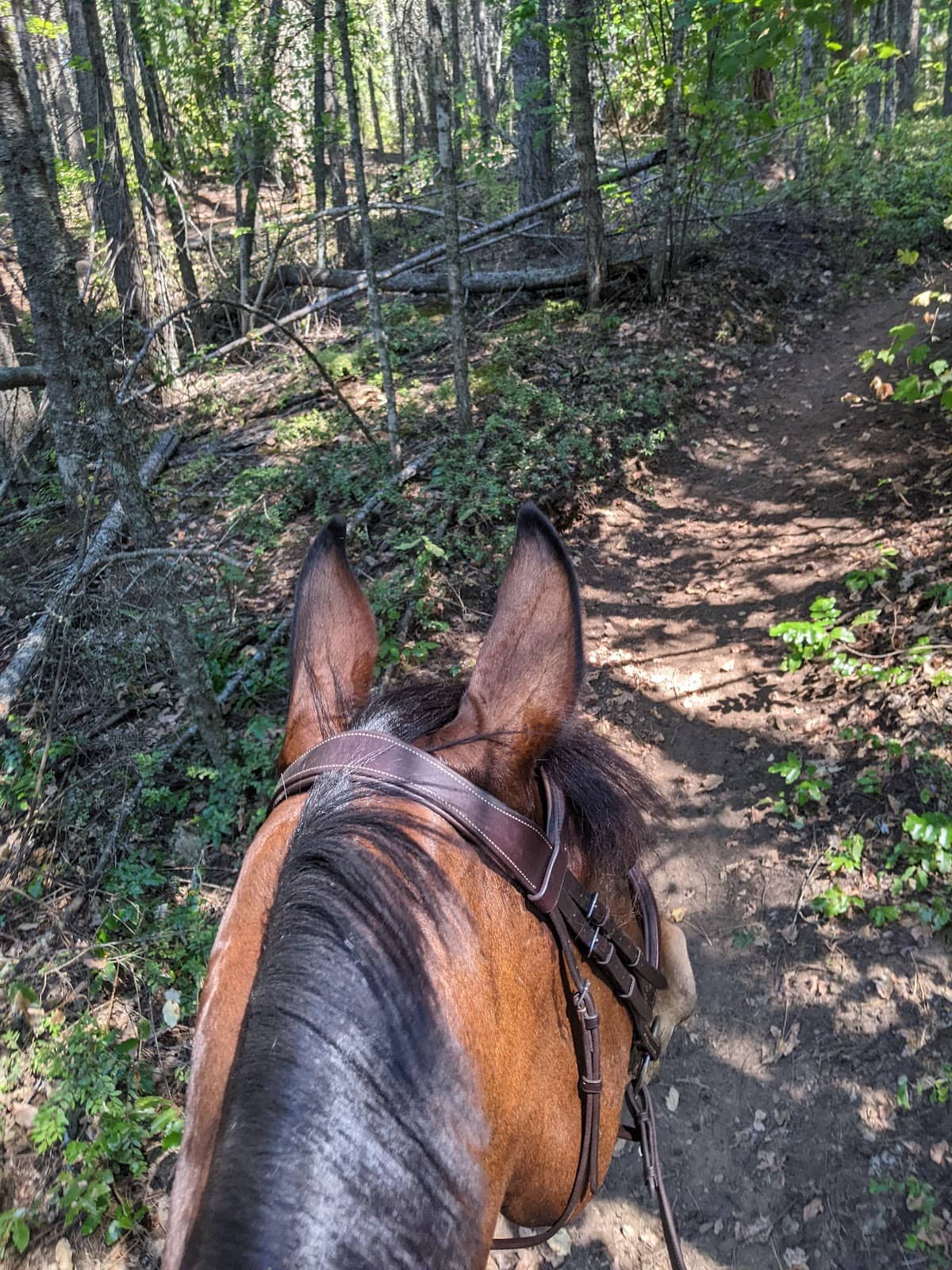
This system is a multi-use area, meaning you'll encounter hikers, runners, and equestrians alongside mountain bikers. Respect for all users is paramount. Some trails are specifically marked for bike or equestrian use to enhance safety and aid in trail maintenance. Always be prepared to yield to others, especially on narrower sections, and be aware of your surroundings. The forestry road that provides access is also actively used by motorized traffic, so exercise caution when entering or exiting the trail system.
Mountain Biking Highlights
The interconnected nature of the trails allows for creative route building. You can link up various sections to create longer rides or focus on specific downhill segments for adrenaline-pumping laps. The South Canoe Trail Association is commended for their work in maintaining this fantastic network. Remember to check trail conditions, especially after wet weather, as some sections can become slick. The presence of a bike repair station at the parking lot is also a welcome amenity for quick adjustments before or after your ride.


Social
from TikTok, Instagram & Reddit