
Säuling Summit Hike
A challenging, rewarding hike with breathtaking 360° summit views and technical rocky scrambles. Requires high fitness and sure-footedness.
Highlights
Must-see attractions

Social
From TikTok & Reddit
Best Time
Quieter trails, more peaceful ascent
Säuling Summit Hike
Best Time
Quieter trails, more peaceful ascent
Highlights
Must-see attractions
A challenging, rewarding hike with breathtaking 360° summit views and technical rocky scrambles. Requires high fitness and sure-footedness.
"Hard hike but absolutely beautiful and amazing. The 360 view is stunning."

🥾 Sturdy Hiking Boots Essential
Crucial for navigating rocky, potentially slippery terrain. Don't underestimate the need for good grip!
💧 Pack Plenty of Water
This is a strenuous hike with significant altitude gain. Stay hydrated throughout your ascent.

Highlights
Discover the most iconic attractions and experiences
The Summit Panorama
Säuling Summit
Experience breathtaking 360-degree views that make the challenging climb absolutely worthwhile.
Rocky Scrambles
Upper sections of the trail
Engage in technical, yet rewarding, rocky scrambles that require using both hands for stability.
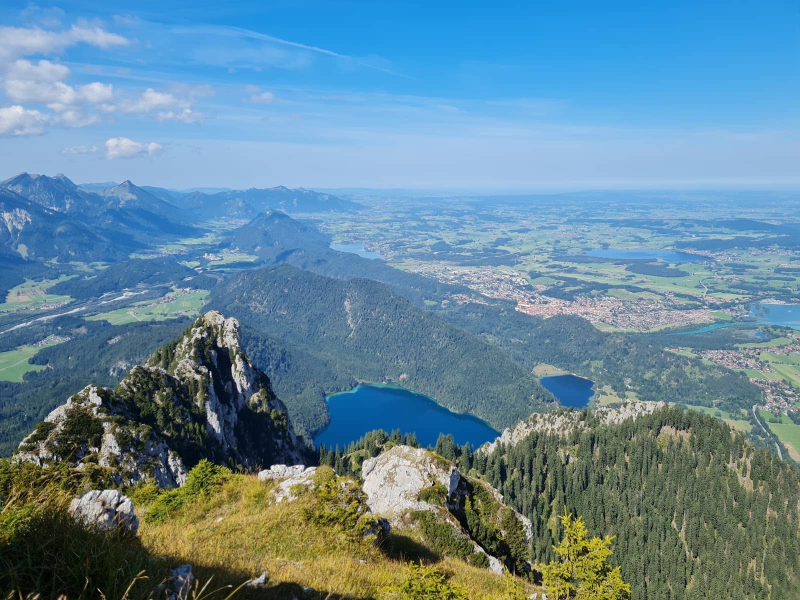
Alpsee Lake Views
Route from Säuling Haus to Hohenschwangau
Enjoy stunning panoramas of the Alpsee lake on the return loop via Säuling Haus.
Plans like a pro.
Thinks like you
Planning Your Visit
Conquer the Säuling Summit: Essential Prep
Timing Your Säuling Summit Adventure
Best Times
Insider Tips
from TikTok, Instagram & Reddit
🥾 Sturdy Hiking Boots Essential
Crucial for navigating rocky, potentially slippery terrain. Don't underestimate the need for good grip!
💧 Pack Plenty of Water
This is a strenuous hike with significant altitude gain. Stay hydrated throughout your ascent.
✋ Use Both Hands for Climbing
Steep sections require using your hands for balance and safety. Be prepared for some scrambling.
🔄 Consider the Round Tour
Offers varied scenery, including beautiful Alpsee lake views on the return.
Tips
from all over the internet
🥾 Sturdy Hiking Boots Essential
Crucial for navigating rocky, potentially slippery terrain. Don't underestimate the need for good grip!
💧 Pack Plenty of Water
This is a strenuous hike with significant altitude gain. Stay hydrated throughout your ascent.
✋ Use Both Hands for Climbing
Steep sections require using your hands for balance and safety. Be prepared for some scrambling.
🔄 Consider the Round Tour
Offers varied scenery, including beautiful Alpsee lake views on the return.
🇦🇹 Austrian Side Approach
Often considered easier and shorter than the German side approach.
What Travellers Say
Reviews Summary
The Säuling Summit hike is a highly rewarding but extremely challenging trek, praised for its breathtaking 360-degree summit views and the exhilarating rocky scrambles. Hikers emphasize the need for excellent stamina, sure-footedness, and proper gear, particularly sturdy boots. While the difficulty is a significant factor, the unparalleled scenery and sense of accomplishment make it a memorable experience for experienced adventurers.
"Amazing! I had to wait two years to actually summit this peak - it was still snow and ice in 2023. Definitely worth the wait! The scramble up either the German or Austrian side to the peak are rather technical, but have plenty of rock.bplted supports."
Aaron Mercer
"Embrace yourselfs for the 360 view. Is stunning.
On week days is quiet and chill. Few persons
Take good and steady hiking boots cause they're alot of rocks to climb. Also water
You need a good stamina for this, and both hands for climbing cause it gets slippery. Hard hike but absolutely beautiful and amazing.
I did the round tour. Go ahead, take care, be aware, have fun and enjoy it.
* I did the round tour. Once up from Hochenschwangau i followed ⚫ Sauling then back from Sauling i followed the sign left for Sauling Haus 🔴 Hochenschwangau so i can get a panorama for the lake Alpsee. After that the routes come together again"
Raluca
"Style: Day hike
Difficulty: 9.1/10 (Very Advanced)
Distance: 15km | Altitude Gain: 1240m
Class: 2 (no real climbing)
Terrain Difficulty: 9.5/10
Path Finding: Trace Amounts
Type: In & Out
! See below the summary for information on these statistics !
Detailed Summary:
It was about a 15 kilometre hike with a 1200 metre altitude gain from Hohenschwangau; the hike took us about 5.5 hours. Near the peak, it gets very steep, you will need two hands free to maneuver the rocky cliffs. The hike can be done as a loop or just to the summit. While on the hike, you will cross the Austrian-German many times. Hiking in from Austria is much easier and shorter than hiking in from Germany like we did.
! Statistics Information:
The #/10 statistics are based on day hike/climbs (so no backpacking routes count)
I consider a hike/climb to be any route where the route class is not above a 3, meaning no climbing equipment or ropes are required.
To be a hike, the route must not exceed a class 2, although, I still group regular hikes in with hike/climbs since they can both be done by non-climbers without equipment.
To be a day hike or day hike/climb, the route must be able to be done in a singular 16-hour day while walking (no jogging or running needed).
Half-day and several-hour routes are also included in this ranking."
Waylavon
What People Like
What People Dislike
Frequently Asked Questions
🚇 🗺️ Getting There
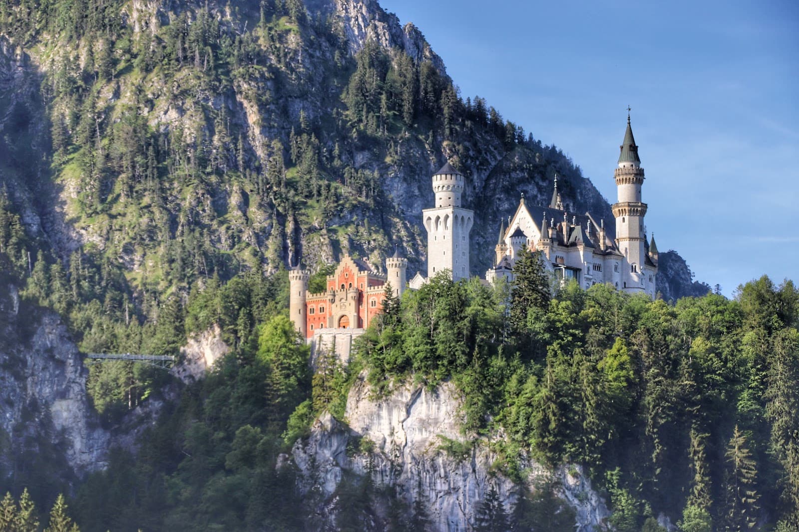
The most common starting point is near Hohenschwangau. You can drive and park in Hohenschwangau, then begin your hike. Alternatively, public transport to Füssen is an option, followed by a local bus to Hohenschwangau.
Yes, hiking from the Austrian side is an option and is often described as easier and shorter than the German approach.
For a day hike, starting from Hohenschwangau is popular. Ensure you have ample time to complete the challenging 15km route with 1200m altitude gain.
You can take a train to Füssen and then a local bus service to Hohenschwangau, which is the gateway to the Säuling Summit hike.
From Füssen, a bus to Hohenschwangau typically takes around 15-20 minutes. From there, you'll start your hike directly.
🎫 🎫 Tickets & Entry
No, there are no entrance tickets required for the Säuling Summit hike itself. It's a natural trail accessible to hikers.
Yes, parking in Hohenschwangau typically involves a fee. It's advisable to check current parking rates before your visit.
The trail is generally accessible year-round during daylight hours. However, conditions can be hazardous in winter due to snow and ice.
While not strictly necessary for experienced hikers, guided tours might be available from local providers, especially for those seeking extra safety or historical context.
No specific permits are generally required for day hiking on the Säuling Summit trail.
🎫 🧭 Onsite Experience
The Säuling Summit hike is considered very advanced and difficult, rated 9.1/10. It involves significant altitude gain, steep ascents, and technical rocky scrambles.
The hike can take around 5.5 hours for a 15km route with 1200m altitude gain. This can vary based on your pace and the chosen route.
Expect a mix of well-trodden paths, steep rocky sections, and areas requiring scrambling. Good hiking boots are essential due to the rocky and potentially slippery terrain.
No, this hike is not recommended for beginners due to its advanced difficulty, steepness, and technical sections. It's best suited for experienced and sure-footed hikers.
While there might be a Säuling Haus on some routes, facilities are generally sparse. It's best to be self-sufficient with water and snacks.
📸 📸 Photography
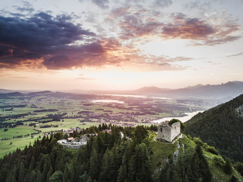
The summit offers incredible 360-degree panoramic views. The route via Säuling Haus provides stunning vistas of Alpsee lake. Capture the dramatic rocky scrambles and the expansive landscapes.
Early morning or late afternoon light can be spectacular for landscape photography, offering softer shadows and golden hues. However, clear weather is paramount for the best views.
A wide-angle lens is great for capturing the panoramic views. Consider a sturdy tripod if you plan for long exposures or low-light shots. Ensure your gear is protected from the elements.
The summit itself is the ultimate viewpoint. Also, look for dramatic rock formations and the expansive views of Alpsee lake on the loop trail.
Focus on the scale of the rocky sections by including a person for reference. Capture the steepness and the effort involved in the climb.
For Different Travelers
Tailored advice for your travel style
👨👩👧 Families with Kids
For families looking for mountain experiences in the area, it would be advisable to seek out less strenuous trails with more accessible viewpoints. While the summit views are incredible, the journey to get there is a serious undertaking that requires advanced hiking capabilities. Prioritize safety and choose an adventure that matches the abilities of all family members.
💰 Budget Travelers
To keep costs down, consider using public transport to reach Füssen and then a local bus to Hohenschwangau. Pack your own food and water for the hike, as there are limited facilities on the trail. This allows you to fully enjoy the stunning natural beauty without significant expense.
Deep Dives
In-depth insights and expert knowledge
Navigating the Säuling Summit Trail
Pathfinding is generally straightforward, but the technical sections demand concentration. Many hikers opt for a loop, which can include a route from Hohenschwangau, up to the summit, and then back down via Säuling Haus, offering beautiful views of Alpsee lake. It's also noted that the approach from the Austrian side can be easier and shorter than the German side. This hike is definitely not for beginners and is best suited for experienced mountaineers and hikers who are comfortable with exposure and challenging ascents.
Key considerations for this hike include wearing sturdy, high-grip hiking boots, carrying ample water and snacks, and being prepared for variable weather conditions. The reward for this strenuous effort is an unparalleled 360-degree panoramic view from the summit, which many describe as absolutely stunning and worth every step.
Best Times and Conditions for Säuling Summit
While the hike is technically possible year-round, summer mornings generally offer the best conditions. This is when the chances of clear skies and good visibility are highest, maximizing the enjoyment of the spectacular summit views. However, it's important to be aware that snow and ice can persist on the higher parts of the trail well into the summer, especially in shaded areas. Always check local weather forecasts and trail conditions before you go.
Even in summer, the mountain can be unpredictable. Be prepared for sudden weather changes, including rain and fog, which can significantly increase the difficulty and danger of the hike. The rocky terrain, combined with moisture, can become extremely slippery, making good footwear and careful footing paramount.


Social
from TikTok, Instagram & Reddit